
By Dr Karabi Das
Rivers are generally considered as open systems within the purview of Geomorphology. The cause behind being them operating in broadly three zones of input, process and output while interacting beyond their boundaries. Thus, there is ample scope of transformations within rivers – both by natural and anthropogenic manners. They are driven by water and sediments so whenever this balance gets modified there occurs a change in the equilibrium of rivers. Well, this can be done both naturally and by controlled environment driven by humans.
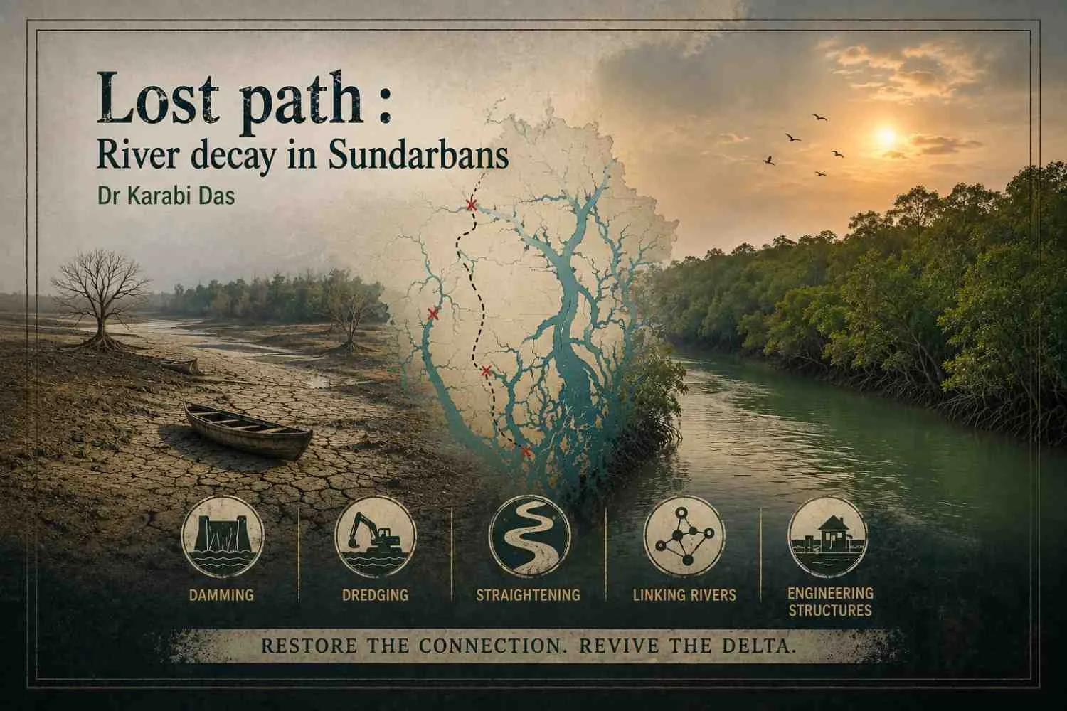
Modifications in the catchment area of any drainage basin can effectively alter the natural system, thus jeopardizing the entire hydrologic regime. Alteration by humans can happen in the form of damming the river course, by dredging the channel, by straightening the river pattern, by linking rivers and by constructing other engineering structures. Flood control and control of bank erosion demand widening or deepening of channels, artificial cutoffs from meanders and straightening of channels. Artificial channelization also modifies the fluvial dynamics of a drainage system.
In Indian Sundarbans, the single largest mangrove tigerland, rivers are the arteries. Enmeshed in an intricate network of interlinked rivers and creeks (also duanis), this region is a part of the retrograding Western Ganga Brahmaputra delta. Progradation (advance) and retrogradation (decay) of a delta is largely dependent on occupancy and abandonment of the delta by deltaic distributaries. Also, following the Gallway triangle it can be said that delta building fluvial force and delta modifying wave and tidal action get to decide the fate of deltas. Neotectonic movements leading to subsidence towards Bangladesh Sundarbans have decided the movement of the main flow of river Ganga towards Padma building the eastern Ganga Brahmaputra delta. This is evident from the younging of the eastward deltaic lobes as shown by Allison. Also, the rivers of Indian Sundarbans are severed from their upstream sources. Up country diversion of water, clogging of offtakes have resulted in reduction in discharge degenerating the distributaries of Ganga in the last 225 years. The switching of the distributary channels over time was one of the causes of delta abandonment which was aggravated by loss of sediment supply which bypass through the “Swatch of No Ground” into the deep sea “Bengal fan” . The creeks of Sundarban are tidally fed, governed by bi directional flow. The funnel shaped macrotidal (tidal range>4 m) Hugli estuary is characterised by time velocity asymmetry whereby flood tide takes only 3 hours to get complete while ebb tide takes 9 hours to complete. Therefore, before the ebb tide gets completed, another flood tide sets in resulting in sedimentation. The premature reclamation of Indian Sundarbans has left the landscape polderized as the tidal spill areas are reduced. This results in inchannel sedimentation and further clogging of rivers. Thus the settled portions are at a lesser height than the rivers and this landscape is termed polderized. The river Ichhamati is dry near it’s off take point at Majdia. The gradual decrease of upstream discharge from Ganga to river Mathabhanga is another reason for the decay of river Ichhamati. River Jamuna can be demarcated up to some few km downstream from itsoff take. River Jamuna got decayed as it lost its connection with
Bhagirathi-Hugli River. The angular orientation of the channel at its off-take point has changed to obtuse angle restricting the flow of river Hugli into Jamuna. River Bidyadhari has been encroached by fisheries while the downstream stretch (40 km) up toits outfall has dried up. Excavation of Keshtopur canal in 1910 disconnected a portion of salt lake spill area and this led to disequilibrium in the natural drainage from north and led to the decay of Bidyadhari river. River Matla started decaying as the discharge from West Bidyadhari and the Karatia into the river Matla stopped. A number of lateral connections of the Matla River on and from inland side (like Belladona river, Kultala gang, Piyali-Nabipukur river, Chulkati gang etc) are presently in a decaying state, cutting off freshwater discharge to river Matla. River Piyali can’t be traced properly upstream of Piyali station and it has got disconnected from its parent river Bidyadhari. The outfall of Piyali has been closed contributing to its decay and deterioration of tidal environment there. River Thakuran debouches near Jaynagar and Mathurapur. To its north the river connects Matla and has link with river Saptamukhi. Beyond the junction with river Jagaddal, the river Thakuran gradually thins out in its upper course. Both the reclaimed and non-reclaimed portions of Indian Sundarban have witnessed river discontinuity and decay. Some rivers connecting large rivers have become completely obliterated. Some rivers have become clogged with mud and hyacinths, while some rivers have decreased in width becoming narrower (Das, 2025). Anthropic activities like construction of embankments, aquaculture farms by severing the rivers have also resulted in river discontinuity and decay.
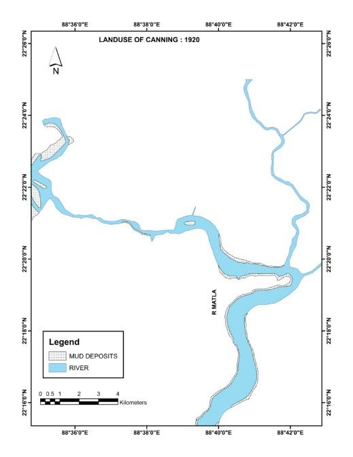
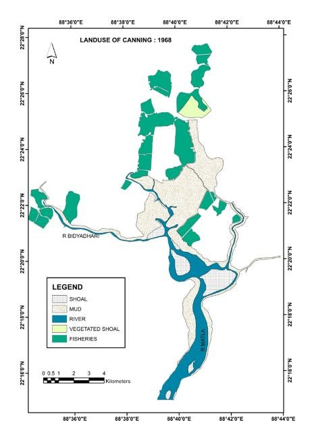
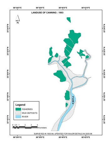
In order to cope up with river discontinuity and decay, estuarine reshaping in the form of reviving the lost paths of the channels and creating additional channelization is required. The polderized landscape has got so much altered and juxtaposed with agricultural landscape and settlements that it is quite impossible to return to it’s virginity. However, reviving the lost paths is necessary and can be still done if all the previous interlinking routes are resuscitated.
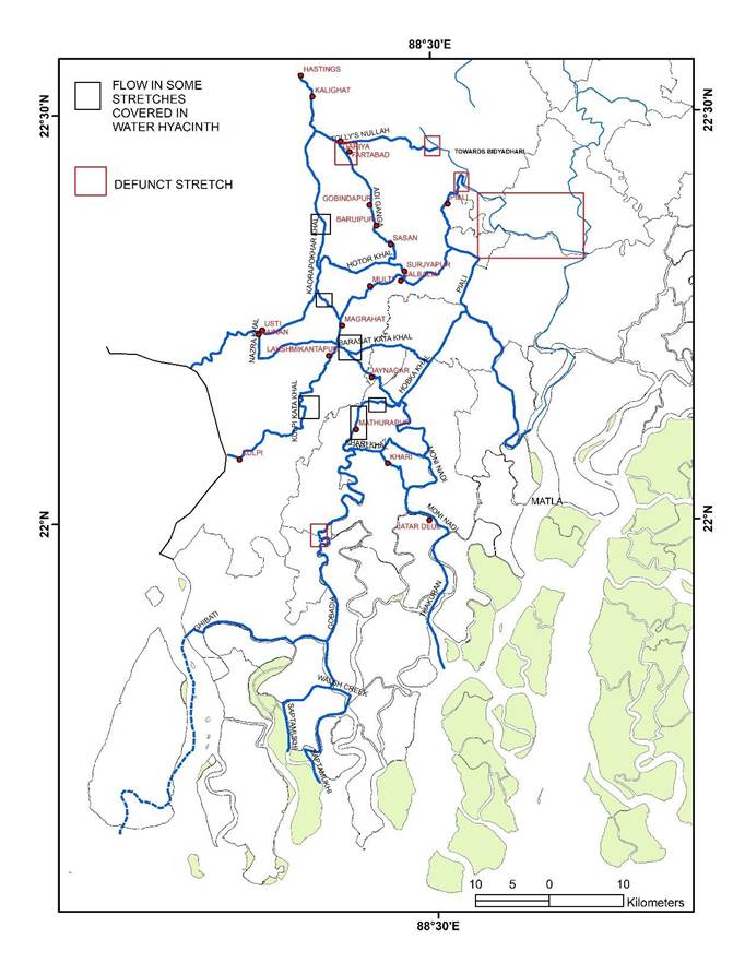
Five probable routes in and out of Adi Ganga can be traced in all probability. Outfalls can be traced to river Hugli via Diamond Harbour and Kulpi, to Saptamukhi estuary, Thakuran estuary and river Matla.
Diamond Harbour route: Kaorapukur khal (29.005 km) can be used as it emanates from Adi Ganga near Kudghat. Then as it connects with Usthi Nainan outfall channel (10.435 km), the accumulated water is directed towards Diamond Harbour creek (14.531 km) which empties into Hugli River. Also, the same route can be accessed from Surjyapur using Hotor khal (12.305 km).
Kulpi route: Water of Adi Ganga can be directed from Surjyapur along settlements Multi, Magrahat and Lakshmikantapur using the canals Surjyapur khal (10.215 km), Magra Jaynagar khal (14.647 km) and Kulpi kata khal (19.039 km) towards Kulpi. Alternatively, water can be directed towards Kulpi kata khal using Nazra khal and Sangrampur Outfall channel.
Route towards Saptamukhi estuary: From Surjyapur, a westward route along Multi using Surjyapur khal (10.215 km) can be followed, upto Magra Jaynagar Khal (14.647 km), flowing past Jaynagar Majilpur. From there, using Burar khal (2.035 km) and Chitraganja khal (5.324 km), the palaeochannel of Adi Ganga can be accessed upto Sudhirghat. From the settlement of Chandbhasa, Banstala khal (16.658 km) can be accessed. Chora Gangadora khal (5.463 km) can be accessed from the settlement of Bakultala. The rivers Kaloa, Gobadia (18.102 km), Barchara and Walsh creek can then be used to direct the water towards Saptamukhi estuary, though Kaloa river has got decayed at present. Alternatively, Curzon creek also can be used to direct the water towards Saptamukhi estuary.
Route towards Thakuran estuary: The same route can be followed upto Burar khal, then the water can be directed to Moni nadi. Alternatively, Khari khal can be used past Chandbhasa and the water can be directed towards Thakuran via Moni nadi.
Route towards Matla: Water from Adi Ganga can be directed towards Matla River using Surjyapur khal and Piali river.
References:
Bandyopadhyay S. (2000): Coastal changes in the perspective of long term evolution of an estuary: Hugli, West Bengal, India, Proc. Int. Quat. Seminar on INQUA shoreline, Indian Ocean Sub Commission: 103-115.
Bandyopadhyay S. and Bandyopadhyay M. K. (1996): Retrogradation of the western Ganga-delta, India and Bangladesh, Possible reasons. In. Tiwary, R.C. (ed.), Proceedings of 6th conference of Indian Institute of Geomorphologists, National Geographer, 31(1&2): 105-128.
Bandyopadhyay S., Kar N.S., Dasgupta S., Mukherjee D. and Das A. (2023): Island area changes in the sundarban region of the abandoned western ganga–brahmaputra– meghna delta, India and Bangladesh, Geomorphology https://doi.org/10.1016/j.geomorph.2022.108482.
Das K (2025): Physical and Socioeconomic changes of Indian Sundarban: An Evaluation PhD thesis, University of Calcutta.
Das K and Das K (2026): Reviving Decaying Rivers: Case Studies from Indian Sundarbans Natural Sciences and Applied Technology Eissn: 3049-4206 3(1)
Majumdar S.C. (1941): Rivers of the Bengal Delta In Biswas K.R. (ed.), Rivers of Bengal, volume 1 West Bengal District Gazetteers, Kolkata.
Paul A. K. (2002): Coastal Geomorphology and Environment. Sundarban coastal plain, Kanthi coastal plain, Subarnarekha delta plain. ACB publication, Kolkata.
About Author

Dr Karabi Das, Masters in Geography from University of Calcutta, former Senior Research Fellow, UGC, PhD on Physical and Socioeconomic changes in the Indian Sundarban is presently working as Assistant Professor of Geography, Dr Kanailal Bhattacharyya College, Howrah.
She has participated in many national and international seminars and has 12 papers and 10 book chapters to her credit.
Her areas of interest include Fluvial Geomorphology, river in equilibrium and human environment relationship.





Add a Comment