
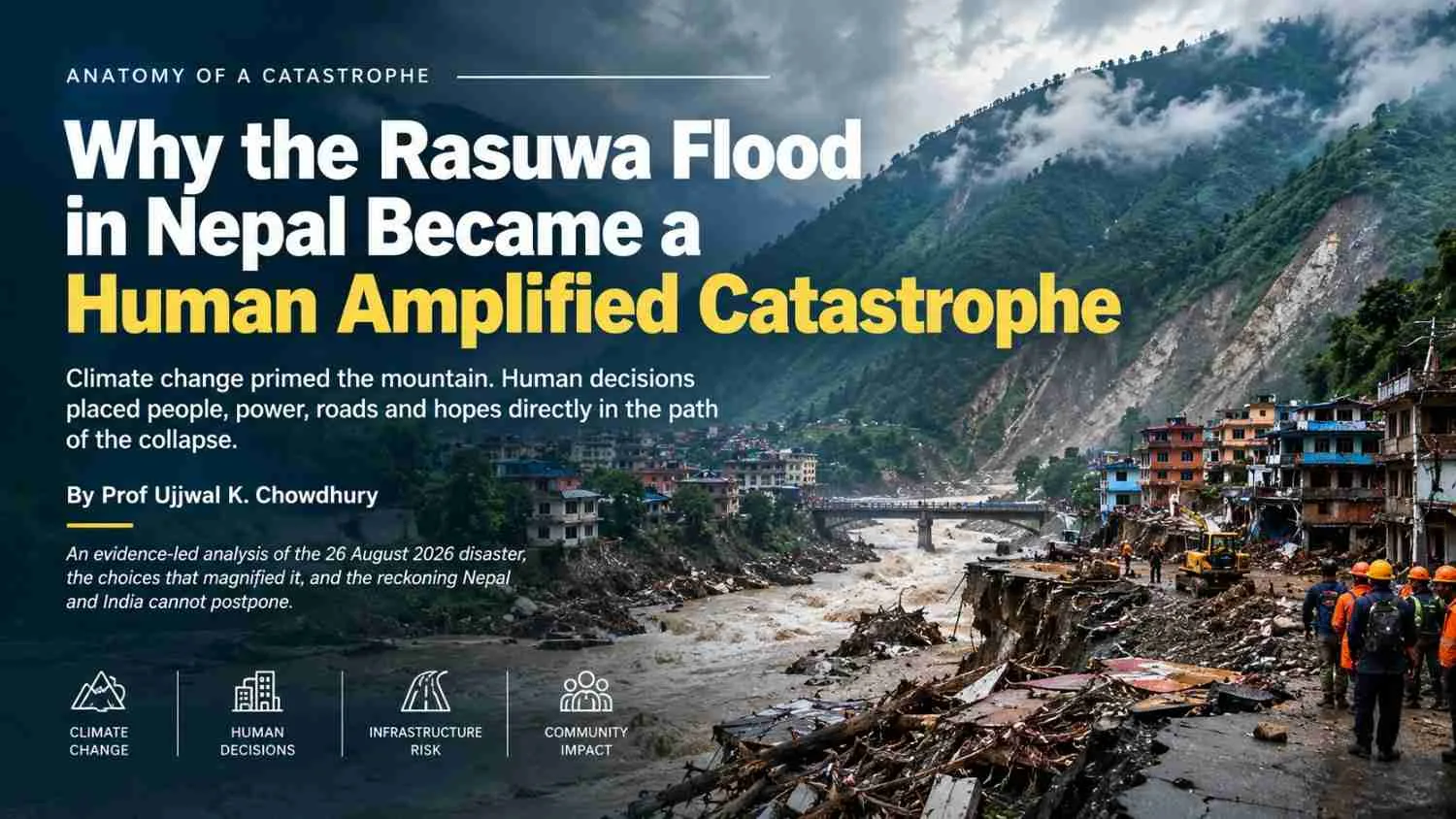
| The Rasuwa disaster was not simply a flood. Climate change increased the mountain’s instability, while human exposure, infrastructure choices, weak warnings, poverty and fragmented governance turned a natural hazard into a human-amplified catastrophe. |
| Summary The 26 August 2026 disaster in Nepal’s Rasuwa region began with a massive rock-and-ice avalanche that triggered a destructive surge through the Bhote Koshi and Trishuli river system. Climate change may have increased the underlying instability of glaciers, permafrost and mountain slopes, but the article argues that human decisions greatly amplified the consequences. Homes, roads, hydropower plants, tunnels, worker camps and economic corridors had been built in highly exposed terrain, while warning systems were not designed to detect such a rapidly developing cascade. Poverty, seasonal populations, fragmented governance and inadequate investment in prevention further narrowed the choices available to communities. The analysis calls for basin-wide risk planning, stronger early-warning systems, safer infrastructure, better relocation and adaptation finance, and greater accountability in development decisions. It also warns India to learn from Rasuwa, as similar combinations of climate hazards, infrastructure and human exposure exist across the Himalayan region. |
Keywords Rasuwa Flood 2026, Nepal flood disaster, Himalayan climate risk, climate change Nepal, human-amplified catastrophe, hydropower risk, disaster resilience, early warning systems, climate adaptation, Himalayan infrastructure |
ANATOMY OF A CATASTROPHE
An analysis by Prof Ujjwal K Chowdhury, a noted academic and sustainability warrior.
Climate change primed the mountain. Human decisions placed people, power, roads and hopes directly in the path of the collapse.
An evidence-led analysis of the 26 August 2026 disaster, the choices that magnified it, and the reckoning Nepal and India cannot postpone.
The first explanation is true, but incomplete. A warming Himalaya helped destabilise ice, rock and frozen ground. It does not by itself explain why a mountain failure became a national catastrophe: why workers were inside tunnels, why homes and markets stood on river terraces, why a border corridor could be cut at so many points, why warnings did not reach people in time, or why one shock could disable electricity, records, communications and rescue routes together. Climate was the trigger. Exposure and institutional weakness supplied the ammunition.
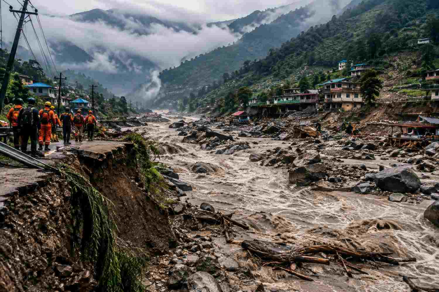
On 26 August, a mixed rock-and-ice avalanche high in the Langtang region struck the Bhote Koshi and Trishuli system. The collapse generated a seismic signal of about magnitude 5.2, not from an earthquake but from the mass movement itself. A pulse of water, ice, rock and sediment travelled more than 100 kilometres through a narrow, steep valley. At points, the river reportedly rose as much as nine metres in roughly 30 minutes. The geography was violent. The disaster was also designed, piece by piece, by where society had chosen to build and how it had chosen to govern risk.
Trigger | Pathway | Exposure | Vulnerability |
|---|---|---|---|
Rock and ice avalanche | Nine metre river pulse in 30 minutes | Homes, roads, tunnels, plants, camps | No end to end warning or safe retreat |
Warming and permafrost stress | Debris amplified velocity and reach | Settlements on terraces and banks | Poverty, weak buildings, broken access |
Development choices | Bottlenecks and cascading failures | Trade and tourism corridors | Fragmented mandates and thin finance |
The numbers remain provisional and will change as identification and search continue. Nepal’s official situation update of 10 September reported 1,377 bodies recovered, 5,130 people missing, including roughly 600 foreign nationals, and 13,656 rescued. These figures describe the scale of the emergency, not a final death toll. They also reveal why a single-cause story is inadequate: a rare geophysical event became a mass-casualty event because a densely used development corridor had almost no time, space or redundancy when the river changed character.
Name the Event Correctly
Calling this “a flood” hides the mechanism. The initiating failure appears to have been a rock avalanche that entrained glacier ice and fractured mountain material before reaching the river. The material may also have interacted with deposits left by earlier failures and briefly dammed or redirected water. The result was not simply rainfall running downhill; it was a high-energy sediment-and-water surge. That distinction matters because a rain gauge can be quiet while an upstream slope is already becoming a missile.
Scientific teams are still resolving the exact sequence, volume and source geometry. Preliminary remote-sensing research points to a very large disturbed footprint, a steep descent and destruction across buildings and roads. The honest conclusion is not uncertainty about whether the event was dangerous. It is uncertainty about which warning signatures would have appeared first. Disaster policy must be designed around that uncertainty, because waiting for a perfect forecast is another way of choosing not to warn.
A hazard becomes a disaster when a society has made the hazard’s pathway the address of its future.
Climate Primed a Mountain Under Stress
The climate signal is substantial. ICIMOD reports that glacier loss in the Hindu Kush Himalaya accelerated by about 65 percent in 2011–2020 compared with the previous decade. Its 2026 assessment says the region lost about 12 percent of glacier area and 9 percent of ice reserves between 1990 and 2020, with the rate doubling after 2000. Permafrost is also warming and weakening. Around the high elevations where ice and rock meet, the margin of stability is being eroded from above and below.
But attribution must be disciplined. Scientists cannot responsibly say that warming alone “caused” this particular slope to fail without reconstructing the slope’s geology, fracture networks, meltwater pathways and short-term weather. What can be said with confidence is that warming changes the background odds: glaciers retreat, ice buttresses thin, meltwater enters cracks, and frozen ground loses its cement. The same mountain can therefore fail under conditions that once would have been less likely to produce such a connected cascade.
That is why climate change is best understood as a risk multiplier, not a complete explanation. It loads the gun. Land-use decisions, infrastructure design and institutional failures determine where the bullet lands and how many people are in the room.
The First Human Multiplier Was Exposure
The river corridor was not empty wilderness. It carried homes, shops, hotels, customs and security facilities, truck yards, bridges, roads, power stations, labour camps and the daily economy of a trans-Himalayan route. Settlements expanded onto alluvial fans and river terraces because those are the few relatively flat surfaces available in a steep valley. “Flat” was mistaken for “safe.” A terrace is often a former flood path waiting for the next, larger pulse.
The 2015 earthquake made this pressure worse. Families displaced by that disaster needed land quickly, and some resettlement and rebuilding occurred close to the Trishuli and its tributaries. In a poor mountain district, the choice is rarely between a safe site and an unsafe site. It is between an exposed site and no house, a roadside shop and no income, a lodge near visitors and no livelihood. Risk maps that do not come with land, credit and services are not plans; they are warnings people cannot afford to obey.
The scale of exposure also had a temporal dimension. Hydropower construction brings rotating workforces; tourism brings seasonal crowds; trade brings drivers and loaders who may sleep in temporary camps; roads bring fuel and machinery. A hazard that occurs at dawn on a workday can kill a different population than the same hazard at midnight in the dry season. Emergency planning that counts permanent residents alone will systematically undercount the people actually present.
Hydropower Turned One River into a Chain of Targets
Nepal’s hydropower ambition is economically understandable. Electricity exports and domestic supply can transform a landlocked, mountainous economy. The problem is not hydropower as an idea. It is treating a high-energy river as a sequence of separate project sites when the hazard operates at basin scale. Reports indicate that at least 12 hydropower plants were badly damaged; more than 430 megawatts—over 10 percent of national capacity by some estimates—went offline. Those numbers are not just an energy story. They are evidence of concentrated exposure.
Run-of-river projects are engineered around expected flows, sediment and floods, not necessarily a sudden cryospheric surge carrying house-sized boulders. Intakes can choke with debris. Desanders can be overwhelmed. Surface powerhouses and switchyards can sit on low benches because that is where construction is practical. Tunnels can become traps when access roads and portals fail. Worker camps, often temporary and poorly protected, can be the most vulnerable assets of all. When several projects occupy one narrow gorge, the failure of one bridge, intake or power line can block the rescue of the next.
There is a second-order danger: infrastructure can amplify flow. A bridge or diversion structure may trap logs and boulders; a breached temporary obstruction may release a secondary pulse; spoil heaps may be remobilised into the river. It would be wrong to declare that every plant “caused” the flood. It is equally wrong to pretend that project siting and construction debris are neutral when a natural surge enters an engineered corridor. The right test is cumulative: what does the entire basin do when its most extreme plausible event arrives?
The Road to Prosperity Became a Channel of Destruction
Mountain roads are lifelines, but cut slopes and spoil dumps can become failure surfaces. Excavation removes toe support. Unlined drains concentrate runoff. Muck tipped near a stream is a ready-made load for the next surge. Quarrying and sand or boulder extraction can lower banks, destabilise crossings and remove the roughness that once slowed water. In a narrow valley, a road is not merely beside the river: it can redirect it, constrict it and then be carried into it.
The flood damaged bridges and long stretches of highway, severing the very routes needed to bring in fuel, food, excavators and forensic teams. This is a classic infrastructure paradox: the more a remote region depends on one corridor, the more valuable that corridor becomes—and the more catastrophic its failure. Resilience means alternate alignments, stockpiles on safe ground, breakaway structures where appropriate, and rescue logistics that do not assume the road will still exist.
The Warning System Was Looking for the Wrong Disaster
Nepal has invested in flood warnings, but a sensor is not a warning system. A functioning chain needs detection, interpretation, a decision rule, communications that survive the first failure, trusted messengers, evacuation routes and a population that has practised what to do. In Rasuwa, the event moved too fast for a conventional rainfall-triggered alert. If the upstream catchment has no real-time seismic, acoustic, camera, lake-level and river-stage integration, the first unmistakable signal may be the wall of water itself.
The reported nine-metre rise in about half an hour illustrates the brutal arithmetic. A message that takes ten minutes to verify, five minutes to translate, five minutes to relay and another ten minutes for people to decide may arrive after the safe window. SMS alone cannot solve this. Sirens, radio interruption, satellite links, local volunteers, marked vertical evacuation sites and drills are needed. The alert must say where to go, not merely that a river is rising.
The neighbouring border adds a governance problem. The headwaters, glaciers and observation points do not respect administrative lines. Nepal needs dependable, rapid, machine-readable data from upstream territories, with agreed protocols for an alert that can be issued even when the science is not yet complete. Diplomacy over data is life-saving infrastructure. Delayed information is not a technical inconvenience; it is lost evacuation time.
Tourism Pilgrimage and Labour Added Seasonal Density
The Himalaya’s tourism economy brings jobs, foreign exchange and a reason to keep remote corridors open. It also places lodges, tea houses, kitchens, guides, porters and transport workers close to unstable banks. Seasonal visitor numbers can make a settlement several times more crowded than the census suggests. A building permit that counts only local households misses the people who sleep, work and travel through the valley during the hazard season.
The answer is not to criminalise tourism or freeze mountain communities in poverty. It is to regulate the footprint: no new accommodation in mapped flow paths; structural retrofits and clearly signed vertical refuge in existing clusters; occupancy registers; multilingual alerts; and evacuation exercises involving visitors and operators. The safest hotel is not the one with the best view of the river. It is the one whose guests know the route uphill before the lights go out.
Poverty Made Relocation Almost Impossible
Disaster vulnerability is income made visible. A family with savings can move stock, reinforce a wall, buy transport and wait out a warning. A labourer in a tunnel, a small shopkeeper, or a farmer on a river terrace may have no second plot and no insurance. Informal housing is not evidence of ignorance; it is often evidence that formal safe land is unaffordable, unavailable or blocked by tenure rules.
This is also why “just move uphill” is not a policy. Relocation must preserve schools, water, health care, markets, land rights and access to work. Otherwise people return to the hazard, as they have after many mountain disasters. Managed retreat is a social contract, not a bulldozer. Its cost should be compared with the price of rebuilding the same road, bridge and home after every extreme event.
Finance Funded Concrete Faster Than Safety
The asymmetry is stark. Commercial infrastructure can often secure a loan because electricity revenue is legible. A community siren, a glacier camera, a safe relocation site or a cross-border data protocol produces benefits that are diffuse and difficult to monetise. Funding therefore arrives faster for concrete that earns a return than for public systems that prevent a loss. This is a market failure disguised as development momentum.
Nepal’s glacier-risk resilience project was approved through the Green Climate Fund after a lengthy, roughly seven-year pipeline; the verified project grant is about $36.1 million and implementation began in 2026. The programme is valuable, but the timing exposes a structural injustice: adaptation money can take years while a slope can fail in seconds. Climate finance must be judged by time-to-protection, not only by money pledged. International lenders and donors should fund the monitoring, zoning and maintenance that make their roads and power investments safer.
Ages-long Governance Failed Before the Water Arrived
The deepest man-made cause is fragmented responsibility. A glacier is watched by one institution, a road licensed by another, a hydropower intake approved by another, a municipality responsible for land use, and a district administration expected to coordinate rescue. Each decision may pass its own checklist while the combined system becomes unsafe. Environmental impact assessments that study projects one by one cannot see a basin-wide cascade.
The missing instrument is an independent, conflict-free cumulative risk review with the power to say no, slow a project or require redesign. It should audit existing dams, tunnels, worker camps, spoil sites, bridges and settlements against updated cryospheric scenarios. After the 2025 flood in the same watershed killed 19 people and damaged infrastructure, a serious post-disaster audit should have treated the valley as an active warning, not as a closed chapter. Memory is a safety system; institutions keep deleting it.
The Current Government Deserves Credit and Must Now Raise the Standard
The Nepal government’s response deserves clear recognition. The Army, Nepal Police, Armed Police Force, NDRRMA, provincial bodies and local governments mobilised under extraordinarily difficult conditions. Helicopters, drones, tunnel teams, medical responders, forensic specialists and foreign search-and-rescue support were brought into a corridor where roads had vanished and debris-filled tunnels remained dangerous. India, China, the Republic of Korea, the UAE, Malaysia, Australia, Singapore and Israel were among those contributing specialised capacity. The rescue of thousands—including more than 300 foreign nationals—required persistence, not headlines.
The financial mobilisation is also significant. Official reporting on 11 September put deposits in the Prime Minister’s Disaster Relief Fund at NPR 13.23 billion, alongside $23.28 million in designated dollar accounts—together more than $100 million equivalent at prevailing exchange rates. The government has released NPR 1 billion through NDRRMA, while assessments and identification continue. The responsible reading is that this is a measure of funds mobilised or held, not a claim that every dollar has already reached every affected household. Transparent district-level dashboards, beneficiary lists and independent audits will turn solidarity into trust.
The government has also been right to demand climate justice. Nepal has contributed little to the cumulative emissions driving global warming, yet it is paying in lives, infrastructure, debt and lost development. Asking larger emitters to provide loss-and-damage compensation is not an attempt to evade domestic accountability. It is a demand that those who benefited most from carbon-intensive growth help finance protection and recovery for those facing the sharpest consequences. The two duties are simultaneous: Nepal must govern its hazard honestly, and wealthy high emitters must stop treating Himalayan loss as a humanitarian footnote.
What Nepal Must Focus on Now
First, secure survivors before rebuilding the old exposure. Complete identification with dignity; restore food, water, health care, schooling and livelihoods; and provide cash and legal help for families whose documents disappeared. Every reconstruction decision should be tagged to a hazard map. “Build back better” must mean build somewhere safer, or build in a way that can survive the credible event—not rebuild the same shop on the same fan because the land title is convenient.
Second, create a whole-mountain observation and warning architecture. Combine satellite radar and optical imagery, seismic and infrasound sensors, glacier and permafrost measurements, cameras, lake levels, river gauges and trained local observers. Monitor not only known glacial lakes but unstable rock slopes and new lakes formed by the collapse. Use layered alerts: automatic local sirens, radio and satellite messaging, police and community runners, and pre-agreed evacuation triggers. Test them at night, in monsoon weather and with power and mobile networks switched off.
Third, impose a basin-wide safety reset. Map red, amber and green zones; halt new construction in flow paths; relocate the most exposed homes and camps with compensation; and require independent cumulative assessments for hydropower, roads, mines and tourism. Audit every intake, powerhouse, switchyard, tunnel portal, bridge, spoil dump and access road. Require emergency drawdown, shutdown and worker-accounting protocols. A project that cannot explain how it will warn and evacuate its people is not resilient, whatever its concrete strength.
Fourth, build redundancy into the state. Store land, health and identity records in protected, replicated systems. Pre-position excavators, fuel, bridge components, drones, body bags, DNA kits and communications equipment on safe ground. Train municipalities to operate for weeks without Kathmandu. Create a permanent recovery authority that can coordinate housing, compensation, infrastructure and ecological restoration beyond the news cycle. The first rescue saves lives; the recovery system determines whether the next disaster finds the same people in the same place.
India Must Read the Same Warning
India should not read Rasuwa as a foreign tragedy. The same Himalayan arc crosses Uttarakhand, Himachal Pradesh, Sikkim, Arunachal Pradesh and Ladakh. The country has already seen the cost of compound mountain hazards: the 2013 Kedarnath disaster, the 2021 Chamoli rock-and-ice event and the 2023 South Lhonak glacial lake outburst flood in Sikkim. Each case carries a different mechanism, but the policy lesson is shared: a high-altitude trigger can meet roads, dams, tunnels, pilgrims, workers and settlements that were designed for yesterday’s climate.
India’s first lesson is to stop treating project-by-project clearance as basin planning. Before approving another hydropower cascade, ask what happens when a debris surge removes the road, blocks the tunnel, overwhelms the intake and cuts the evacuation bridge at the same time. The second is to count transient populations: pilgrims, tourists, construction labour and military or border personnel. The third is to integrate the Indian Space Research Organisation, the Central Water Commission, GSI, NDMA, state disaster authorities and local communities into one operational warning chain rather than a shelf of reports.
The fourth lesson is cross-border realism. Rivers, air masses, glaciers and seismic signals cross Nepal, India and China. India should support a standing Himalayan data-and-alert compact with shared thresholds, rapid exchange and joint exercises. It should help Nepal with drones, LiDAR, bridge logistics, forensic capacity and training while also making its own mountain infrastructure safer. The fifth is political: climate justice is not only a diplomatic phrase used by Kathmandu. Indian states in the Himalaya will increasingly need loss-and-damage finance, insurance reform and adaptation grants that do not arrive after the next catastrophe.
The Mountain Fell Human Systems Chose the Exposure
There is a seductive comfort in blaming climate change alone. It makes the disaster feel inevitable, global and therefore beyond local responsibility. There is an equal and opposite error in blaming poor planning alone, as if better engineering could freeze a warming mountain in place. Both are evasions. The truth is harder and more useful: climate change enlarged the hazard; development decisions enlarged the population and assets in its path; weak warnings shortened the escape window; fragmented governance multiplied failures; poverty narrowed the choices; and slow international finance left prevention underbuilt.
Nepal’s rescue effort shows what the state can do when it is forced to concentrate its full capacity. The next test is whether that urgency survives the cameras. The country should accept help without surrendering public scrutiny, demand compensation without excusing unsafe domestic choices, and rebuild with the courage to move people and cancel projects. India should do the same before its next Himalayan warning becomes an obituary. The question is no longer whether the mountains are dangerous. The question is whether our institutions will keep making danger profitable, normal and occupied.
Sources and Evidence:
The article distinguishes official situation figures from early media estimates and from preliminary scientific interpretation. Casualty and rescue numbers are provisional. The physical sequence remains under investigation; where evidence is preliminary, the language above says so.
[1] Nepal Ministry of Foreign Affairs Daily Situation Update 10 September 2026. official casualty, missing, rescue, response and international-support update Open source
[2] Nepal Ministry of Foreign Affairs Diplomatic Briefing 3 September 2026. official account of mobilisation, specialist teams, reconstruction and climate-justice position Open source
[3] Radio Nepal Report on Prime Minister Disaster Relief Fund 11 September 2026. reported rupee and dollar deposits and NDRRMA release Open source
[4] Scientific American Why Glacial Collapse Likely Caused the Nepal Disaster. early scientific explanation of the rock-and-ice avalanche and climate context Open source
[5] The Guardian What We Know About the Link Between Nepal’s Flash Floods and Our Climate Crisis. reported fall height, travel speed, river rise and exposure context Open source
[6] Nature News on the Nepal Disaster. scientific context and expert interpretation Open source
[7] Kathmandu Post Rasuwa Flood Science and Risk Reporting. bedrock failure, preliminary volumes, monitoring and early-warning needs Open source
[8] ICIMOD Himalayan Climate and Water Atlas Updates. glacier loss, permafrost, dangerous lakes and monitoring gaps Open source
[9] UNDP Nepal and Green Climate Fund Glacier Risk Reduction Project. verified $36.1 million grant, seven-year programme and risk-reduction measures Open source
[10] Reuters Nepal Flood Search Rescue and Rebuilding Reports September 2026. reported national toll, hydropower damage, rebuilding needs and rescue logistics Open source
[11] Associated Press Nepal Flood Aftermath Report 8 September 2026. reported infrastructure damage, blocked routes and preliminary reconstruction costs Open source
[12] Stimson Center Analysis of the Rasuwa Cascade. preliminary cascade reconstruction and monitoring lessons Open source
[13] University of Reading Expert Comment on the Rasuwa Avalanche. expert interpretation of slope failure, permafrost and warning-chain limits Open source
[14] When a High Mountain Slope Failure Cascades Downstream. preprint with uncertainty-explicit remote-sensing reconstruction Open source
[15] Counterview Climate Change a Trigger Not the Whole Story. human drivers, hydropower force multipliers and climate-justice framing Open source
[16] India National Disaster Management Authority Sikkim Glacial Lake Outburst Flood Materials. Indian comparison and early-warning lessons Open source




Add a Comment