
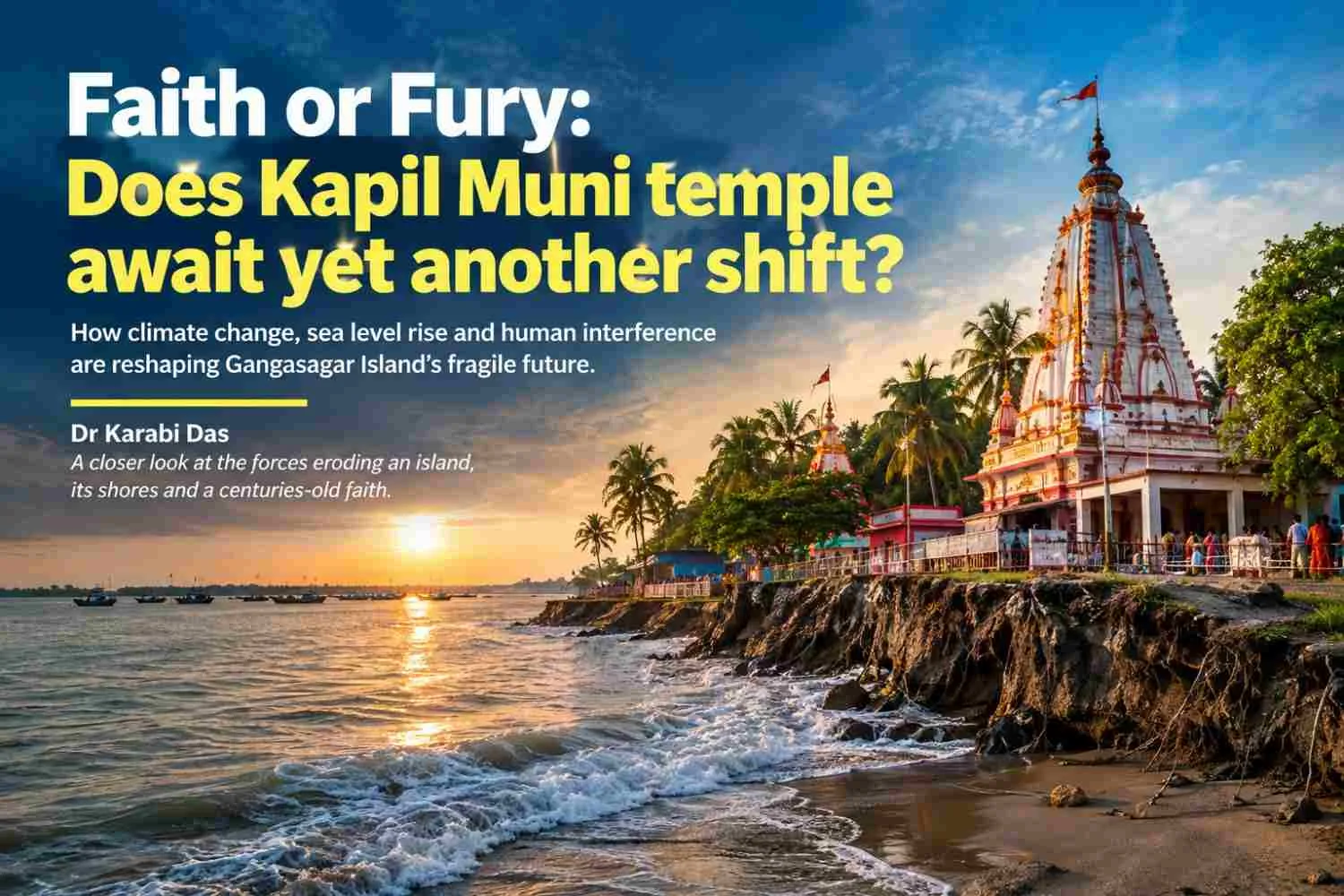
| Summary A long-drawn debate still goes on regarding the erosive nature of Indian Sundarbans, precisely the Gangasagar Island. Highly revered for the cultural significance of Sagar mela at makar Sankranti, this island draws its significance from the confluence of main flow of river Ganga through its medieval channel of Adi Ganga with the Bay of Bengal. In the Anthropocene when climate change and sea level rise are gnawing at the spine, what makes Gangasagar Island increasingly vulnerable is the galaxy of geomorphic factors and anthropic interference which play their roles in shaping the erosion accretion pattern of the island. |
| Keywords: Sundarbans, Sea level rise, Gangasagar Island, Kapil Muni temple |
Highly acclaimed for the world famous Gangasagar mela at Kapil Muni ashram, every year, Gangasagar Island is one of the most vulnerable islands of Indian Sundarban. Located at a distance of 100 km from Kolkata at the confluence of rivers Bhagirathi and Hugli, this island is approximately 30 km in north-south extent and 12 km in east-west.
Premature reclamation was done in Sagar Island like the rest of Sundarban, by embanking the coastline and major tidal channels, completely blocking the smaller tidal creeks followed by deforestation. Sagar Island has been in news owing to continuous coastal erosion, which has compelled to shift the Kapil Muni temple. Most experts have shifted the blame to climate change, ensuing sea level rise (terms which are sure to capture attention within a blink of the eye). Nevertheless, geomorphic uniqueness of Ganga-Brahmaputra delta, Sundarban and the continuous in equilibrium caused by anthropic interference play their roles in carving the erosion-accretion pattern. Reclamation by preventing the tidal spill area also results in loss of morphologic equilibrium. As Hugli estuary is a macrotidal resonant estuary, loss of tidal spill area results in disequilibrium by reducing the intertidal area and increasing the mean depth of the estuary. The estuary then tries to restore the equilibrium by active erosion of embanked channel margins and by in channel sedimentation which reduces the depth (Pethick, 1994).
Erosion accretion scenario of Gangasagar Island:
The progradation and retrogradation of any delta is determined by the occupance and abandonment of the distributary channels. The relative dominance of erosive wave and tidal action and accreting fluvial forces demarcates the stability of the delta. The Ganga Brahmaputra delta is tide dominated and the western part of the delta of which Indian Sundarban is a part, is retrograding in nature due to various factors. The silt trapping ‘Swatch of No Ground’ submarine canyon, subsidence of Bangladesh side due to neo-tectonic movements causing the major flow of river Ganga towards Padma, siltation of the offtake points of river Ganga with its distributaries and sediment trapping by construction of barrages and dams in the upstream by humans have contributed to sediment starvation causing retrogradation of Western Ganga Brahmaputra delta.
Both erosion and accretion can be found sporadically with erosion being the main characteristic. The northern part of Gangasagar Island was observed to be detached from the islet of Ghoramara episodically between 1903-19014. The time span of 1922-1997 saw maximum erosion at Shibpur-Boatkhali area with recession rates as high as 23.8 m/y with 6 m frontal dune and series of embankments being obliterated (Bandyopadhyay, 1997). Erosion at Gangasagar Island has been so frequent that the Kapil Muni temple a shrine of great cultural significance had to be shifted about six times since it was built. The earliest recorded temple (Anon, 1841; Wilson, 1846) was submerged in mid-19th century. A number of temporary temples were constructed subsequently (O Malley, 1914; Mitra, 1954; Ray, 1971). Though a permanent building was constructed in the year 1961 but it too got eroded. The present temple was constructed in 1973, some 1.5 km inside the spring tide line (Bandyopadhyay, 1997).
Interestingly, an erosion accretion cycle got superposed over the dominant erosive pattern at the southern sector between Gangasagar and Basantapur since 1922-23. This region retrograded during 1922- 1942, prograded during 1942-1969, retrograded again during 196869 – 1975 and was almost stable during 1975-1997. Small islands in the Baratala branch to the east of Sagar Island grew and disappeared bearing testimony to the ephemeral nature of Hugli estuary. A fusion of Kabasgadi Island to the left bank of the estuary between 1967-68 and 2001 was observed. The widening of the Baratala river throughout previous 200 years remarked that Sagar was attached to the area to its east sometimes in the past (Bandyopadhyay, 2000). Long term oscillations in the thalweg of Hugli are observed and changes in the islands of Hugli estuary are linked to the changes in its tidal channels and sand ridges. Reworking of sediments by wave action plays an important role in regulating the ephemeral nature of islands in Hugli estuary. Moreover, the islands are characterized by cyclical patterns of erosion and accretion and this strongly discards the model of sea level rise.
Even in the 80s, Muriganga river was accessible, better than the present times. Vessels used to ply regularly from Lot no 8 of Kakdwip to Kochuberia of Gangasagar Island. The journey was hassle free unlike today when vessel service needs to be kept closed for at least 5 hours daily as there is a risk of getting obstructed by bars. Even the coastline was different; one had to walk for about 2 km crossing sandy path. The sandy beach was interspersed with runnels (depressed areas filled with clay) and beach berms (sand dunes). One had to cross a tidal creek to reach Beguakhali to the east from Gangasagar. This path was laden with mangrove patch. A lighthouse was present even then about 500 m from sea. High sand dunes were present in Tapovan area. Concrete embankment which was created in 2022 March breached within September 2022. Even high concrete embankments broke down during cyclone Sitrang of 2023.
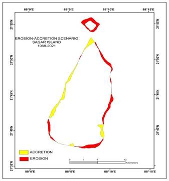
Fig 1: Erosion accretion scenario of Gangasagar Island
Previously, during the 80s, Gangasagar creek was surrounded by mangrove patch and to its east, a sand ridge used to block the creek perpendicularly. At some places these sand ridges were 30-40 feet high. Even sand encroachment at Raspur, Basantapur villages were observed previously. Even past remnants of zamindari embankments used to get exposed in these areas along with exposure of tree trunks. This bears testimony to the fact that there was a forested stretch to the southern portion of these settlements. For the previous 30 years, these areas have been experiencing beach lowering.
Gangasagar Island has lost about 12.982 km2 and gained about 10.244 km2 within 1968 and 2021. Erosion persists more in the north east and south east portions adjacent to Kochuberia, Haradhanpur, Dhablat and Beguakhali to the west.
SL NO | ISLAND UNITS |
|
|
|
| Area (km2) |
|
|
| |
1920 | 1968 | 1978 | 1988 | 2006 | 2019 | 2021 | 2023 | 2025 | ||
1 | G Plot | 57.2 | 55.7 | 51.9 | 50.4 | 42.4 | 41.8 | 41.6 | 41.8 | 41.2 |
2 | Mousuni | 30.6 | 30.2 | 33.3 | 27.6 | 29.4 | 28.1 | 27 | 26.7 | 25.8 |
3 | Sagar |
| 242.9 | 258.8 | 248 | 253.4 | 236.8 | 240.2 | 235.7 | 231.5 |
4 | Namkhana | 154.4 | 157.4 | 155.3 | 156.4 | 151.9 | 145.3 | 147.7 | 147.1 | 146.2 |
Displacement of residents from Ghoramara and conflict:
People of Lohachara and Khashimara (Ghoramara) have been rehabilitated at Dhablat, where at present 267 families reside. Presently, agriculture relies on paddy and khesari (pulses). Freshwater supply has resulted in cultivation of Aman paddy and potatoes in the winter. Watermelon is no longer profitable. Also, people of Lohachara have bought land at Kakdwip. Literacy is high in Gangasagar Island but outmigration is common among the young generation.
Connectivity has increased at Gangasagar Island, which is a sign of development according to the local residents. All small and big tourist resorts, even the government bungalows get filled during Gangasagar Mela. Erosion has increased in the past 4-5 years. People demand concrete Aila bandh (15 ft deep) to be constructed in front of Kapil Muni temple. Gunny bags are provided to protect the area adjacent to Kapil Muni temple just before Gangasagar mela.
Displaced to | Displaced from | Year | Brief description |
Phuldubi (80-85 families) | Khashimara, Ghoramara | 1964 | Each family was given 0.533 ha of land from the Government |
Dakshin Haradhanpur (50 families approximately) | Khasimara | 1964 | Each family was given 0.533 ha of land from the Government |
Bankimnagar | Lohachara | 1972 | Each family was given 0.883 ha of land from the Government. Bankimnagar Colony Fisherman Cooperative Society was established. |
Gangasagar Colony | Ghoramara | 1981 | Each family was given 0.267 ha of land from the Government and one room earthen house was given. |
Jibantala Kamalpur | Lohachara, Ghoramara | 1983 | Each family was provided with asbestos roof pucca house and 0.2 ha land. |
Plate 2: In front of Kapil Muni Temple, 2026 (Photo credit: Dr Kanailal Das)
It is thus of no doubt that Kapil Muni temple awaits yet another shift. However, the timeline may be disputed upon. Wave dashing engulfs the sea facing islands and Gangasagar Island is no exception in this case. Options like offshore breakwater and artificial coral reefs have been thought about but these options are not only exorbitant but also are sure to cause other knock on effects on the natural systems operating here.
References:
Bandyopadhyay S. (1997): Coastal erosion and its management in Sagar Island, South 24 Parganas, West Bengal Indian JournalEarth Sci. 24(3-4) 51-69 https://doi.org/10.5281/zenodo.7264120.
Bandyopadhyay S. (2000): Coastal changes in the perspective of long term evolution of an estuary: Hugli, West Bengal, India, Proc. Int. Quat. Seminar on INQUA shoreline, Indian Ocean Sub-Commission: 103-115.
Bandyopadhyay S. and Bandyopadhyay M. K. (1996): Retrogradation of the western Ganga-delta, India and Bangladesh, Possible reasons. In. Tiwary, R.C. (ed.), Proceedings of 6th conference of Indian Institute of Geomorphologists, National Geographer, 31(1&2): 105-128.
Bandyopadhyay S., Kar N.S., Dasgupta S., Mukherjee D. and Das A. (2023): Island area changes in the sundarban region of the abandoned western ganga–brahmaputra– meghna delta, India and Bangladesh, Geomorphology 422 (2023) 108482, https://doi.org/10.1016/j.geomorph.2022.108482.
Mitra R (2013): Need of a paradigm shift in disaster management approach: A case study from coastal Sundarbans presented in 7th Biennial Conference Indian Society for Ecoloical Economics (INSEE) Global Change, Ecosystem Sustainability.
O Malley’ L.S.S. (1914): Bengal District Gazetteers: 24 Parganas (Bengal Secretariat Book Depot, Calcutta) 1914.
Paul A. K. (2002): Coastal geomorphology and environment published by acb publications.
Paul A.K. (1991): Effective management strategies for the coast of West Bengal J. Geogr. Rev. India 53, pp 60-74.
Pethick J (1994): Estuaries and Wetlands: Function and form In Wetland Management, edited by Falconer, R.A. and Goodwin P (Thomas Tetford), London 1994, pp 75-142.
Ray A.K. (1971): The Gangasagar Fair (In Bengali), In Mitra, A. Ed. Religious Festivals and Fairs of West Bengal in Bengali, 3 (24 Parganas district), Govt of India (Census Operations), New Delhi, 255-271.




Add a Comment