

By Dr Kanailal Das
| Summary: Kolkata is a city shaped by water, wetlands and rivers, yet it faces mounting environmental challenges from both natural processes and human intervention. This article examines the interconnected risks of sea-level rise, tropical cyclones, urban heat islands, earthquakes, air pollution, waterlogging and the degradation of the East Kolkata Wetlands. It also explores how altered drainage systems, disappearing canals, rapid urbanisation and the loss of natural floodplains have increased the city's vulnerability. By linking Kolkata's historical geography with present-day environmental pressures, the article highlights the urgent need for resilient urban planning, wetland conservation and sustainable infrastructure to secure the city's future. |
Key Topics #Kolkata #ClimateChange #SeaLevelRise #Cyclones #UrbanFlooding #Waterlogging #AirPollution #UrbanHeatIsland #EastKolkataWetlands #WetlandConservation #UrbanResilience #DisasterPreparedness #SustainableCities #EnvironmentalPlanning #SustainVerse |
Once a premier capital of British India, Kolkata is at present proclaimed to be a dying city. Researches done by Climate Central and Intergovernmental Panel on Climate Change do proclaim that according to the latest projections of sea level rise and climate change certain low-lying areas of Kolkata shall submerge by 2030. Dating back in history, Kolkata in 1690 was under dense forested stretches. In 1622 Kolkata was protected from Portuguese atrocities by Shah Jahan and Nawab Shaista Khan (probably the Bengali word for teaching a lesson, “shayesta” ows its birth from here, well, a wild guess offcourse!). However, the imperial Kolkata faces various kinds of natural and anthropogenic hazards.
Sea Level Rise: According to projections by IPCC, the average rate of global sea level rise was 3.6 mm within 2006-2015 and that of Bay of Bengal was 4.04 mm (Rudra, 2022). This coupled with subsidence shall lead to a relative sea level rise of 7 mm/yr.
Tropical Cyclones: Kolkata is in the vicinity of Bay of Bengal, which is vulnerable to tropical cyclones and 3 out of 10 turn out to be severe cyclones. Sea surface temperature is rising at a rate of 1.6°C per decade which is much higher than the global rate of increase (1.006°C). As a result, sea level is increasing at the rate of 4 mm, while the relative sea level rise of adjacent areas of Kolkata is as high as 9 mm.
The Calcutta cyclone of 1737, also known as the Hooghly River cyclone, is regarded as Kolkata's first recorded super cyclone. This cyclone in the northern Indian Ocean has been described as the worst natural disaster in India. The flooding caused by this cyclone and the accompanying tsunami destroyed the famous Navaratna Temple at Chitpur. On 11 October 1737, a powerful earthquake occurred along with the Great Calcutta Cyclone, causing the water level of the Hooghly River to surge by 13 meters and crash into Kolkata. Later, on 5 October 1864, Kolkata was struck by another cyclone that claimed around 60,000 lives. Mud houses collapsed, boats sank, and even the ports of Khejuri and Hijli were damaged.
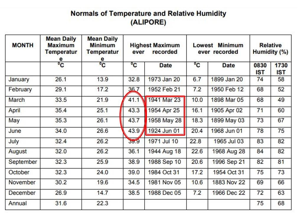
Climate change and Urban Heat Island: Heat waves, high intensity rainfall and increasing temperature since the month of March are alarming. Kolkata has turned into an urban heat island because of the urban sprawl, change in landuse and use of building materials which increase heat trapping. The maximum temperature in Kolkata crossed the 30 degrees Celsius mark on 19/2/26, wednesday after close to three months. The last time it was 30 degrees was on November 20. Since November 21, it has stayed below 30 degrees constantly. The minimum temperatures on Wednesday at 17.4 degrees Celsius was below normal. On January 6 it was as low as 18 degrees Celsius.
Earthquakes: Kolkata holds the 4th position among the locations prone to earthquakes. Even tremors were felt at Kolkata on 10th August 2023, with a magnitude of more than 5 on Richter scale. Kolkata was jeopardized due to cyclone, flooding and earthquake even on 30th September 1737. A report by Gentleman’s magazine stated casualty of 30,000 people, damage of more than 20,000 boats and ships, leading a capsize of 5 tonnes of English ship near present Creek Row. Earthquake along with cyclone was experienced on 11th October 1737.
The western side of Kolkata is higher in elevation. It gradually rises and merges with the Rajmahal Hills to the west. That was once the ancient coastline. Later, sediment carried by Himalayan rivers gradually filled the bowl-shaped Ganges delta region. At one time, the area from the Rajmahal Hills to the Garo Hills of Meghalaya was an elevated, undulating plateau.
About thirty million years ago, during the uplift of the Himalayas, the area between the Rajmahal and Garo Hills subsided into a bowl-like depression. This is the Bengal Basin.
In terms of earthquake vulnerability, Kolkata falls close to Zone 4. The plateau region west of Kolkata was once the continental shelf of the sea. That shelf still exists beneath the ground. To the east of the shelf, deep deposits of sediment from the Ganges and its tributaries have accumulated. Therefore, a deep flexure or fault zone exists along the boundary between the shelf and the sediment deposits. That fault zone is a source of earthquakes. In addition, active tectonic movements in the Darjeeling and Chattogram regions will certainly affect Kolkata. In the past, severe earthquakes caused extensive loss of life and property in Kolkata and surrounding areas. While Kolkata and several parts of south Bengal felt the tremors on Friday, 27 February afternoon, the worst damage was reported from the Villages along the India Bangladesh border, particularly near Taki in Basirhat Subdivision, which is 26 km from the epicentre in Nayabazar.
According to The National Centre for Seismology, NCS, the earthquake measured 5.5 on the Rchter scale and struck at a depth of 10 km in Nayabazar. In Villages bordering Bangladesh, between 19 km and 30 km from Satkhira, atleast five houses suffered structural damage. Portions of concrete ceilings collapsed in some homes, while wall tiles fell off in others.
Small tremors may be signs of bigger quake in Bengal seismic zone, warn experts.
Air Pollution: Pollution in Kolkata – SPM was 511 (Scientific and Environmental Research Institute, 2009). 70% of the residents of Kolkata suffer from loss of breath with 18.4 people in each 1 lakh population experiencing lung cancer (Chittaranjan National Cancer Institute, Kolkata). About 12% of the cancer patients of India hail from Kolkata (Centre for Science and Environment). According to the Scientific and Environmental Research Institute (2009 report), Kolkata's SPM level was 511. According to the institute, Kolkata is India's most polluted metropolitan city, followed by Mumbai, Delhi, and Chennai. A six-year study by the Chittaranjan National Cancer Institute (CNCI) reports that 70% of Kolkata's residents suffer from respiratory illnesses, asthma, and lung cancer. There are 18.4 lung cancer patients per 100,000 people. Recently, Kolkata's air pollution has reached levels comparable to Delhi's. During Kali Puja and Diwali, Kolkata's Air Quality Index now approaches 300. Air pollution in Delhi has recently created "pollution refugees"—residents are being forced to leave the city because of poor air quality. Even in Kolkata, high-rise development is expanding south beyond the Kolkata Metropolitan Area, and more people are moving from the city centre to the suburbs.
Although Air Quality Index (AQI) levels fluctuated marginally throughout the day, pollution levels remained well above safe limits in several areas.
AQI on 21/1/26
Sites | 6am | 6pm |
Ballygunge | 311 | 268 |
Fort William | 266 | 236 |
Jadavpur University | 313 | 283 |
Rabindra Bharati University | 355 | 287 |
Victoria Memorial | 281 | 253 |
Waterlogging: Just a few days ago, a single night's rainfall left almost all of Kolkata underwater, severely disrupting daily life. Questions were raised about cloudbursts, extreme rainfall, and the poor state of the drainage system. Ignoring Kolkata's natural slope, which was well suited to carrying away rainwater and accumulated drainage water, we built high-rises and a modern city. As a result, waterlogging in Kolkata has increased. From an administrative perspective, Kolkata can be divided into two parts: the core Kolkata and the added areas. The core area had been identified since the British period. It included Wards 1 to 100. Wards 101 to 144 are the added areas. During the British era, a drainage system was introduced according to the design of the British engineer William Clark, in which the drainage channels were located deep underground and built with large bricks. Above these drains ran the drinking water pipelines. As a result, drainage water could not mix with the drinking water.
Kolkata's establishment was completed by amalgamating three villages which had many canals where tides were experienced. Bidyadhari river used to flow through the present day Bidhannagar. Various navigable channels were found passing through Panihati, Kamarhati, Barahanagar, Cossipore and Dumdum. Even 100 years back, Salt Lake and the adjacent wetlands could be seen from Ultadanga railway station, filled with boats. This area was replete with fishing communities, fish godowns from where fish used to be marketed to Shyambazar, Beleghata even Jessore and Khulna in Bangladesh. As river Bidyadhari dried up it lost its connection with river Hugli turning it into a confined waterbody. In the year 1962, the region was reclaimed into Salt Lake City.
Krishnapur Canal was cut during British rule and it moves across Bidyadhari basin and Rajarhat area. VIP road and EM Bypass were constructed over Krishnapur canal. This road construction has created a barrier in the drainage system of Kolkata. East Kolkata Wetlands was used as storage of flood water but it got transformed to reclaimed town. All the garbage of the city gets dumped in Krishnapur Canal and Bagjola khal reducing their capacity.
At present, the situation is different. Biman Bandyopadhyay, an experienced town planner of the Kolkata Improvement Trust (KIT), says that the drainage channels and drinking water pipelines are now located very close to each other. This is extremely dangerous. This arrangement exists not only in the added areas but also in some parts of the core area. In some places, the drinking water pipelines even pass through manholes. In addition, telephone, electricity, and broadband lines run underground at various places beneath the roads. Quite often, when roads are dug up to install these lines, water pipes burst. As a result, toxic substances mix with the drinking water. According to municipal engineers, there are so many different kinds of pipes beneath the roads that the drinking water pipelines laid over the past 30–40 years have had to be placed close to the drainage channels. As a result, contaminated water enters the drinking water pipelines, especially when the water supply through those pipes is shut off.
It has been found that water flowing into Tolly Nullah exceeds its water holding capacity. Also the slope of the area surrounding Tolly Nullah is to the east but that of the canal is to the west. Keorapukur basin stores the accumulated flow from Regent Park, Bansdroni, Tollygunge, Alipur, Khidderpore. The discharge of Keorapukur basin takes place through Keorapukur main and and Keorapukur western channel. One pump of capacity 200 cusecs has been established at Keorapukur western channel. Another pump of capacity of 750 cusecs was installed at Tolly Nullah by Kolkata Environment Improvement Project Authority. 'Invert level' of the outfall drain doesn't match with outfall channel. Also, a fresh assessment regarding the actual water holding capacity of Tolly Nullah is required.
Flow from Keorapukur khal amounts to 1422 cusecs, that from Boat canal, Chetla, Mominpur amounts to 699cusecs and that from Kalighat is 566.9 cusecs. Pump and regulating structure need to be installed at Hugli outfall near Watganj in order to regulate flow of the high tide.
Starting from the airport, the airport channel crossing VIP road to join Cantonment khal and Bagjola khal. This channel is not traceable near Cantonment Khal. Another canal (Donagar khal) joins Noai khal but all these are heavily sedimented and needs dredging.
Paralysis of the Calcutta Canals:
Detachment of main channels (eg Belgachia, Bagjola and Tolly's Nullah) from Hugli River.
Increasing human settlements and effluents.
Conversion of salt marsh to Salt Lake City; development of Rajarhat New Town without considering the preexisting drainage constraints.
Upland flows of Bidyadhari and Ichhamati are almost choked. Semi diurnal tides without any upland discharge have worsened the siltation scenario.
Gradual shifting of Saptagram and Tamralipta port to the present position of Calcutta port at Khiderpore; proposals for subsidiary ports at Palta/Sagar Island indicate the gradual lowering of upland discharge level of Bhagirathi Hugli River through time.
The Role of East Kolkata Wetlands: According to NATMO, the Land Revenue Department, and the Fisheries Department, 8,000 wetlands have disappeared over the past thirty years. Kolkata and the areas on three sides of it have undergone rapid urbanization. The East Kolkata Wetlands have shrunk to half their former extent. Bare soil has nearly vanished, so rainwater can no longer infiltrate the ground, and groundwater is therefore not being recharged. Behala, Garden Reach, Tollygunge, Jadavpur, Garia, and surrounding areas are suffering from water scarcity. Nearly thirty million gallons of water are extracted from underground every day.
At one time, the water in these wetlands was saline, which is why the area was known as Salt Lake. At that time, these wetlands were part of the Bidyadhari River, and the tides flowed through them. Fish farming was mainly carried out by creating ponds with small embankments. Later, toward the end of the nineteenth century, when wastewater from the Kolkata metropolitan area began to be discharged into these wetlands, the flow of the Bidyadhari River was blocked. The inflow of saline water into the wetlands stopped. In response to the changed conditions, the fishing communities began farming freshwater fish. Based on local knowledge and experience, fish farming using the city's wastewater continued. The wetlands to the east of Kolkata once covered 20,000 acres. During the 1970s and 1980s, 10,000 acres of wetlands were filled in for the construction of Bidhannagar and the EM Bypass. In 1992, a nongovernmental organization called PUBLIC approached the Calcutta High Court to protect the East Kolkata Wetlands. Following the judgment in that case, an officially recognized map of the wetlands was prepared, and all development and construction activities within the wetlands were prohibited. In 2002, these wetlands were recognized as wetlands of international importance. Covering Kolkata as well as North and South 24 Parganas, they are now included in the Ramsar List. At present, 47 percent of the total area consists of wetlands, 46 percent is agricultural land, and the remainder is residential area. Every year, these wetlands produce 11,000 metric tons of fish, 15,000 metric tons of rice, and 150 metric tons of vegetables every day.
(Kalikata Pukur Katha, Environment, History, Society, Mohit Ray, Ananda, 2019)
About Author
Dr Kanailal Das
Masters in Geography from University of Calcutta, former senior research fellow, CSIR, PhD on Vulnerability of Gosaba, Basanti, Sundarban from Vidyasagar University.
He has participated in many national and international seminars and has papers and book chapters to his credit.




Add a Comment