By Dr Karabi Das
| Summary: Ghoramara Island in the Indian Sundarbans has lost more than half of its area over the last five decades. While climate change and sea-level rise are often blamed for this erosion, the island's disappearance is also driven by complex geomorphic processes, altered river dynamics, tidal asymmetry, and human interventions. This article explores why understanding both climate and geomorphology is essential for protecting one of the world's most vulnerable delta landscapes. |
Key Topics #IndianSundarbans #GhoramaraIsland #ClimateChange #CoastalErosion #Geomorphology #SeaLevelRise #DeltaDynamics #MangroveEcosystem #RiverMorphology #Sedimentation #TidalProcesses #HugliEstuary #CoastalResilience #NatureBasedSolutions |
The Indian Sundarban is vulnerable to riverine and coastal erosion. Though many harbour on climate change and sea level rise as the major causative factors behind the erosion of Indian Sundarban but geomorphic uniqueness of this tide country cannot be outdone. Within 1930-2000, about 283.58 sq km was lost due to erosion, while accretion of about 83.97 sq km was observed. Whether a coastline will prograde or retrograde, this will depend on whether the distributary channels are occupying or abandoning the delta. Also if there is any temporary pause in the replenishment of sediments in a portion of the delta causes erosive tidal and wave processes to take over causing erosion (Woodroffe, 2003; Bird, 2010).
Sundarban forms a part of retrograding tidal section interspersed with decaying distributaries (Das, 2025). The sector to the south west between Hugli and Baleswar Haringhata estuaries is macro to mesotidal in nature, growing about 7-1.8 kyr ago with three overlapping deltaic lobes progressing eastwards (Allison et al., 2003; Sarkar et al., 2009).
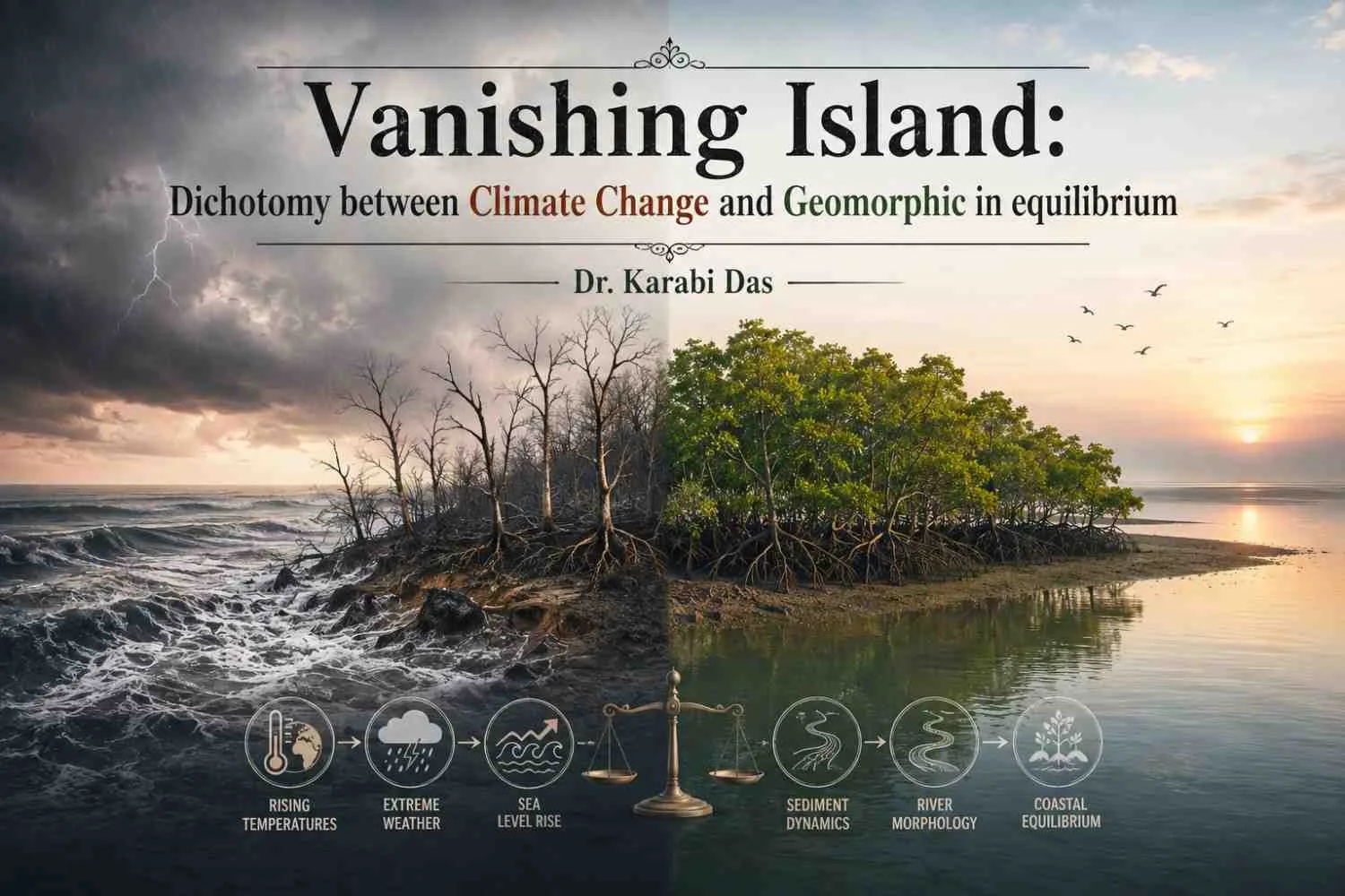
Ghoramara, popularly known as the sinking island can be cited as a significant instance of geomorphic in equilibrium perturbed by ongoing climate change and relative sea level rise. The Hugli estuary is widely known to be a victim of climate change, the Bay of Bengal being a breeding ground of tropical cyclones. However what remains largely unattended is the geomorphic uniqueness of the Hugli estuary.
The Hugli estuary is a funnel shaped (protruding towards Bay of Bengal and shrinking as we move north) macrotidal estuary, where the tidal range is greater than 4 m. Another notable feature is that the Hugli estuary is a part of the western side of Ganga Brahmaputra delta which is retrograding in nature (no new sedimentation here retards delta progradation towards the sea). Various factors such as neotectonic movements, subsidence of the eastern Ganga Brahmaputra delta, diversion of the flow towards Padma and anthropogenic activities have brought about retrogradation of the western Ganga Brahmaputra delta. In addition to this the Hugli estuary is dominated by tides and due to time velocity asymmetry (flood tides taking 3 hours to complete, ebb tides taking 9 hours to complete), result in in channel sedimentation.
This geomorphic uniqueness leads to an ephemeral character of the islands on Hugli estuary and Ghoramara is one such island. It was attached to Gangasagar island previously, but since 1968, the area of the island is observed to be decreasing.
Nayachar, another island to the west of Ghoramara is increasing in area on the contrary. This was brought about by the initiative of Kolkata port whereby a guide wall was constructed on the north western side of Nayachar island to keep the Hugli estuary navigable and aid the survival of Kolkata port. This in turn brought about a diversion of flow, causing massive erosion of
Ghoramara and Gangasagar island. The areal change of Ghoramara and Nayachar islands are notable -
Areal change of Ghoramara and Nayachar islands (sq km)
Years | Area ( | sq km) |
Ghoramara | Nayachar | |
1968 | 8.3845 | 17.327 |
1978 | 7.514 | 32.280 |
1991 | 6.235 | 48.279 |
2003 | 4.430 | 50.738 |
2009 | 4.860 | 48.847 |
2013 | 4.348 | 46.204 |
2019 | 3.999 | 51.988 |
2021 | 3.703 | 55.117 |
2025 | 3.305 | 50.155 |
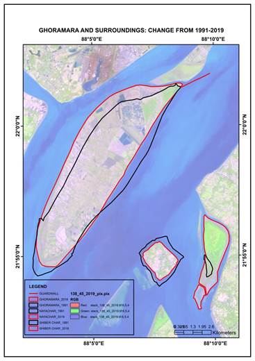
It is clearly evident that only climate change and sea level rise cannot be cited as the causative factors behind the erosion of Ghoramara. Instead a complex geomorphic characteristic and geomorphic inequilibrium are at play. In order to combat erosion the south western part of the island has been fortified with enmeshed boulders and this has arrested erosion to some extent.
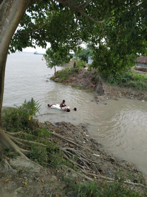
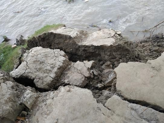 Photo plate 1: Erosion of Ghoramara
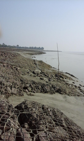
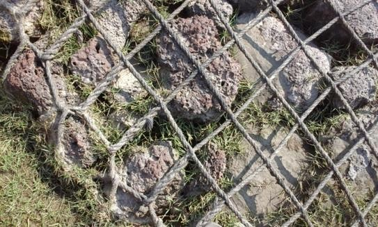
Photo plate 2: Enmeshed boulder on the south western side has protected this part of the island
(Photograph by author)
The people of Ghoramara opine that the river water should be diverted to Shiber Char to protect Ghoramara and help dredging near Sagar Island. They demand boulder protection on eastern side. A flood shelter should be built on central location near the market with all facilities. A bio-engineering technique, involving the planting or sowing of local plant species can be helpful to reduce erosion. Climate resilient embankment with bioengineered structure needs to be considered. Wherever erosion is constant, tidal basin management should be considered as an option and the rivers should be allowed their spill areas so that the height of the islands gets increased by sedimentation.
References:
Allison M.A., Khan S.R., Goodbred S.L. and Kuehl S.A. (2003): Stratigraphic evolution of the late Holocene Ganges – Brahmaputra lower delta plain, Sedimentary Geology 155(2003): 317 – 342.
Bandyopadhyay S (1997a): Natural environmental hazards and their management: A case study of Sagar Island, India, Singapore J. Tropical Geogr, 18(1997), pp 20-45. •
Bandyopadhyay S (1997b): Coastal Erosion and it's management in Sagar Island, South 24 Parganas,West Bengal. Indian Journal of Earth Science, 24 (3-4): 51-69.
Bandyopadhyay S (2000): Coastal changes in the perspective of long term evolution of an estuary Hughli, West Bengal, India published in Quaternary Sea Level Variation, Shoreline Displacement and Coastal Environments, edited by Rajamanickam V and Tooley M.J. (New Academic Publishers, New Delhi) pp 103115.
Bandyopadhyay S (2007) Evolution of the Ganga Brahmaputra delta:a review. Geogr Rev India 69(3):235–268 • Bandyopadhyay S, Nandy S (2011) Trends of sea level rise in Hugli estuary, India. Indian J Geomarine Sci 40:802–812
Bandyopadhyay S, Mukherjee D, Bag S, Pal DK, Rudra K (2004): 20th Century Evolution of Banks and Islands of the Hugli estuary. In: Singh S, Sharma HS, De SK (eds) West Bengal, India: Evidence from Maps, Images and GPS Survey, Geomorphology and environment. ACB Publications, Kolkata, pp 235–263
Bird E.C.F. (Ed) (2010): Encyclopedia of the World’s Coastal Landforms Vol.1 Springer Science Business Media B.V. (1493 pp).
Das K (2025): Physical and Socioeconomic Changes in the Indian Sundarban: An Evaluation, University of Calcutta
Das K. (2022): Vanishing Islands and Vulnerabilities: Case Studies from selected sites of Indian Sundarban. In Purkait S.K. (ed.), Sundarbans Society, Environment & Development, ISBN 978-8-19-511040-7
Woodroffe C.D. (2003): Coasts, Forms Process and Evolution Cambridge University Press, Cambridge 623 pp.
About Author

Dr Karabi Das, Masters in Geography from University of Calcutta, former Senior Research Fellow, UGC, PhD on Physical and Socioeconomic changes in the Indian Sundarban is presently working as Assistant Professor of Geography, Dr Kanailal Bhattacharyya College, Howrah.
She has participated in many national and international seminars and has 12 papers and 10 book chapters to her credit.
Her areas of interest include Fluvial Geomorphology, river in equilibrium and human environment relationship.




2 Comments
Payel Chatterjee
Excellent.
Suhana Parveen
Dissertation ar jonno onak help holo madam.