
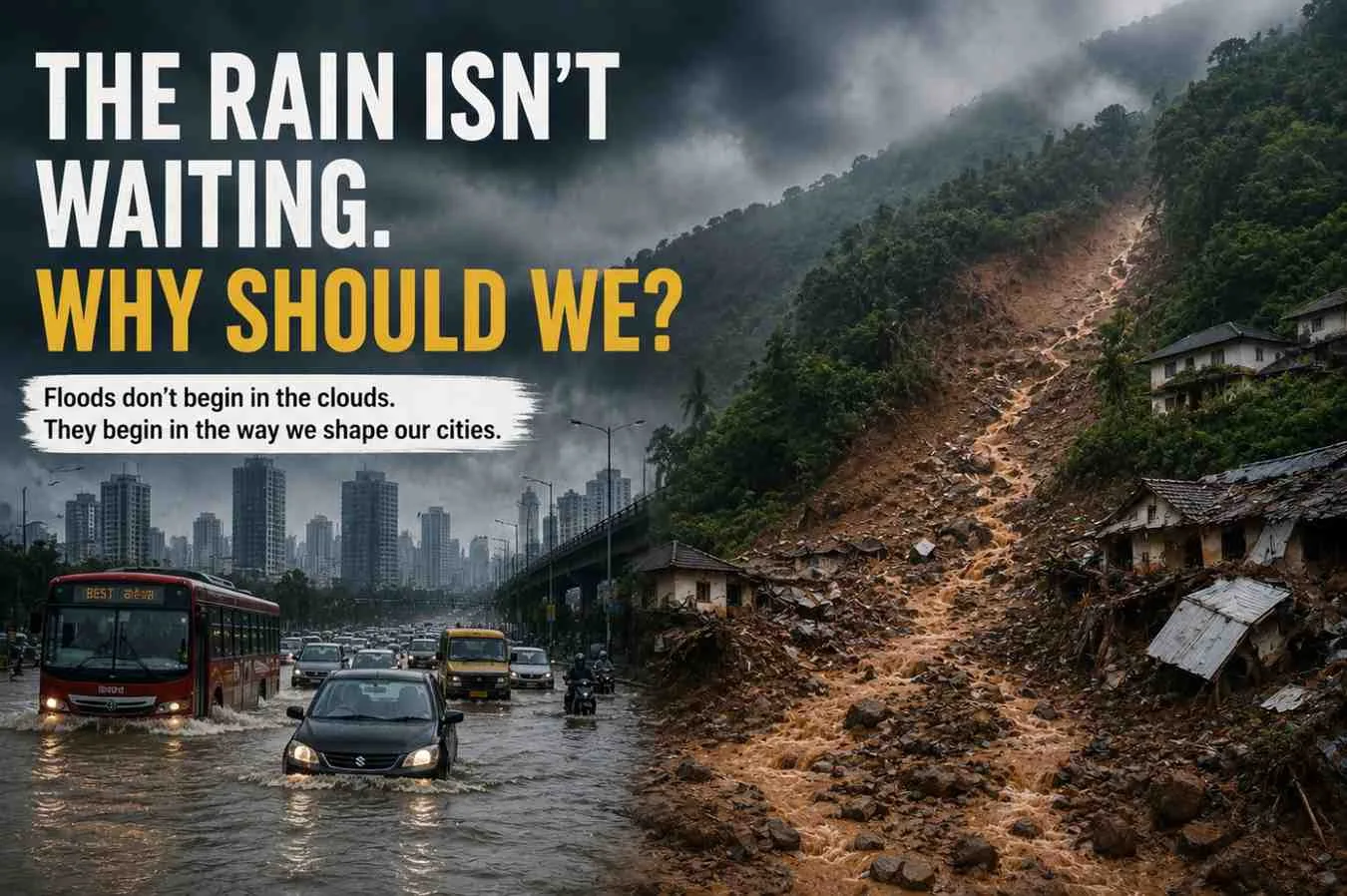
Floods don't begin in the clouds. They begin in the way we shape our cities.
By Tiyasha Ghosh
Can we keep blaming just the rain for floods? Or are our cities part of the problem even today?
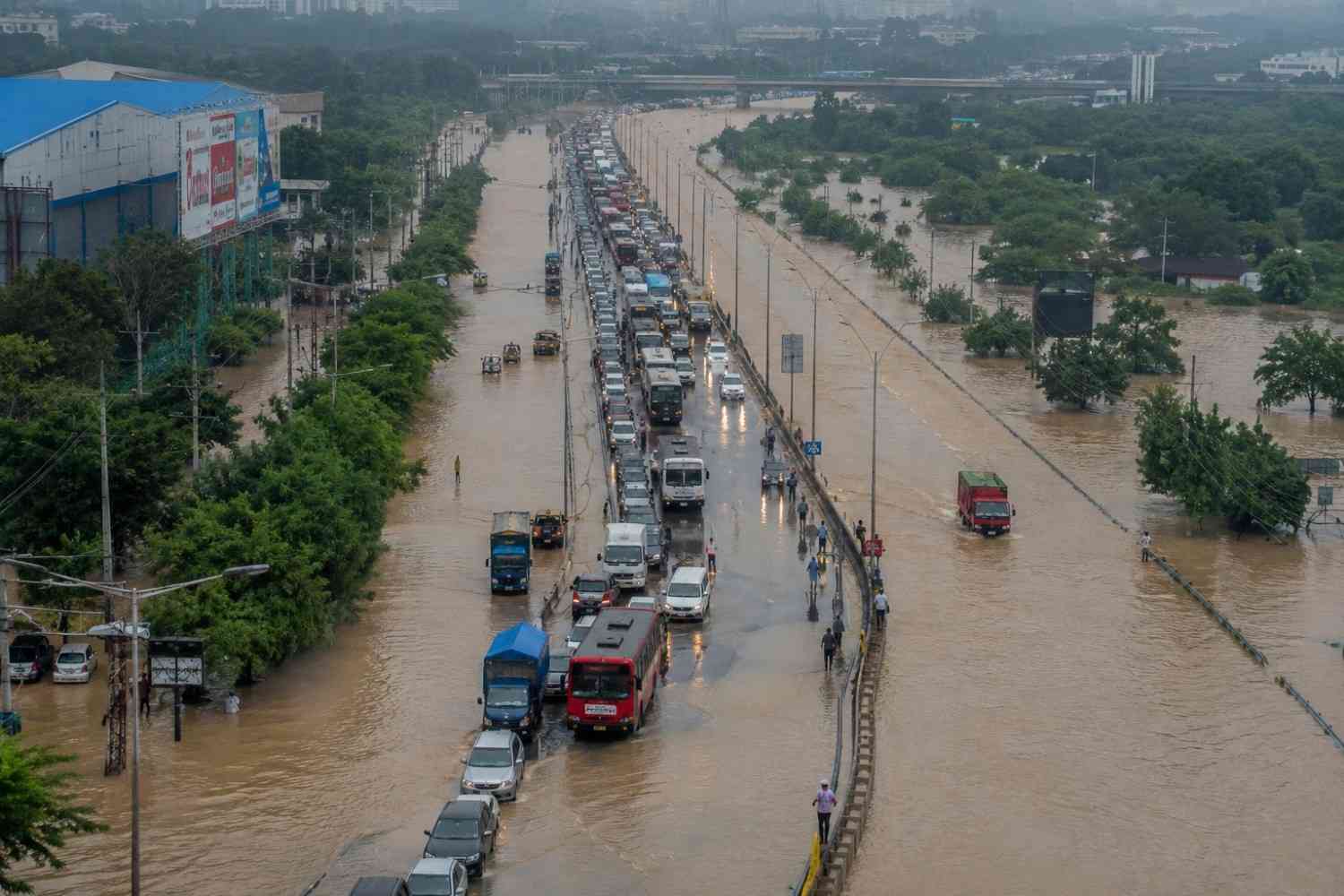
The monsoon arrives with hope, every year.
Water for our reservoirs, life for our farms, and relief from the heat.
However, every year, it leaves behind waterlogged streets, damaged infrastructure, destroyed homes and many lost lives.
Two places, two disasters: Mumbai drowned, Wayanad collapsed! One is a city of skyscrapers and the other is a quiet forested district. Different locations but identical warning!
The sky changed faster than the concrete below it.
Our infrastructure was designed for a climate that no longer exists. We used old rainfall recording system and assumed stability. Today, climate change delivers heavier rain with no warning, everything at once.
Rain is arriving faster than we can handle. Cloudbursts are turning mountains into landslide zones. The question isn’t “how much rain this season?” But the question isn’t “how much?” It’s “how fast?” - and can our land and roads survive it?
Which leaves us with one question:
Whether India’s design standards use up-to-date rainfall data, or continue to rely on old IDF curves that don’t represent today’s climate.
According to engineers, many drainage systems were built to handle rainfall expected once in several decades. However, climate records indicate that extreme rainfall events are occurring more frequently. Events once termed "once-in-a-century" storms may be happening much more often now.
You can see the impact all over the country.
Roads vanish underwater in hours. Drains can’t keep up. Buildings drown even after crores spent on their upgrades. In the hills, the ground itself gives way - mud, rocks and debris crashing into villages below.
According to experts, the cause goes beyond rainfall - it points to failures in urban and infrastructure planning.
Wetlands that previously stored excess rainwater have been reclaimed for development. Natural drainage channels have been constricted or obstructed. Hillsides have been cut to accommodate roads, hotels and buildings. In many vulnerable regions, declining forest cover has reduced the land’s capacity to absorb water during heavy rainfall.
The cost goes far beyond concrete and steel.
People lose homes and income. Kids stay out of school. Businesses close. Transport comes to a standstill. Hospitals get overcrowded. These storms are no longer just environmental problems - they hit our economy and society too.
Experts argue that India needs to stop treating floods, landslides and waterlogging as separate events. They point to a larger issue like climate change, rapid urbanisation and weak planning coming all together.
Unless cities plan for future rainfall instead of past records, every monsoon will bring the same question:
Are we preparing for the next storm- or simply recovering from the last one?
Heavy Rain
↓
Wetlands & Lakes
↓
Natural Streams
↓
Rivers
↓
Groundwater Recharge
(Current Situation)
Heavy Rain
↓
Concrete Roads
↓
Blocked Drains
↓
Waterlogging
↓
Floods & Landslides
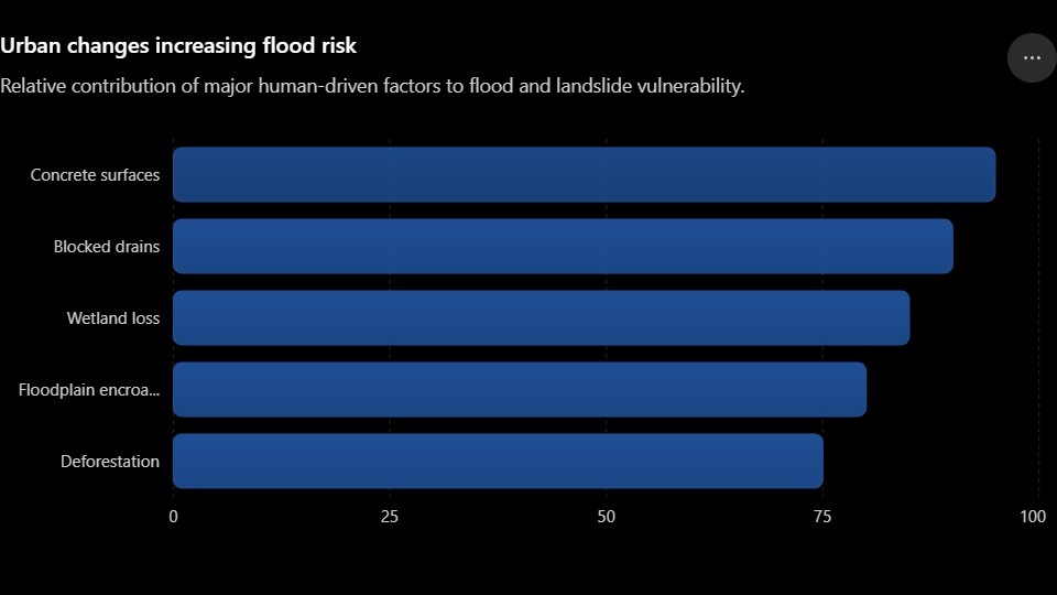
Natural drainage systems once absorbed excess rainwater. Urbanisation has disrupted these pathways, increasing flood risks
The rain hasn't changed. The ground beneath it, has.
Like water on concrete instead of a sponge, India's cities can no longer absorb what falls from the sky.
Nature once managed the rain. Wetlands, forests, floodplains, and open land worked together to absorb, slow, and store water.
Today, many of these natural safeguards have disappeared.
Wetlands are disappearing beneath housing projects. Floodplains are turning into commercial hubs. Hillsides are being cut for development. And across India's cities, concrete has replaced the open ground that once soaked up rain.
With heavy downpour, water becomes stagnant with no outlet for respite. It keeps flowing until it floods roads, homes, and entire neighbourhoods.
Floods today are shaped as much by land use as by rainfall, experts say.
Here's why.
How do engineers decide how big a drain should be? They use Intensity-Duration-Frequency (IDF) curves, which estimate how much rain can fall, how quickly it may arrive, and how often such events are expected.
The problem?
A lot of these rules were made using old rainfall data. But climate change has changed those patterns.
Cloudbursts have grown more frequent and short-duration rainfall has become more intense. For example, 100 millimetres of rain that previously fell for an entire day can now occur within two to three hours.
Drainage systems have not evolved in line with changing rainfall conditions. Many continue to operate based on historical rainfall patterns that are no longer valid.
Experts say India can no longer rely on yesterday's rainfall patterns. Infrastructure must be designed using today's climate realities.
The challenge is even greater in the hills.
Unlike cities, where water usually causes flooding, mountain regions face another danger- landslides.
Cutting down forests and carving slopes for roads or buildings loosens up the soil. When heavy and long rainfall persists, water soaks in, weakens the slope, and everything collapses.
The Wayanad landslide was a painful reminder: when heavy rain hits fragile hills and if we ignore the risks, it can turn deadly.
Scientists say this is why climate adaptation can no longer remain separated from urban or infrastructure planning.
Every new road, bridge, housing project, and drainage system must answer one question:
Is it built for tomorrow's rainfall?
| Parameter | Earlier Climate | Current Climate |
| Rainfall Pattern | Spread over longer periods | Intense rainfall in short bursts |
| Drainage Design | Based on historical rainfall | Frequently exceeded |
| Wetlands | Larger natural storage | Rapidly shrinking |
| Flood Frequency | Less frequent | Increasing |
| Climate Risk | Moderate | High |
Rain may trigger the disaster. But building for yesterday's climate could make it inevitable.
Experts say India must rethink how it builds its cities. Instead of forcing water to adapt to development, development must adapt to water.
And that begins with something many places have lost, i.e., space.
Protecting floodplains, wetlands, hills, and stormwater channels isn't just about conserving nature- it's about protecting people.
Because when nature's defenses disappear, concrete isn't enough.
Experts say cities can't plan for tomorrow using yesterday's flood maps. Updated rainfall data should guide every development decision, and flood-prone areas must be identified before new roads, housing projects, or commercial complexes that are built.
Experts also say IDF curves should be updated regularly so drainage systems are built for today's climate- not yesterday's.
Technology can also make a huge difference.
Floods can't always be prevented. But with accurate forecasts and real-time monitoring, their impact can be reduced through timely warnings and faster action.
But technology alone is not enough; good governance is equally important.
Experts say flood management shouldn't begin when the rain starts- it should begin long before. Drains need to be cleared before the monsoon, natural waterways kept free of invasions, and construction in high-risk areas are strictly regulated. Most importantly, agencies must work together before the disaster strikes.
Communities also play a crucial role.
Communities hold critical, lived knowledge like which streets flood first, which drains fail annually, and which areas remain mostly exposed. When local knowledge becomes part of disaster planning, warnings arrive sooner and responses become more effective.
Small actions can also create a big impact. Keeping drains free of plastic waste, protecting neighbourhood ponds, planting trees, avoiding construction on natural drainage channels and following official weather advisories all help reduce flood risks.
The lesson extends beyond Mumbai or Wayanad.
Urban growth and climate change are colliding. One is covering the ground with concrete, the other is bringing heavier rain. What we build today will shape tomorrow's disasters.
India has a choice: keep rebuilding after every disaster- or start preventing the next one. Or we can act now by investing in smarter planning, stronger natural defences, modern infrastructure and cities built for a changing climate.
Because resilience is not built during an emergency. It is built way before the first raindrop falls.
The cost of preparing may be high but the cost of not preparing will be higher.
Mumbai and Wayanad were more than disasters - they were warnings.
| Aspect | Mumbai | Wayanad |
| Main Hazard | Urban Flooding | Landslides |
| Primary Cause | Blocked drainage & urbanisation | Fragile slopes & intense rainfall |
| Natural Buffer Lost | Wetlands & mangroves | Forest cover |
| Main Impact | Waterlogging & transport disruption | Loss of lives & infrastructure |
For decades, India has responded after the damage has been done. But experts say rebuilding after every flood and landslide is no longer enough in a climate where extreme weather is becoming the new normal.
The focus must shift now from disaster response to disaster prevention.
The solution begins with working alongside nature - protecting wetlands, restoring rivers, safeguarding forests, and modernizing drainage standards. It also means planning every new project around future rainfall, not outdated climate records.
Climate resilience begins with collective action.
Governments, businesses, planners, engineers, and citizens all have a major role to play. Because every protected wetland, every clear drain, and every preserved green space make a city stronger when the next storm arrives.
The cost of acting may seem high today but the cost of doing nothing is higher.
Every flooded street, every collapsed hillside, and every displaced family carry the same message: preparing before disaster is less costly than rebuilding after.
Nature has always played by its own rules.
Water will always find its way. Rivers will always seek their floodplains. Hills will always become unstable when forests disappear and slopes are pushed beyond their limits.
The real choice is whether we build with nature- or keep building against it.
Resilience isn't about rebuilding faster. It's about ensuring there's less to rebuild.
As India enters a warmer and more uncertain future, every road, bridge, neighbourhood, and city will reflect the choices we make today.
Because tomorrow's resilience is being built long before the next storm arrives.
DOCUMENT & DATA STACK
| Document | Purpose |
| India Meteorological Department (IMD) Rainfall Data | Compare historical and current rainfall intensity. |
| National Disaster Management Authority (NDMA) – Urban Flooding Guidelines | India's official recommendations for urban flood management. |
| Geological Survey of India (GSI) – National Landslide Susceptibility Mapping | Explains why regions like Wayanad remain highly landslide-prone. |
| IPCC Sixth Assessment Report (AR6) | Scientific evidence linking climate change to increasing extreme rainfall events. |
| Ministry of Housing & Urban Affairs (MoHUA) | Urban drainage and climate-resilient infrastructure guidelines. |
| Central Water Commission (CWC) | Flood monitoring and drainage management data. |
| ISRO National Wetland Inventory | Wetland loss and land-use changes across Indian cities. |
Key Data Points:
| Topic | Data/Observation |
| Rainfall Pattern | India is witnessing more frequent short-duration, high-intensity rainfall events due to climate change. |
| Urban Flooding | Existing stormwater drains in many cities were designed using historical rainfall data that no longer reflects today's climate. |
| Wayanad | Highly vulnerable due to steep slopes, fragile geology and extreme monsoon rainfall. |
| Wetlands | Shrinking wetlands and encroached floodplains reduce natural flood storage capacity. |
| Climate Adaptation | Experts recommend updating Intensity-Duration-Frequency (IDF) curves using present-day climate observations. |
| Problem | Solution |
| Urban Flooding | Restore wetlands |
| Waterlogging | Permeable pavements |
| Landslides | Afforestation & slope stabilisation |
| Drain Overflow | Regular desilting & drain maintenance |
| Climate Risk | Climate-resilient urban planning |
Sources:
India Meteorological Department (IMD)
National Disaster Management Authority (NDMA)
Geological Survey of India (GSI)
Central Water Commission (CWC)
Ministry of Housing & Urban Affairs (MoHUA)
Intergovernmental Panel on Climate Change (IPCC AR6)
ISRO National Wetland Inventory
The Times of India (base report)



Add a Comment