

| Summary: Floodwaters in Assam have hit hard this year. However, there is a dilemma between the real cause behind this deluge. Was it because of rainfall alone or were anthropic interferences have something to account for? |
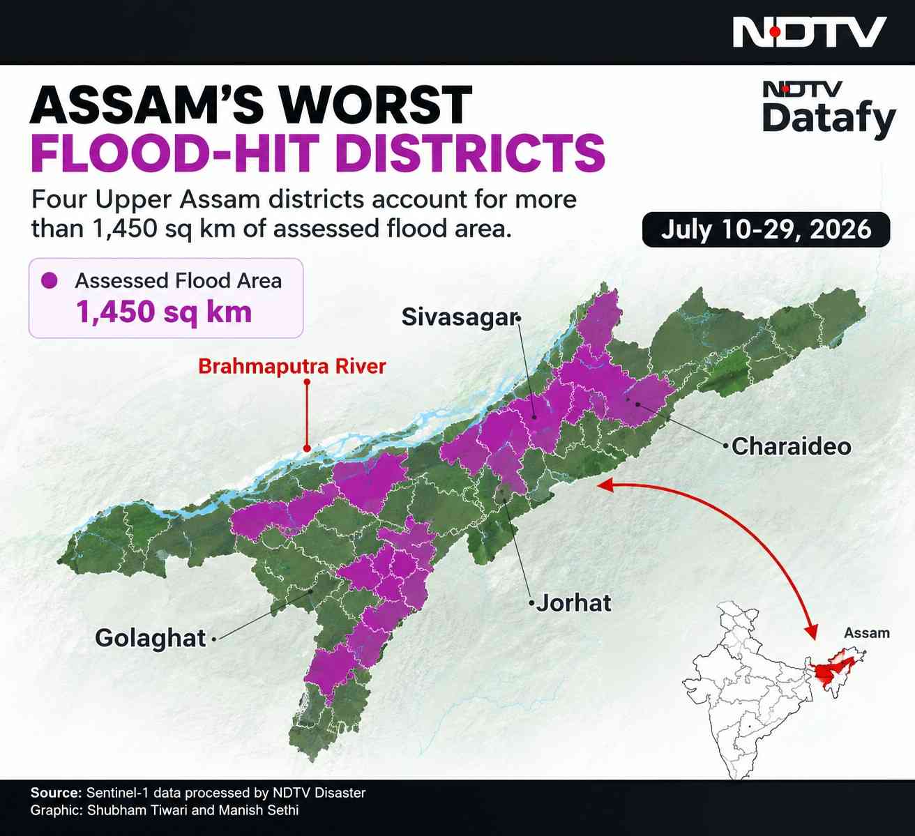
On 19 July, 2026 Assam experienced a disastrous flood in four districts, Shibagar, Chorai Deo, Jorhat and Golaghat. About 100 people have lost their lives. By 20 July, reports indicated that about 3.6 lakh were affected across 15-16 districts, with death rising rapidly as the flood intensified. About 40,000 hectares of crop area have been submerged, causing a significant loss of livelihood in agriculturally dependent areas. The subsequent 2026 Assam flood became much larger than the initial 19-20 July flood episode. Was the flood, the outcome of excessive rainfall or was it the result of non-scientific human activities?
Why did the two rivers of Nagaland become so violent this year?
There was heavy rainfall in the month of July, mainly mid-July. The important feature of the rainfall is the high concentration within a short period. Heavy downpours with landslides along the slopes of hills in Nagaland made the situation disastrous. Dikhou and Bhog doi rivers gushed down with huge water and hill slop debris.
Lower Assam in the Brahmaputra valley experiences flood almost every year. But the Upper Assam does not experience flooding as it is located in high altitude. On 19 July the people of upper Assam were surprised when the villages were flooded with water and a huge amount of silt.
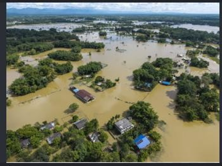
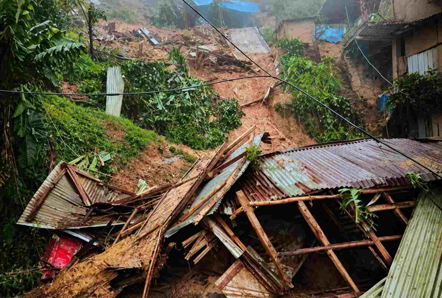
One of the neighbouring states of Assam is Nagaland. It is located at a higher altitude. There is a district named Mon near Assam. Heavy downpours on 19 July caused severe landslides killing 11 persons. At the same time the rivers like Dhikhow, Nadan, Dhansiri, Disang,Janji, Taokak started flowing much above the danger level. This situation was known to the Government agencies like disaster management and civil defense. But prompt responses from these Government agencies were not taken. The situation led to disaster eventually.
Seventeen districts of Nagaland have coal mines where illegal mining activities have been continuing for a long period. This was not uncontrolled for the sake of unscrupulous businessmen. In some areas artificial lakes were formed due to unscientific extraction of coal and stone.
The hillslopes of Assam and adjoining states also experienced huge deforestation in recent years. Assam Tribune on 31 July, 26 commented, about 800 sq. km of forest was destroyed during 2013-2023. As per the report of the 'Global Forest Watch', within a time span from 2001 to 2025, 3.6 lakh acres of land were deforested. Deforestation in the hill slopes enhanced the risk of landslides and floods. The lakes in different parts of Nagaland formed by the mining activities overflowed and after breaching the embankment came down at a very high speed.
For the construction of four lane National highway huge amount of sand and rocks were extracted from the hillslopes. As a result, long stretches of hills were deforested. Excessive constuction activities, reckless deforestation and illegal sand collection from the Dikhow river have made the situation out of control.
The rivers are forced to transport huge amount of silts causing the continuous rising of riverbeds. After the disaster many deadbodies have been recovered from the silted mud. The houses in large numbers were submerged under the mud.
How human activities are responsible?
Human activities contributed to the severity of the 2026 Assam floods. Actually, the disaster is the outcome of extreme rainfall, Assam's river system, and human induced environmental changes.
- Deforestation and hill slope modification enhance faster run-off. Removal of vegetation has reduced infiltration of rainwater and increased surface runoff. These again enhance soil erosion adding sediments to the rivers.
- Wetlands degeneration: Wetlands retain excess monsoon rainfall. Degradation of wetlands reduces natural water holding capacity of the landscape to mitigate flood waters surge.
- Encroachment of riverine flood plains: Expansion of settlements on natural flood plains of the rivers had already been captured. During water level rise in the major rivers of Assam caused havoc on the settlements.
- Infrastructural development and drainage modification are obstructing natural drainage system and alter the pathway of surface runoff.
- Embankments are built to restrict the river from invading the adjoining floodplains and human settlements. This is against the natural course of the rivers. Rivers during monsoon breach the embankments to maintain their previous pathway. Thus, devastating flood occurred frequently. In many cases rivers change their courses leading to river bank erosion, overtopping and embankment breaching.
- increasingly intense rainfall causing increased flash floods risks have enhanced the possibility of flash floods.
An important note on July 19 flood:
The initial trigger was generated largely by intensive rainfall in the neighbouring states of Nagaland on 19July. But human interference on the hillslopes and natural drainage system had determined how much damage that rainfall produces.
That can be explained in this way,
Heavy rainfall -------------Rapid run off --------------erosion-----------more sediment supply--------reduced water holding capacity -------------water spill over in the vulnerable zones ---------greater impact of flooding.
A better interpretation:
Highly concentrated rainfall and Assam's extraordinary river geomorphology created the flood hazard; human activities increased the vulnerability and, in some locations, probably increased the intensity and extent of flooding.
Is the cloud burst responsible?
The Government attributed the cause of heavy rainfall to a huge cloud burst. So, the disaster in Assam is the outcome of natural calamities though the rainfall pattern is describing the other side of the coin.
How can Assam have floods despite deficient rainfall??
Assam is one of the deficient states in rainfall in 2026. The IMD data reported on 1 September showed Assam's cumulative monsoon rainfall at 24% below the normal. Out of 35 districts of Assam 18 districts got below normal rainfall.
Assam experienced large deficit, about 40% below normal by early July.
Assam got 29% below normal rainfall from 1 June -29 July.
On 19 July extremely heavy rainfall took place in neighbouring Nagaland and Arunachal Pradesh and parts of Assam.
August 2026 was also a deficient rainfall month for Assam, although there were several spells of heavy rainfall.
Assam experienced intermittent heavy rainfall, especially around the beginning and end of August, rather than continuous widespread rainfall.
- By the end of the August, the overall 2026 monsoon rainfall remained deficient in Assam.
The 2026 rainfall pattern of Assam was as follows
Long dry periods -------- Sudden intense rainfall ---------- Rapid river rises and flash floods ---------Relatively dry periods.
Government initiatives:
After each flood, Government initiatives include repairing and construction of embankment. Actually Assam' s primary response to flooding has been the construction of embankments, now totalling nearly 4,800 km. Every year there is constuction or repair of these embankments after or before the flood. No long- term measures have been implemented so far as to mitigate the flood and erosion problem. Unplanned growth of urban settlements are not checked, wetlands are not being saved.






Add a Comment