
12 October, 2026 | Kolkata
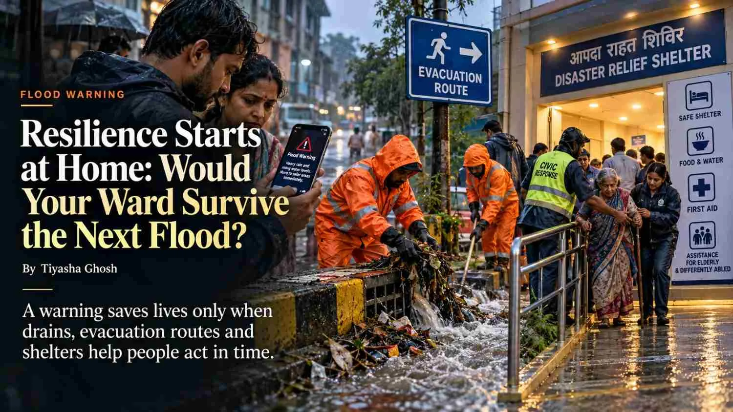
| A flood warning may reach people in time, yet fail to protect a family if drains are clogged, evacuation routes are unsafe or the nearest shelter is inaccessible. By examining household preparedness, public infrastructure and early-warning systems, this analysis explores what genuine flood resilience means and whether communities are truly equipped to act when disaster strikes. |
| Summary: From waterlogged streets in Kolkata to flood-prone delta settlements and cloudburst-exposed Himalayan communities, disaster preparedness depends on more than forecasts. This investigation examines whether warnings, drainage, evacuation routes and shelters can protect people when they need them most. |
If a Flood Warning Arrives Today, Would Every Household Know What to Do - and Be Able to Do It?
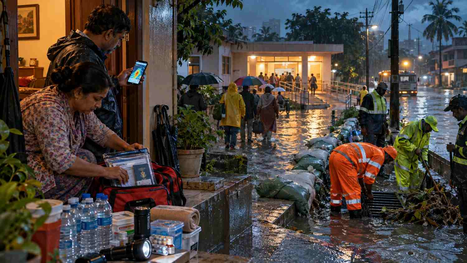
A warning on a phone is only the beginning of disaster preparedness. Imagine a family receiving an alert about heavy rainfall. The nearest drain is clogged, the lane outside is already filling with water, and the designated evacuation route passes through a low-lying stretch. An older family member cannot walk quickly, while the household is unsure which shelter is open.
The warning may be accurate, but the family’s ability to respond depends on what happens next. Can they reach safety in time? Is the evacuation route accessible? Will the nearest shelter be open and equipped to receive them?
These questions lie at the heart of the 2026 International Day for Disaster Risk Reduction, observed on 13 October under the theme “Resilience Starts at Home.” The United Nations Office for Disaster Risk Reduction (UNDRR) is using this year’s theme to highlight safe housing, risk-informed planning, accessible warnings and household preparedness. It also recognises that people do not have equal access to safe homes, reliable information, financial resources or the support needed to evacuate. Source: UNDRR
For India, this question matters across very different landscapes. Urban neighbourhoods can struggle with waterlogging and drainage failures; delta settlements face flood- and cyclone-related risks; and Himalayan communities may experience intense, highly localised rainfall, landslides and sudden changes in river conditions. Although these hazards differ, they expose a common problem: preparedness is only as strong as the weakest link between receiving a warning and being able to act on it.
What Happens Between a Warning and a Safe Evacuation?
India has developed systems to monitor weather hazards and distribute warnings. The India Meteorological Department (IMD) provides impact-based and risk-based weather warnings, while the National Disaster Management Authority (NDMA) operates the SACHET National Disaster Alert Portal. SACHET brings together warnings from agencies, including IMD and the Central Water Commission (CWC), and supports their dissemination through mobile phones, television, radio, apps and other communication channels. Sources: IMD information via PIB and NDMA SACHET
These systems are important advances. However, the availability of a warning channel does not automatically establish that every household received the message, understood its urgency or had enough time to leave.
Official figures also show why forecasts must be interpreted carefully. In a December 2025 parliamentary response, the Ministry of Earth Sciences reported that IMD’s accuracy for heavy-rainfall forecasts was 85% at a one-day lead time and 58% at a five-day lead time. These figures describe national heavy-rainfall forecast performance at different lead times. They do not indicate the probability that a particular street will flood or that a specific household will receive an alert. Nevertheless, they underline why forecasts, local observations and preparedness plans must work together. Source: PIB, 17 December 2025
The investigation should therefore follow an alert through its entire journey: when the forecast was issued, when the relevant authority received it, when a local message was sent, when residents received or heard it, and what action followed. Where records are unavailable, that gap must be reported rather than filled with assumptions.
Can a Kolkata Ward Drain the Water - and Move People Out Safely?
In an urban neighbourhood, flooding is not simply a question of how much rain falls. Drainage capacity, waste accumulation, maintenance, road levels, land use and the condition of nearby water channels can all influence how quickly water collects and recedes.
The National Institute of Disaster Management (NIDM) has identified urban flooding as an issue requiring coordination among local bodies, planners and disaster-management authorities. Its training material on urban flood management also highlights the role of geospatial tools and community-based approaches. Source: NIDM
A ward-level audit should begin with a drainage map and a physical inspection. Which streets and lanes are most vulnerable? Where are the drains, culverts and outfalls located? Are maintenance records available, and do they show when the system was last cleared? Are there recurring complaints about waterlogging, and what action followed?
These questions matter because a map of infrastructure cannot, by itself, establish its actual condition. A drain may appear on a municipal map but remain blocked in practice. A road may be designated as an evacuation route but become impassable when water rises.
The same test applies to housing. Reporting should examine whether homes have safe exits, whether residents know where to go, and whether people living in ground-floor or low-lying dwellings have a practical way to move essential belongings and reach safer ground. It should also distinguish household responsibilities from the public responsibility to maintain drainage, enforce appropriate building and land-use standards, communicate risks and provide safe evacuation options.
Does a Delta Settlement Face a Different Preparedness Test?
A delta settlement requires a different risk assessment. Its exposure may involve river flooding, intense rainfall, tidal conditions, cyclone-related inundation or damage to roads and other connections. The specific hazards must be established for the settlement selected rather than assumed to be identical across the Sundarbans or the wider delta.
The audit should examine whether residents have reliable access to warnings, whether evacuation routes remain usable during flooding and whether the designated shelter can be reached on foot, by boat or through another locally appropriate means. It should also establish what happens when transport services stop, mobile connectivity weakens or a route becomes inaccessible.
Shelter availability is not the same as shelter accessibility. A building may be designated for evacuation but remain difficult to reach for a wheelchair user, an older person, a pregnant resident or someone who needs assistance. The investigation should check ramps, entrances, toilets, lighting, accessible communication and arrangements for people who cannot evacuate independently.
The comparison with Kolkata should not rank one community as safer simply because it has more visible infrastructure. Instead, it should identify how each location manages its specific risks and which gaps prevent residents from acting on warnings.
What Can Himalayan Cloudbursts Teach Us About the Last Mile?
The additional reporting module on Himalayan cloudbursts and early-warning systems extends the investigation beyond the two flood-prone locations. It examines how warning systems perform in remote hill districts, where steep terrain, highly localised rainfall and limited observation coverage can complicate risk communication.
IMD has explained that cloudbursts are highly localised events and that monitoring them requires dense networks of automatic rain gauges and weather stations. It has also noted that remote Himalayan and Western Ghats areas remain data-sparse, making long-term trend analysis difficult. This distinction matters: warning systems may improve, while highly localised events can remain challenging to observe and anticipate. Source: IMD press release, 15 October 2025
The comparison should focus on the practical chain from detection to action: available observations, forecast or warning issuance, transmission to district and local authorities, communication to residents, and the availability of safe routes and shelters. It should not suggest that a Himalayan cloudburst can be predicted in exactly the same way as a widespread heavy-rainfall event.
The Tunis exercise also requires careful treatment. Its findings may offer useful lessons about preparedness, coordination or warning communication, but a simulation cannot establish how effectively a system performs in real conditions. Any exercise results should be presented as findings from that exercise, supported by its date, participants, scenario and documented outcomes. Claims about actual performance in Indian communities must be supported by separate Indian records or field observations.
Who Is Responsible When a Warning Does Not Lead to Safety?
Preparedness is a shared responsibility, but responsibility is not distributed equally. Households can keep emergency contacts, understand local alerts and prepare essential supplies. They cannot independently clear municipal drains, repair damaged public roads, build accessible shelters or establish a reliable public warning network.
Local authorities and ward officials must be able to explain their drainage and maintenance arrangements, evacuation plans and shelter provisions. Engineers can help establish whether infrastructure is designed and maintained for the relevant risks. Disaster-management authorities can explain how warnings are received and passed on. Disability advocates can identify barriers that standard evacuation plans may overlook.
The investigation should include different perspectives. Authorities may point to warning platforms, preparedness plans, shelters or completed infrastructure works. Residents may report that routes remain unusable or that messages arrive too late to act on. Engineers may explain the limits of drainage capacity, funding or the challenges of managing intense rainfall. Each perspective should be tested against records and direct observations rather than treated as a complete explanation.
The evidence should include warning timestamps, drainage maps, maintenance records, shelter-access checks and documentation of disaster drills. A published plan establishes that a plan exists; it does not prove that the plan has been practised or will work under pressure. Similarly, a completed drill does not prove that every resident can evacuate safely.
What Should a Household and Ward Preparedness Audit Include?
The final reader tool should make the investigation practical. A household and ward checklist can ask:
- Housing: Are exits safe, and does the household understand the hazards affecting its location?
- Warnings: Which official channels provide alerts, and is there a backup if a phone or internet connection fails?
- Drainage: Are nearby drains and outfalls maintained, and are recurring waterlogging points documented?
- Evacuation: Is there a clearly identified route, and has it been assessed for flood conditions?
- Shelters: Is the shelter open, reachable and suitable for people with different mobility and support needs?
- Emergency arrangements: Are contact numbers, essential medicines, documents and necessary supplies accessible?
- Practice and accountability: Has a drill been documented, and is there a designated authority or office to contact about unresolved risks?
A ward risk map should accompany the feature only after locations and routes have been verified. It should distinguish confirmed hazards, official evacuation and shelter information, observed infrastructure problems, and locations that still require verification. Sensitive household information should not be published.
Resilience Is Measured Before the Water Rises
The proposed comparison between a Kolkata ward, a delta settlement and Himalayan warning systems should produce more than a list of risks. It should reveal where the chain of preparedness works, where it breaks and who has the authority to address each gap.
The aim is not to claim that every flood can be prevented or every warning can eliminate danger. It is to examine whether people receive usable information, whether public infrastructure supports safe action and whether the most vulnerable residents are included in disaster planning.
On the International Day for Disaster Risk Reduction, “Resilience Starts at Home” offers a useful principle. But homes cannot become resilient through household effort alone. Safe housing, maintained drainage, accessible evacuation routes, dependable warnings and accountable local planning must work together.
The real test is not whether a ward has a disaster plan. It is whether residents can use that plan when the next warning arrives.
Sources:
- UNDRR — 2026 International Day for Disaster Risk Reduction: “Resilience Starts at Home”
- UNDRR — 2026 campaign and key messages
- Ministry of Earth Sciences / PIB — Early Warning System, 1 April 2026
- Ministry of Earth Sciences / PIB — Monsoon Warning System, 17 December 2025
- NDMA — SACHET National Disaster Alert Portal
- IMD — Press release on cloudbursts and observation requirements, 15 October 2025
- National Institute of Disaster Management — Urban flood management training report, March 2025
- NDMA guidelines — Floods, urban flooding and disability-inclusive disaster risk reduction




Add a Comment