Water security

Covers India’s efforts to ensure sustainable water availability through conservation, efficient management, and protection of water resources.

Showing 11

10 Sep 2026

  SummaryThe present is tumultuous with all kinds of disasters looming in and guess what, we are to blame mostly. In the actively changing and evolving Himalayas, claws of so called development seep in causing the Himalayas to bleed and the rivers changing their courses, changing their planform, often flooding and leaving millions homeless. Be it the charlands of West Bengal or the upstream stretches of Ganges in the Himalayas, anthropogenic activities in the form of river engineering, development of smart cities, river linking projects and what not, we are interrupting with the fluvial dynamics only to get doomed.  KeywordsAvulsion, fluvial dynamics, Anthropocene, equilibrium  Avulsion and shifts in river courses are characterized by scouring of riverbed and banks. These phenomena are common in case of Himalayan rivers and have been on the increase in the Anthropocene. Humans can completely alter a river system turning it into a controlled one by damming its course, by flow diversion, by dredging or clearing the channel, by straightening the channel pattern or by increasing its supply via an artificial channel. In order to control flooding and river bank erosion, channels are frequently modified. Modifications of channels often include channel widening, channel deepening, artificially cutting meanders and even channel straightening. This jeopardizes the hydrologic regime. Also, if channelization occurs, higher flows are often found downstream as the water rushes out of the channelized reach. High backwaters are resulted, resulting channel deposition lowering the channel capacity.   A direct change in the river system is caused when dams are constructed. The hydrologic regime is altered by flow regulation, decreasing peak flows and increasing low flow. As a result, sediment transport capacity is modified inducing erosion and deposition affecting channel morphology. Dams also cause deposition in and above the reservoirs which thereby lose their capacity to retain water. Spillway water from dams is devoid of sediment load and thus tends to erode the channel immediately downstream.  The case of Aswan dam can be cited as an example where scour erosion is noted in the lower reaches, with a lean sediment transport and downstream erosion as the flow is regulated. Increase in depth and decrease in width is also reported for other channels which have experienced dam construction.  Morphologic discourse of the Ganga valley leads to its classification into 7 segments (Singh and Singh, 1992). Variation in discharge, sediment load, ground slope, anthropogenic activities and tectonics result in variation in channel morphology (Valdiya, 2003). Geology, geomorphology, climate alongwith human influence modifies fluvial dynamics. The outer Himalayan belt consists of recently uplifted Siwalik of Miocene Pliestocene detritus filled sediments – coarse sandstones, clays and conglomerates. Except the Siwaliks, the concerned region is a portion of the Ganga megafan and this surface shows several north-south aligned drainage channels (Shukla et al., 2001). This region is deeply incised by the active Ganga River and other rivers. Active incision of channel over the megafan surface is evidenced by the prominent channel scarps.  Over the years, channel sedimentation with the formation of channel bars in Ganga and other rivers is observed. Decline in the number of bars accompanied with increase in size of the bars indicates rapid silt deposition. Sandbars are observed to change occasionally during floods. The shifting nature of Ganga channel is evidenced by the presence of an abandoned channel within the cross section situated below the Chandi bridge, located on the left bank of river Ganga at Nildhara area.  The Bhimgoda barrage is located on river Ganga at Har ki Pauri. It was built as the headworks of upper Ganges canal. The initial barrage was completed by 1854. Replaced twice, the barrage was completed in 1983. The primary purpose of the barrage was irrigation; it was also used to generate hydroelectricity and used for flood control. The barrage has a length of 454 m and a spillway capacity of 19,300 m3/s.  The local geomorphology of the Ganga River is significantly altered due to the construction of the Bhimgoda barrage as it results in huge diversion of water into the upper Ganga canal. This leads to excessive in channel sedimentation in both upstream and downstream courses interrupting the natural channel equilibrium. As a result, the flow velocity is reduced in the lean periods with the reduction in monsoonal rainfall. The braided floodplain dynamics also gets altered as a result.  The Bhimgoda barrage diverts the the river water into the upper Ganga canal for hydroelectric power generation. Studies indicate that water velocity of river Ganga is about 1-1.9 m/s in the Haridwar region after the Bhimgoda barrage (Kumar et al., 2023).  There have been drastic changes in water discharge, sediment concentration and calculated sediment load before and after the construction of the Bhimgoda barrage. The water discharge was uninterrupted with high velocities (reaching up to 1.5-2 m/s), with massive flushes during monsoon. Post construction, this discharge has become fractioned upto 300-400 cumecs are permanently diverted out of the river into the canal system. Sediment concentration was highly variable before the construction (varying from <50 mg/l in winter to >2000 mg/l in monsoons). Post construction sediment concentration has become high upstream of the gates, heavily diluted getting finer downstream due to sediment trapping. The calculated sediment load used to pass uniformly downstream scaling up to 8 million tonnes/day across the upper Ganga. Post construction this has been disrupted, massive trapping upstream now leads to a drastically lower calculated sediment load footprint in the downstream riverine stretch.  Braiding index according to Brice has been calculated for this stretch for the years 1916,1972,2005 and 2026. The braiding index in 1916 was 7.347, for 1972 it was 6.76, in 2005 it was 5.4779 and in 2026 it increased to 6.26.                                                                           Fig 1: Location of Bhimgoda barrage and change in braiding immediately upstream and downstream of the barrage (1916,1972,2005,2025)        Source: SurveyofIndia toposheets 53K/1 and Google Earth Imagery)  Photo 1: Braiding and bar formation in the vicinity of Bhimgoda barrage (Dutta, 2001)  Fig 1: Changes in braiding at Haridwar, with location of Bhimgoda barrage (1916,1972,2005,2025 – Source: Survey of India toposheets 53K/1 and Google Earth Imagery)  Increase in braiding index indicates that a river is shifting from a single channel into a more complicated network of multiple branching channels which rejoin each other and are separated by islands or sandbars. Often this indicates higher sediment loads, unstable banks and changing water flows. There is also more fluctuation of discharge. Factors like flatter slope leads to a velocity drop, initiating sediment deposition and weak riverbanks which can collapse easily widening the active channel belt. Increase in stream power can also cause increasing braids. Anthropic interference in the form of river engineering works thus often lead to modifications in fluvial dynamics interrupting the morphologic equilibrium of rivers.  References:  Dutta R.K. (2017): Controlling Factors of Channel Shifting and Avulsion in Haridwar District, Uttarakhand Geographical Review of India 79(2) June 2017, 153-167 Kumar D, Kumar A, Malik D.S., Sharma R and Gupta V (2023): Effect of Barrages and Anthropogenic Activities on Ecological Integrity of the Ganga River: A Review on  Current Issues and Restoration Efforts AgroEnvironmental Sustainability, 2023, 1(1), 67-75 https://doi.org/10.00000/s2023010109  Shukla, U. K., Singh, I. B., Sharma, M., & Sharma, S. (2001). A model of alluvial megafan sedimentation: Ganga Megafan. Sedimentary Geology, 14, 243–262. Singh, M., & Singh, I. B. (1992). The Ganga River Valley: Alluvial valley in an active foreland basin. In 29th International Geological Conference, Kyoto, 2 (p. 30). Japan. Valdiya K.S. (2003): Reactivation of Himalayan Frontal Fault, Current Science, 85(7), 2001 1031-1040. ABOUT AUTHOR  Dr Karabi Das, Masters in Geography from University of Calcutta, former Senior Research Fellow, UGC, PhD on Physical and Socioeconomic changes in the Indian Sundarban is presently working as Assistant Professor of Geography, Dr Kanailal Bhattacharyya College, Howrah.She has participated in many national and international seminars and has 12 papers and 10 book chapters to her credit.Her areas of interest include Fluvial Geomorphology, river in equilibrium and human environment relationship. ...Read more

09 Sep 2026

SummaryIn an era when the world is perturbed with ecological flow of rivers and river health, man made lakes and natural rivers of Hyderabad are in deep crisis, gasping for breath. In the Anthropocene, maintaining health of the waterbodies seems to be a gruesome challenge. The article hereby takes up all these issues hoping for a better future.  KeywordsEnvironmental flow, health of river, Hyderabad, manmade lakes  Rivers and lakes of Hyderabad are facing severe ecological decline. The major lakes and rivers of Hyderabad and Secunderabad are now considered as poorly rated water quality basins and water flows. Highly polluted untreated sewage, millions of litres of waste are directly meeting the river stretch and urban lakes. Besides, unchecked chemical discharge from nearby manufacturing and industrial centres, dumping of construction debris, plastic waste, and uncontrolled encroachment have led to the degeneration of the river and water bodies of Hyderabad and Secunderabad.  The impact of the degeneration:  Oxygen depletion ------ very low DO, dissolved oxygen even drops down to 0.3mg/l as it is in Durgam Cheruvu ------------ Biologically dead water ------ considered lowest grade 'E quality ' as in Asanikunta and Sunam Cherevu ---- unfit for any public use or ecological use ------------ stagnant water --------- infamous breeding grounds of disease carrying mosquitoes.  Historical Musi River:  Once dynamic and wider, River Musi, a tributary of river Krishna, flows right past the Southern edge of Osmania General Hospital. The river Musi in Hyderabad is heavily polluted with millions of litres of daily untreated domestic sewage, toxic industrial and pharmaceutical waste. Besides urban encroachment and loss of wetlands due to urban expansion have led to the shrinkage of natural water flow and natural vegetation cover.  As per archaeological evidences the oldest settlement on the Musi River bank date back to the 5th century, when Vishnu Kundinis built their capital to the south bank of the river at Indrapalanagar. But the power centres on the Musi River moved westwards to the interior parts of Telengana. The famous Golconda fort is on the north bank of the river.  Musi, popularly known Machukunda, is a major tributary of the Krishna River in Telangana, India. It is flowing through the heart of the Hyderabad city separating old city from the modern urban settlement. It originates from the hill Avantagiri and flows about 250 km before merging with the Krishna River at Vedapalli. Musi is formed by the convergence of two small rivers, the Esi and the Musa. In the late 16th century, Muhammad Quil Qutb Shah found Hyderabad on the banks of Musi River for the expansion of settlement beyond the crowded Golconda fort. A bridge named Purana Pul (old bridge) was constructed in the late 16th century to connect the capital of Golconda.  Even in the 19th century, Musi was a wide, dynamic and ecologically vibrant river. The banks and the ghats of the river Musi experienced many cultural activities of the settlements along the river. The river was then associated with green spaces, temples, washing ghats and grand palaces belonging to the Nizams. People of the nearby settlements used daily for fishing, farming, rituals and drinking water needs.  Bathukamme:  It is a vibrant nine -day floral festival celebrated by the women in Telengana to honour Goddess Gauri and worship nature. Women gather in circles around floral arrangement clapping rhythmically and singing traditional folk songs. Then the Bathukamma, the floral arrangements looking like a conical hill of flowers are floated in water of river Musi. The festival marks praising womanhood, life and nature.  Muharram:  The river Musi served as the traditional culminating point for processions with ceremonial alams. These are brought to the waterfront, sometimes alams are immersed in the river. An alam is crescent - and - star shaped decorative metal ornaments capping a mosque’s dome or minaret. Shia Muslims carry the alams, which represent justice, sacrifice, and the eternal victory of truth over tyranny.  Livelihoods:  Generation after generation washer folks (Dhobis) utilised traditional ghats of the river Musi for community trade and daily urban life. Fig 1: Two stretches of Musi River, 1975 (Source: Survey of India Toposheet no 56K/7, 56K/11)  Fig 2: Musi River, 2026 (Source: Google Earth Image)    Photo 1: Musi river in 2026 (Photo credit: author)  What is the present scenario?  1.  Now the river is reduced to a mostly dry or sluggish water flow within the city. The flow of the river Musi is now being controlled by building two reservoirs named Osman Sagar and Himayat Sagar. The reservoirs were designed for drinking water and flood control.  2. The downstream section of the river has deteriorated from a historic water lifeline to ecologically dead water flow. About 1,00,000 residents across at least 30 downstream villages are highly affected by the polluted stretch of the river.  3.Recent environmental studies indicate that the Musi is one of the most pharmaceutical contaminated rivers. Massive volumes of dumped pain killers, antibiotics and cardiac medicine have created a major global hotspot for drug - resistant bacteria. This has caused loss of efficacy of common medical treatments for the locals.  4. Downstream communities are experiencing severe chronic illness, high rate of kidney disease, skin allergies, stomach infections and various types of cancers, food chain contamination.  5. Over 1.5 lakh acres of agricultural land use this toxic water for the production of crops like cotton, vegetables and paddy. Heavy metals like lead, nickel and chromium are abundantly present in soil, crops, vegetables and local fish. Toxic substances are returning to the plates of Hyderabad residents.  6. Shallow borewells and open wells in the villages along the Musi River are drawing highly saline and contaminated water unfit for consumption as toxic substances reach the local ground water table.  What are the measures taken by the Telengana Government?  The Government of Telengana established Musi River Rejuvenation Project, MRRP. The State Cabinet formally approved 7,345 crore rupees for the execution of core phase 1.  1.Phase 1 execution plan includes on ground cleaning and restoration across a 21 km priority corridor stretching from the Osman Sagar and Himayat Sagar catchment down to Bapu ghat.  2. Sewage Treatment Plants, STP’s, are installed across Hyderabad suburbs. Daily 1,500 million litres of waste water are treated in the plants.  3. Social Rehabilitation: The Government approved allotment of 15,000 double bed room along with financial compensation for legally titled property owners.  4. Urban land and buffer zoning: Boundary along the riverbeds is enforced to clear illegal dump yards and to stop further encroachment of the areas adjacent to riverbed.  Community participation and citizens’ movement:  1. Musi Jan Andolan, MJA, an independent non - political platform-initiated movement to safeguard the Musi River and protect the thousands of families living along the river.  MJA highlights that over 36% of the total project budget is allocated for concrete heavy infrastructure, multi lane roads, bridges, toe walls and retaining walls.  MJA demands tree plantation all along the stretch of the riverbank. The organisation warns that replacing natural river banks with the concrete creates urban heat island effect. Again, it will destroy native vegetation and prevent natural ground water recharge.  2. Community participation in cleaning the river is urgently necessary. The residents of the Hyderabad and Secunderabad should be aware of the result of the death of a once wide and dynamic river like Musi.  The residents should play active role against the dumping of the toxic substances along the riverbank. The pharmaceutical waste must be collected from the hospitals regularly by the concerned authority and the community participation is needed to monitor the matter.  Contaminated and untreated waste water from the houses of the municipal wards should be treated in the treatment plants before mixing with the river water.  Traditional festivals along the river Musi must be restored so that the people can play active role in protecting the river from drying.  RK Puram lake:  The Ramkrishna Puram Lake (RK Puram Lake), originally Mukidigan Cherevu, was constructed by the Nizam in 1798. It was once a massive 100 -acre water reservoir to support the growing Secunderabad cantonment area. The lake was clean up to 1960 and the lake served as a major drinking water source for nearby villages and colonies. It was famous nesting place of migratory birds. Now the lake area came down from 100 acres to only 40 acres. After 1960 following the establishment of public sector unit and housing society the lake became the site of domestic sewage and garbage.  Ramkrishna Puram lake in Hyderabad faces severe degeneration due to unchecked sewage inflows, garbage dumping and uncontrolled encroachment. Once the lake was a highly attractive and beautiful destination, now the urban settlements around the lake experience urban flooding during heavy rain almost every year. Once it was an important reservoir of flood waters.  Causes of degeneration:  1. Untreated domestic waste water are supplied to the lake for years. This had blocked the storm water channels.  2. Rapid urbanization around the lake, primarily due to the availability of water, had caused shrinkage of the lake bed areas.  3. Low lying residential colonies get regularly under water during monsoon. Again, during lean period heavy algae growth foster ideal breeding grounds for disease carrying mosquitoes.  4. Rapid urbanization around the lake and subsequent withdrawal of groundwater in huge amount made the situation worse. Groundwater depletion in and around the lake RK Puram is related to the expansion of urban settlements. Again, natural percolation of surface water during monsoon is being hindered due concrete surface area expansion.    Fig 3: RK Puram lake in 1978 and in 2026 (Source: Survey of India toposheet and Google Earth Image)  Photo 2: RK Puram lake in 2026 (Photo credit: author)  Initiatives to be taken:  1. Illegal constructions around the lake area should be stopped.  2. The lake must not be the natural dumping ground of the urban waste material  3. Regular monitoring of the change in areas of the water surface of the lake.  4. Change detection with the help of satellite images should be done time to time.  5. Seasonal water depth variations should be observed and the data must be restored for restoration of the lake.  6. Auditing inflow points and mapping all storm water drains ensuring rainwater inflow into the lake.  7. Construction debris and sediments should not be allowed to inflow with the rainwater during monsoon.  8. Stopping plastic and trash dumping which is reducing the water holding capacity of the lake.  9. To check the bank failures along the circular pathway for the walkers. Local people are of the opinion that the lake is also experiencing climate change impacts, mainly changing rainfall pattern of the region. In recent past the region experienced enough rainfall during monsoon. K. Shridhar, a local resident with his friends told that in their teens, before thirty years, they enjoyed swimming in the lake. This year also the region has experienced below normal rainfall.  Hossain Sagar:  Even the large Hossain Sagar in Hyderabad (spanning about 5.7sq km) is currently dealing with environmental challenges including high pollution, heavy algal bloom and foul odours. The Hossain Sagar Lake in Hyderabad was built in 1562 AD across the river Musi during the Qutb Shahi dynasty to meet the drinking water needs of the growing settlement outside Golconda fort. The lake was the primary drinking water source for Hyderabad as the lake physically separates the core of Hyderabad from Secunderabad.  It is now an important tourist destination of Telengana with its beautiful necklace roads and the statue of Lord Buddha on the Gibraltar Rock in the middle of the lake.  Fig 4: Hussain Sagar in 1975 and 2026 (Source: Survey of India toposheet and Google Earth Image)  Photo 3: Hussain Sagar in 2026 (Photo credit: author)  Major initiatives taken:  1.Multiple STPs are set up around the lake to check the mixing of untreated sewage inflows.  2.To check the mixing of dry weather sewage from feeder drains like Banjara nala, Picket nala and Balkapur nala diversion structures are constructed.  3. Constant removal activity of floating solid waste.  4. Hossain Sagar Lake and catchment Area Improvement Project was launched in 2006 to upgrade sewerage infrastructure and manage nutrients- rich sediments.  But the result of the initiatives is not satisfactory:  The STPs and interception and diversions systems are not capable to tackle the problem in eradicating the pollution of the lake.  National Green Tribunal, NGT, indicated that nearly 376. 5 million litres per day of waste is still entering the lake.  Balanagar industrial area is still supplying highly toxic chemicals through the Kukatpally nala.  Reports from CAG and the Pollution control Board stated that the lakes Dissolved oxygen, DO, level dropped down below 3 mg/l, while The Central Pollution Control Board recommends 6 mg/ l for a healthy water body.  Citizens Role:  1. Stop single use plastic  2. Segregate waste properly.  3. Traditional Plaster of Paris idols should be discarded, Eco-friendly clay idols for Ganesh chaturthi and Durga should be made, immersion of the idols should be stopped directly in Hossain Sagar, may be immersed in baby ponds.  4. Communities living along the Kukatpally nala should check the mixing of untreated waste by installing simple wire -mesh trash traps at the community drains.  5. Community participation will include vigilance and reporting and giving support by making local lake warrior groups.ABOUT AUTHOR Dr Kanailal DasMasters in Geography from University of Calcutta, former senior research fellow, CSIR, PhD on Vulnerability of Gosaba, Basanti, Sundarban from Vidyasagar University.He has participated in many national and international seminars and has papers and book chapters to his credit.     ...Read more

31 Aug 2026

Summary Actively evolving Himalayas have spread their wrath once again, at present the World is gripped with the images of Glacial Lake Outburst Flood (GLOF) of Nepal, this year. Recent episodes of urbanization and developments in the name of mega infrastructure have disturbed Himalayas to such an extent that disasters have become much more frequent than ever. Keywords Himalayas, GLOF, Nepal flash flood The Kedarnath disaster of 2013 had popularized the term GLOF, acronym of Glacial Lake Outburst Flood. This year has witnessed another such episode in Nepal following the one at South Lhonak Lake of Sikkim in 2023. Glacial lake outburst flood (GLOF) takes place when ice blocks with huge number of rocks fall down in the glacial lakes supplying great amount of water and debris. The water holding capacity of the glacial lakes exceeds and after breaching the morainic embankment, water gushes out flooding the entire surrounding. By Dr Kanailal Das Fig 1: Glacial Lake Outburst Flood, a schematic diagram (Source: Antarcticglaciers.org)  An unimaginable disastrous flash flood flood took place in Nepal Tibet border on 26th August, 2026 at the confluence of Bhote Koshi and Trishuli rivers. Primarily it was established that a huge block of glacier collapsed and fell nearly 1000m downstream. This block of ice with englacial moraines (rocks within the glacier) instantly supplied enormous water and glacial debris. Generally, all glaciers have glacial lakes where glaciers start melting. Snow melt water beneath the glaciers is common in the high mountains. Thousands of glacial lakes beneath the glaciers are commonly found in Indian Himalayas. Fig 2: Locations affected by the flash flood (Source: NDTV Datafy)Nepal -Tibet border disaster has destroyed large number of bridges, roads, buildings and hydro power infrastructure. Rescue operations were very tough due to rugged terrain. The local community of the settlement was under the thick layer of mud and remnants of the collapsed infrastructure.     Course of events in Nepal disaster: High mountains - steep slopes - glacial melting due to warming - detached glacial block - huge amounts of debris and water supplied to glacial lake - breaching of the lake boundary - lake outburst - flow of water, mud and debris - settlement and infrastructure along the river swept away - bridges and road connectivity wiped away - death and missing humans and animals.   Fig 3: Pre and Post scenario of Nepal flood (The Economist, moneycontrolcom, abc news)  The disaster took place of August 26, 2026 occurred at the Gyirong - Rasuwagadhi gorge. It is the point where crossing roads via the Himalayas is possible between Nepal and China. The narrow place between two rivers is associated with hydro power infrastructure, heavily constructed zone of roads, custom facility and trade. The route across the location was being used by thousands of Mount Kailash pilgrims. Before 2011 the crossing was associated with very little infrastructure development with a rough road connectivity. The area experienced earthquake and landslides in the year 2015. A bridge was badly damaged. In 2017, the crossing was upgraded as an international dry port between Nepal and China. China also built a new bridge, 110 m Friendship Bridge beside the earthquake- damaged crossing site. The crossing and the dry port areas became an area of dense infrastructural development. Again, in July, 2025 a flash flood swept away the bridge. After that a temporary Bailey bridge had reopened the crossing. Number of missing people rises to 2,482, including 320 Indians, as Nepal disaster toll hits 584. Nepal accounted for 579 deaths and 1,924 missing and Tibet reported five death and 558 missing.  Rescue teams on both sides of the border were repeatedly forced to reassess and retreat Fryday as an unstable barrier lake overflowed into Bhote Koshi river, sent a fresh surge downstream and halted rescue. After a brief interval, another Avalanche dumped an estimated 50,000 cubic metres of ice debris. Satellite images showed post disaster formation of a great lake in the course of the river. 13 bridges along the river were swept away as the disastrous flood hit Rasuwa district of Nepal. Road connectivity was heavily destroyed. It took an arduous 50 hours after the mighty flash flood for the Chinese rescue teams to reach the core disaster zone around Gyirong dry port on Nepal - Tibet border using boats, ropes and heavily - lift drones. Thirty-seven tourists from West Bengal are missing in Nepal. A total of 39 persons of West Bengal were missing. Two of them have been rescued.    Fig 4: Satellite imagery showing aftermath of Nepal Flash Flood, 2026 (EU Space Program) Nepal is now monitoring the mountain glaciers near the glacier collapse zone. Satellite images show cracks in the glacier raising concern over fresh flash floods. Some information regarding the loss of life: The Times of india,28th August reported : No trace of 50 persons from Maharashtra and 37 from Tamilnadu. Among the Indians untraced in the Nepal Disaster 50 Kailash Manasa Sarovar yatris were from Maharashtra. At least 37 out of 57 pilgrims from Tamil Nadu and Puducherry are missing. Isha Sadhguru X Post :The whereabouts of 77 foreign nationals of Isha Foundation's Kailash Yatra, part of Isha Sacred Walks remained missing after the china immigration check post at Gyirong in Tibet was swallowed by the running water wall.  On August 27, 84 Indian nationals were rescued from Nepal including 63 workers at under - construction Trishuli 1 hydro power project. Around 200 Indian pilgrims on the Tibet side seek help for evacuation. Five groups of Indian pilgrims are missing till date. According to the latest reports the death toll from the Bhote Koshi -Trishuli disaster rose to 675 in Nepal on Saturday night, with 2,426 people still missing. Rescue teams are engaged in searching operations in glacial debris filled valleys, riverbanks and the tunnels of hydro power projects. Chinese authorities reported seven deaths and 554 people missing at Gyirong dry port on Saturday morning. Indian authorities revised down the number of Indian nationals unaccounted for in Nepal to 275 on Saturday evening, saying contact was reestablished with about 50 people. (Vishant Agarwala,The Times of india, August 30, 2026). According to the geologists the speed of Bhote Koshi river flow exceeded 55 km /hour in some stretches of the river. That is 15.3 m per second. A man cannot run so fast, most probably a man can run 3/4 m per second. In some parts of the river valley where there was no highland to take shelter men ran over the pathway along the river valley and got submerged within the swift disastrous flow of water and glacial debris. At the time of disaster there was no such heavy rainfall. The sky was almost fully clear. A shopkeeper of Trishuli market in Nuyakote said, “We were warned by the local authority to leave the market as soon as possible, we got a brief time to save us, but my family is lost." A bus carrying Manas Saravor pilgrims took a shelter in a comparatively high place, but some buses in front of us got no time and washed away in the surge with the pilgrims. Mallinath Kalkundi of Kanatataka told the reporter after the incident. However, danger lurks somewhere: The disaster is not over Satellite images indicate in the upstream there are two glacial lakes, one of the two lakes is full to the brim with huge amount of snow melt water. There is high probability of another glacial lake outburst flood in the same region. Glacial Lake Outburst Flood: Episodes from Indian Himalayas Thirteen glacial lakes in Uttarakhand in India are highly vulnerable for glacial lake outburst flood. In Indian Himalayas around 200 glacial lakes are recorded as unsafe and 25 of these lakes are considered of very high risk. The glacial Lake Outburst Flood, (GLOF) disaster in Nepal Wednesday, 26 August, 2026, has revived discussion on monitoring and management of the glacial lakes in Indian Himalayas. Himalayan ranges are the host of as many as 7,500 of them and 4,700 glacial lakes are situated in Ganga river basin with a catchment area over 2.5 lakh km2. One of the worst GLOF took place on October 3 midnight, 2023 producing 14.7 cubic metres glacial debris in the South Lhonak Lake in Sikkim. Several hydro power assets and settlements downstream were wiped out. This is a classic example of how a GLOF can transform a highaltitude glacial detachment into a major regional disaster.  Glacial block detachment - ice with englacial moraines - supply of water and glacial debris - water holding capacity of South Lhonak Lake exceeded - Lake Outburst took place -- huge amount of water and glacial debris supply to the Teesta water - hydro power infrastructure and part of settlement were wiped away - affected settlements downstream, causing loss of life and resources.   Fig 5: Pre and post South Lhonak Lake outburst (ICIMOD; Sattar et al., 2021) In June 2013 the famous Kedarnath Temple region and the settlements along the river Mandakini experienced rainfall induced glacial lake outburst flood.   Cloud burst, Extreme rainfall - rapid melting of snow and ice - landslides - debris supply to the lake behind Kedarnath Temple - Chora Bari Lake outburst - devastating flood around Kedarnath Temple and Mandakini river valley - Rambara settlement was completely destroyed.  Fig 6: Pre, syn and post flood situation, Kedarnath, 2013 (Bandyopadhyay and Kar, 2014) Other worst affected areas were Gaurikund, Sonprayag - Guptkashi, Agastyamuni and Rudraprayag. According to Government assessment 169 persons were dead and 4,021 people were reported missing. But local information indicated thousands of people were dead. The Kedarnath Disaster affected more than nine million people across Uttarakhand in various ways, including loss of homes, roads, bridges, communication and livelihoods. Rapid climate change causing glacial melting accentuates the genesis of GLOFs. As we tend to speeden up our so-called development in the name of smart cities and macro infrastructure the ensuing flood gups the whole settlement in seconds. Himalayas is still actively evolving, with unstable debris which is geologically very fragile and any unplanned construction without catering to the geology and climate is sure to invite apocalypse.  Response to Glacial Lake Outburst Floods: As a response to the Sikkim disaster National Disaster Management Authority, NDMA had set up a high-level coordination committee on GLOF disaster risk reduction. To take necessary steps to lessen the severity of the GLOF: Identifying the high mountains glacier - monitoring the change in the size of glaciers - Mapping the glacial lakes - monitoring the change in the volume of water in the glacial lakes - identifying the lakes at risk - initiative to stabilize the lakes at risk - controlled outflow of water if possible - establish an early warning system - evacuation of people - vulnerable zones of lake outburst flood, landslides should be avoided for settlement and infrastructure development. References: Bandyopadhyay S and Kar N.S. (2014): The Kedarnath Disaster: in search of scientific reasoning, Current Science, 107(4):557  https://www.icimod.org/press-release/new-scientific-study-confirms-climate-changeplayed-key-role-in-deadly-2023-lake-outburst-in-sikkim/ https://abcnews.com/International/deadly-nepal-flood-caused-enormous-landslideglacier-tumble/story?id=135984405 What caused Nepal flood? Scientist says it was enormous landslide, glacier fall https://eu-space.europa.eu/components/earth-observation-copernicus/image-of-theday/aftermath-nepal-flash-flood https://www.economist.com/science-and-technology/2026/08/27/the-terrifyingmechanics-of-the-nepali-flash-floodSattar A, Goswami A, Kulkarni A.V., Emmer A, Haritasya U.K., Allen S, Frey H and Huggel C (2021): Future Glacial Lake Outburst Flood (GLOF) hazard of the South Lhonak Lake, Sikkim Himalaya, Geomorphology, 388 (2021) 107783 https://doi.org/10.1016/j.geomorph.2021.107783 Vishant Agarwala, Tamaghna Bannerjee Chandrima Bannerjee, The Times of India, Saturday, August 29,2026.ABOUT AUTHOR  Dr Kanailal Das Masters in Geography from University of Calcutta, former senior research fellow, CSIR, PhD on Vulnerability of Gosaba, Basanti, Sundarban from Vidyasagar University.He has participated in many national and international seminars and has papers and book chapters to his credit.  ...Read more

24 Aug 2026

Summary: Originally acclaimed as the kidney of Kolkata, the East Kolkata Wetlands suffer instances of encroachment in the form of settlements, agriculture and other land use changes. A Ramsar site, the role of East Kolkata Wetlands in Kolkata’s natural drainage and sewage system, water filtering by means of phytoplanktons and algae, maintaining urban micro climate, carbon sequestration and being a rich source of biodiversity can never be left unnoticed. Its time that the East Kolkata Wetlands are preserved for the betterment of our larger society.  Keywords: Environment, East Kolkata Wetlands, Urban Heat Island, Carbon sequestration  Illegal encroachments have surfaced on the eastern fringes of Kolkata with residents accusing land sharks of once again targeting the East Kolkata wetlands (EKW), an internationally recognized Ramsar site by filling up a sprawling waterbody in Nayabad for suspected real estate development. A complaint has been lodged with urban development minister Agnimitra Paul, the Municipal Commissioner and the East Kolkata Wetland Management Authority, alleging that a large pond near Sadhubari on Nayabad Main Road, close to the Upohar Condominium off Eastern Metropolitan Bypass is being systematically filled up in broad daylight without any visible intervention from the authorities.   East Kolkata Wetlands has an area of 12,500 hectares with 254 sewage fed fisheries spread across 37 mouzas and is internationally considered to be a Ramsar site. Shrinking wetlands could increase urban flooding, destroy biodiversity, force huge spending on artificial drainage and contribute to urban heating as a result of change in weather.     Photo plate: East Kolkata Wetlands (Photo by Dr Kanailal Das, 2024)    Figure 1: Change of EKW through years (1922,1968,2026: prepared by author using Survey of India toposheets and Google Earth Imagery) As climate change brings more intense rainfall, these wetlands absorb these wetlands absorb enormous volumes of water. Losing these will worsen flooding, destroy livelihoods and force the city to spend hundreds of crores in preparing infrastructure for artificial drainage.  The latest allegations come six months after the January 26 blaze in Anandapur that killed 27 people inside a warehouse and an adjacent food manufacturing unit. Investigation later revealed that the gutted warehouses stood on land bordering or forming part of the East Kolkata Wetlands.   Locals and environmental activists alleged the operation follows a familiar pattern seen across the wetlands. Asbestos sheds are first erected; settlers are brought in and after a while the land is cleared for permanent residential or commercial structures.  The role of East Kolkata Wetlands as Kolkata’s natural wastewater treatment system, flood buffer and carbon sink cannot be looked down upon and the shrinking condition of this Ramsar site needs immediate and stringent action.  History of East Kolkata Wetlands: East Kolkata Wetlands owes its formation through the natural avulsions of river Bidyadhari. The evolution of East Kolkata Wetlands dates back to British colonial canal building into the world’s largest natural wastewater fed aquaculture and sewage treatment system and has gone a long way to become noted as Ramsar site.  Originally a marshy saline lake system of the 18th century, East Kolkata Wetlands abounded in fish and birds before tidal flows receded to leave freshwater environments. East Kolkata Wetlands treat about 60-80% of Kolkata’s sewage naturally as the world’s largest organic sewage management system, supporting almost 50,000 agro workers and supplying about 1/3rd of Kolkata’s fish requirement.  East Kolkata Wetlands got its name from late Dhrubajyoti Ghosh, Special Advisory (Agricultural Ecosystem) Commission on Ecosystem Management, who reached this incredible but neglected part of the city, while working as an engineer for the Water and Sanitation Department, Government of West Bengal on his quest for an answer to the question what exactly happens to the city sewage.  These natural waterbodies which were known just as fisheries provided the answer. Devised by the local fishermen and farmers, these wetlands served in effect as the natural sewage treatment plant for the city.  Despite protective legislation enacted since 2006, the East Kolkata Wetlands have experienced severe physical reduction. The total area declined approximately 65 sq km to 41 sq km within just 30 years. This is due to illegal land conversion. This continuous reduction in size has directly harmed the livelihoods of fishing communities and sewage farmers who depend on the ecosystem for their survival. In 1991 the West Bengal Government accepted an offer by a nonresident Indian to build a World Trade Centre and allotted 227 acres of wetlands for this purpose. As a result, the NGO “People United for Better Living in Calcutta (PUBLIC) filed a public interest litigation in the Calcutta High Court arguing for the importance of the wetlands and why they should be left unchanged. The order of Justice Umesh Chandra Bannerjee on this matter is considered a landmark judgement. As an outcome, the proposal for World Trade Centre was turned down in its original form and strict conditions were laid “I do not find any justiciable reason to disagree with the opinion expressed by the environmentalists that wetland should be preserved and no interference or reclamation should be permitted”.   Following the order of the Calcutta High Court in 1992 to its credit, the State Government did not appeal but accepted the ruling. In fact, the environment Secretary Kalyan Biswas applied for the East Calcutta Wetlands to be designed a “wetland of international importance” under the Ramsar Convention. This was observed in 2002.  Methods for Conservation:  To demarcate the boundaries of East Kolkata Wetlands. To take measures to stop, undo and prevent any unauthorized development project in EKW. To prevent, prohibit or restrict any mining, quarrying, blasting or other operations in EKW. To direct demolition or alteration of any hoarding frame, post, kiosk, structure, neon signed or sky sign erected, exhibited illegally for the purpose of advertisement on any land in EKW. To take measures to abate pollution in EKW and conserve the flora, fauna and biodiversity in general. To prepare action plans conforming to the resolutions taken and recommendations made from time to time underRamsar Convention and to update the land use maps of EKW. To promote research and disseminate findings of such research among the stakeholders. To raise awareness about the utility of the wetlands in general and the EKW in particular. To promote basic conservation principles like sewage fed pisciculture and ecotourism in the EKW. To enforce land use control in substantially waterbody-oriented areas of EKW. To detect changes of ecological characters and land use in EKW. To conduct enquiry or scientific study within the scope of the project.   About 100 species of flora have been recognized in and around EKW. Several kinds of water hyacinths across these wetlands. The area is also home to large numbers of coconut and betel nut trees. Varieties of vegetables like cauliflower, eggplant, pumpkin, sunflower are farmed.  Numerous species of fish are farmed in sewage fed ponds called bheries in EKW. These include silver carp, tilapia. The area is also home to the marsh mongoose and small Indian mongoose, Palm civet and small Indian Civet.  This sewage fed aquaculture is an example of potential carbon sink. East Kolkata Wetlands can sequester 1.9 MgC/ha/year, mitigating at least 118 Gg atmospheric CO2 per year. Also, carbon intake by harvested fish crop corresponds to 61 Gg CO2 per year rewarding US $ 3.6/kg blue carbon harvested. East Kolkata Wetlands act as vital natural thermal sink and sponge for Kolkata. They regulate the urban microclimate by moderating temperature gradients reducing the Urban Heat Island (UHI) effect maintaining ambient humidity through high evaporation rate and sequestering carbon. High rates of water surface evaporation sustainably regulate relative humidity in the eastern fringes of the urban sprawl. Abundant aquatic vegetation and phytoplankton generate large quantities of oxygen supporting cleaner local air circulation. The wetlands act as a natural retention basin that absorbs heavy monsoon downpours and slowly releases stored moisture during dry spell stabilizing local hydrological micro rhythms.    About Author Dr Karabi Das, Masters in Geography from University of Calcutta, former Senior Research Fellow, UGC, PhD on Physical and Socioeconomic changes in the Indian Sundarban is presently working as Assistant Professor of Geography, Dr Kanailal Bhattacharyya College, Howrah.She has participated in many national and international seminars and has 12 papers and 10 book chapters to her credit.Her areas of interest include Fluvial Geomorphology, river in equilibrium and human environment relationship.   ...Read more

20 Jul 2026

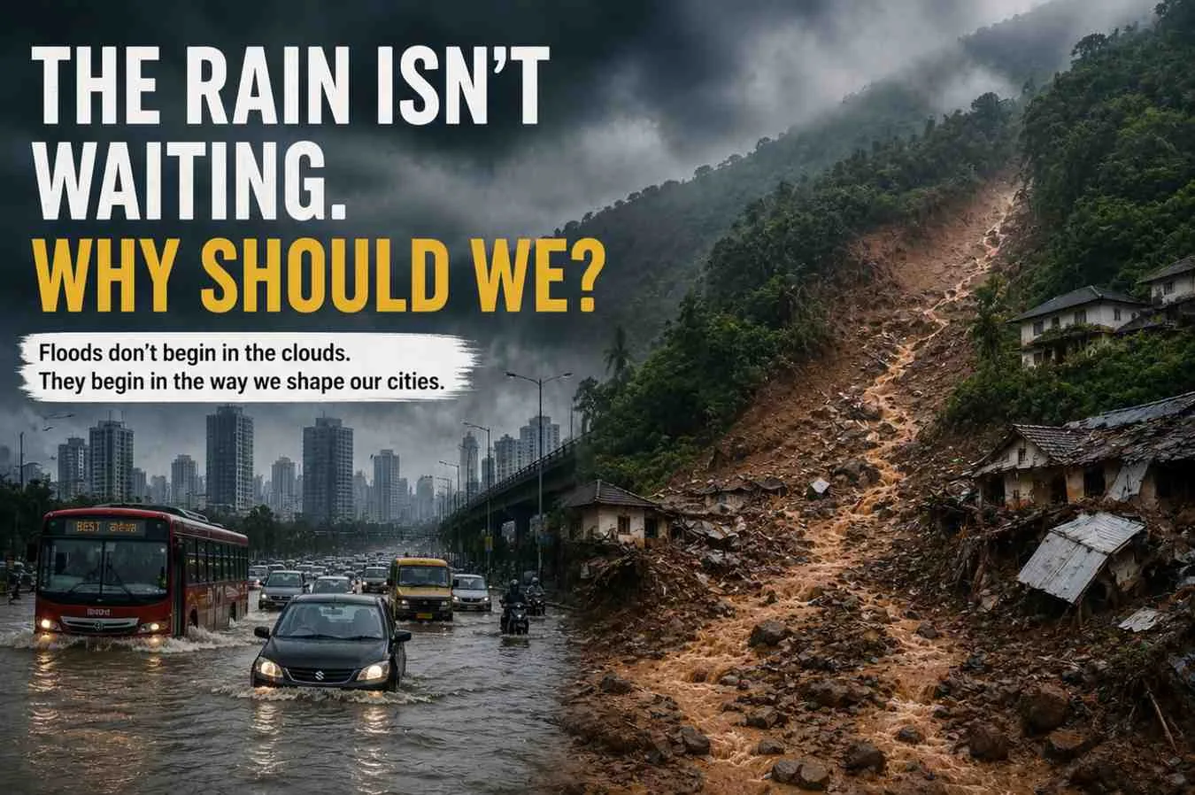
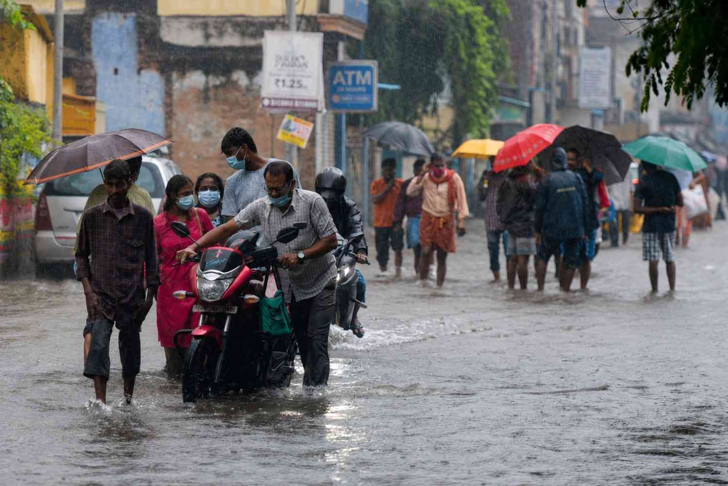
Floods don't begin in the clouds. They begin in the way we shape our cities.    By Tiyasha Ghosh    Can we keep blaming just the rain for floods? Or are our cities part of the problem even today? The monsoon arrives with hope, every year.Water for our reservoirs, life for our farms, and relief from the heat.However, every year, it leaves behind waterlogged streets, damaged infrastructure, destroyed homes and many lost lives. Two places, two disasters: Mumbai drowned, Wayanad collapsed! One is a city of skyscrapers and the other is a quiet forested district. Different locations but identical warning! The sky changed faster than the concrete below it. Our infrastructure was designed for a climate that no longer exists. We used old rainfall recording system and assumed stability. Today, climate change delivers heavier rain with no warning, everything at once.  Rain is arriving faster than we can handle. Cloudbursts are turning mountains into landslide zones. The question isn’t “how much rain this season?” But the question isn’t “how much?” It’s “how fast?” - and can our land and roads survive it? Which leaves us with one question: Whether India’s design standards use up-to-date rainfall data, or continue to rely on old IDF curves that don’t represent today’s climate.According to engineers, many drainage systems were built to handle rainfall expected once in several decades. However, climate records indicate that extreme rainfall events are occurring more frequently. Events once termed "once-in-a-century" storms may be happening much more often now.You can see the impact all over the country. Roads vanish underwater in hours. Drains can’t keep up. Buildings drown even after crores spent on their upgrades. In the hills, the ground itself gives way - mud, rocks and debris crashing into villages below. According to experts, the cause goes beyond rainfall - it points to failures in urban and infrastructure planning. Wetlands that previously stored excess rainwater have been reclaimed for development. Natural drainage channels have been constricted or obstructed. Hillsides have been cut to accommodate roads, hotels and buildings. In many vulnerable regions, declining forest cover has reduced the land’s capacity to absorb water during heavy rainfall. The cost goes far beyond concrete and steel. People lose homes and income. Kids stay out of school. Businesses close. Transport comes to a standstill. Hospitals get overcrowded. These storms are no longer just environmental problems - they hit our economy and society too. Experts argue that India needs to stop treating floods, landslides and waterlogging as separate events. They point to a larger issue like climate change, rapid urbanisation and weak planning coming all together. Unless cities plan for future rainfall instead of past records, every monsoon will bring the same question: Are we preparing for the next storm- or simply recovering from the last one? Heavy Rain       ↓ Wetlands & Lakes       ↓ Natural Streams       ↓ Rivers       ↓ Groundwater Recharge   (Current Situation)   Heavy Rain       ↓ Concrete Roads       ↓ Blocked Drains       ↓ Waterlogging       ↓ Floods & Landslides Natural drainage systems once absorbed excess rainwater. Urbanisation has disrupted these pathways, increasing flood risks The rain hasn't changed. The ground beneath it, has.Like water on concrete instead of a sponge, India's cities can no longer absorb what falls from the sky. Nature once managed the rain. Wetlands, forests, floodplains, and open land worked together to absorb, slow, and store water. Today, many of these natural safeguards have disappeared. Wetlands are disappearing beneath housing projects. Floodplains are turning into commercial hubs. Hillsides are being cut for development. And across India's cities, concrete has replaced the open ground that once soaked up rain. With heavy downpour, water becomes stagnant with no outlet for respite. It keeps flowing until it floods roads, homes, and entire neighbourhoods. Floods today are shaped as much by land use as by rainfall, experts say. Here's why. How do engineers decide how big a drain should be? They use Intensity-Duration-Frequency (IDF) curves, which estimate how much rain can fall, how quickly it may arrive, and how often such events are expected. The problem? A lot of these rules were made using old rainfall data. But climate change has changed those patterns. Cloudbursts have grown more frequent and short-duration rainfall has become more intense. For example, 100 millimetres of rain that previously fell for an entire day can now occur within two to three hours. Drainage systems have not evolved in line with changing rainfall conditions. Many continue to operate based on historical rainfall patterns that are no longer valid. Experts say India can no longer rely on yesterday's rainfall patterns. Infrastructure must be designed using today's climate realities. The challenge is even greater in the hills. Unlike cities, where water usually causes flooding, mountain regions face another danger- landslides. Cutting down forests and carving slopes for roads or buildings loosens up the soil. When heavy and long rainfall persists, water soaks in, weakens the slope, and everything collapses. The Wayanad landslide was a painful reminder: when heavy rain hits fragile hills and if we ignore the risks, it can turn deadly.Scientists say this is why climate adaptation can no longer remain separated from urban or infrastructure planning. Every new road, bridge, housing project, and drainage system must answer one question: Is it built for tomorrow's rainfall? ParameterEarlier ClimateCurrent ClimateRainfall PatternSpread over longer periodsIntense rainfall in short burstsDrainage DesignBased on historical rainfallFrequently exceededWetlandsLarger natural storageRapidly shrinkingFlood FrequencyLess frequentIncreasingClimate RiskModerateHigh Rain may trigger the disaster. But building for yesterday's climate could make it inevitable. Experts say India must rethink how it builds its cities. Instead of forcing water to adapt to development, development must adapt to water. And that begins with something many places have lost, i.e., space. Protecting floodplains, wetlands, hills, and stormwater channels isn't just about conserving nature- it's about protecting people. Because when nature's defenses disappear, concrete isn't enough. Experts say cities can't plan for tomorrow using yesterday's flood maps. Updated rainfall data should guide every development decision, and flood-prone areas must be identified before new roads, housing projects, or commercial complexes that are built. Experts also say IDF curves should be updated regularly so drainage systems are built for today's climate- not yesterday's. Technology can also make a huge difference. Floods can't always be prevented. But with accurate forecasts and real-time monitoring, their impact can be reduced through timely warnings and faster action. But technology alone is not enough; good governance is equally important. Experts say flood management shouldn't begin when the rain starts- it should begin long before. Drains need to be cleared before the monsoon, natural waterways kept free of invasions, and construction in high-risk areas are strictly regulated. Most importantly, agencies must work together before the disaster strikes. Communities also play a crucial role. Communities hold critical, lived knowledge like which streets flood first, which drains fail annually, and which areas remain mostly exposed. When local knowledge becomes part of disaster planning, warnings arrive sooner and responses become more effective. Small actions can also create a big impact. Keeping drains free of plastic waste, protecting neighbourhood ponds, planting trees, avoiding construction on natural drainage channels and following official weather advisories all help reduce flood risks. The lesson extends beyond Mumbai or Wayanad. Urban growth and climate change are colliding. One is covering the ground with concrete, the other is bringing heavier rain. What we build today will shape tomorrow's disasters. India has a choice: keep rebuilding after every disaster- or start preventing the next one. Or we can act now by investing in smarter planning, stronger natural defences, modern infrastructure and cities built for a changing climate. Because resilience is not built during an emergency. It is built way before the first raindrop falls. The cost of preparing may be high but the cost of not preparing will be higher. Mumbai and Wayanad were more than disasters - they were warnings. AspectMumbaiWayanadMain HazardUrban FloodingLandslidesPrimary CauseBlocked drainage & urbanisationFragile slopes & intense rainfallNatural Buffer LostWetlands & mangrovesForest coverMain ImpactWaterlogging & transport disruptionLoss of lives & infrastructure For decades, India has responded after the damage has been done. But experts say rebuilding after every flood and landslide is no longer enough in a climate where extreme weather is becoming the new normal. The focus must shift now from disaster response to disaster prevention. The solution begins with working alongside nature - protecting wetlands, restoring rivers, safeguarding forests, and modernizing drainage standards. It also means planning every new project around future rainfall, not outdated climate records. Climate resilience begins with collective action.Governments, businesses, planners, engineers, and citizens all have a major role to play. Because every protected wetland, every clear drain, and every preserved green space make a city stronger when the next storm arrives. The cost of acting may seem high today but the cost of doing nothing is higher. Every flooded street, every collapsed hillside, and every displaced family carry the same message: preparing before disaster is less costly than rebuilding after. Nature has always played by its own rules. Water will always find its way. Rivers will always seek their floodplains. Hills will always become unstable when forests disappear and slopes are pushed beyond their limits. The real choice is whether we build with nature- or keep building against it. Resilience isn't about rebuilding faster. It's about ensuring there's less to rebuild. As India enters a warmer and more uncertain future, every road, bridge, neighbourhood, and city will reflect the choices we make today. Because tomorrow's resilience is being built long before the next storm arrives. DOCUMENT & DATA STACK  DocumentPurposeIndia Meteorological Department (IMD) Rainfall DataCompare historical and current rainfall intensity.National Disaster Management Authority (NDMA) – Urban Flooding GuidelinesIndia's official recommendations for urban flood management.Geological Survey of India (GSI) – National Landslide Susceptibility MappingExplains why regions like Wayanad remain highly landslide-prone.IPCC Sixth Assessment Report (AR6)Scientific evidence linking climate change to increasing extreme rainfall events.Ministry of Housing & Urban Affairs (MoHUA)Urban drainage and climate-resilient infrastructure guidelines.Central Water Commission (CWC)Flood monitoring and drainage management data.ISRO National Wetland InventoryWetland loss and land-use changes across Indian cities. Key Data Points: TopicData/ObservationRainfall PatternIndia is witnessing more frequent short-duration, high-intensity rainfall events due to climate change.Urban FloodingExisting stormwater drains in many cities were designed using historical rainfall data that no longer reflects today's climate.WayanadHighly vulnerable due to steep slopes, fragile geology and extreme monsoon rainfall.WetlandsShrinking wetlands and encroached floodplains reduce natural flood storage capacity.Climate AdaptationExperts recommend updating Intensity-Duration-Frequency (IDF) curves using present-day climate observations.   ProblemSolutionUrban FloodingRestore wetlandsWaterloggingPermeable pavementsLandslidesAfforestation & slope stabilisationDrain OverflowRegular desilting & drain maintenanceClimate RiskClimate-resilient urban planning   Sources:India Meteorological Department (IMD) National Disaster Management Authority (NDMA) Geological Survey of India (GSI) Central Water Commission (CWC) Ministry of Housing & Urban Affairs (MoHUA) Intergovernmental Panel on Climate Change (IPCC AR6) ISRO National Wetland Inventory The Times of India (base report) ...Read more

17 Jul 2026

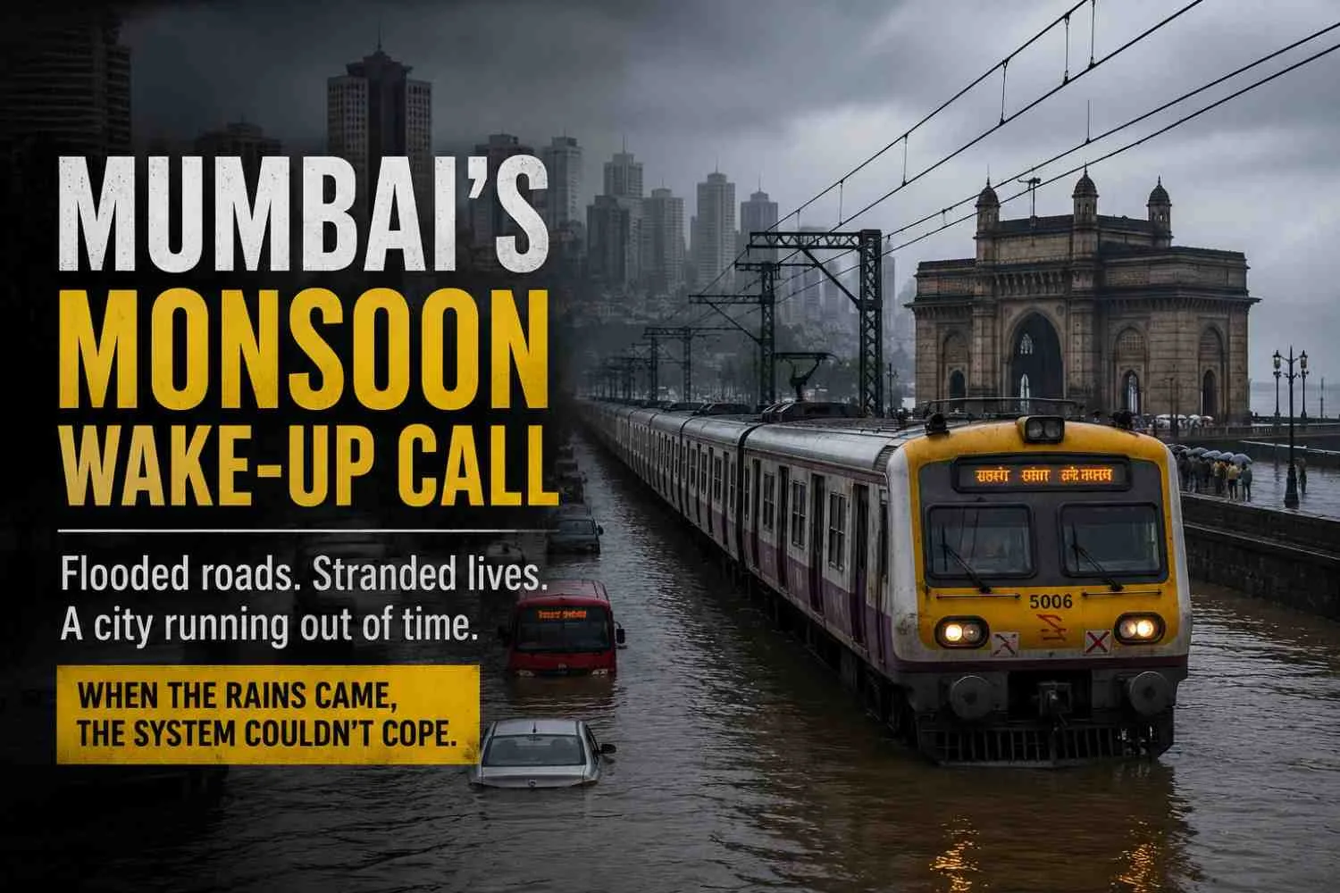
The floods exposed more than clogged drains. They revealed a city struggling to keep pace with a changing climate   By Tiyasha Ghosh   Kolkata | July 17, 2026:   Rain isn’t new to Mumbai. So why is the city still caught off guard? Why does it take just a few hours for roads to become rivers? And if we face this every year, why are we still asking the same questions? Because intense rainfall between June 30 and July 6 brought large parts of Mumbai to a standstill and these questions returned once again!Roads were submerged, train services were disrupted, flights were delayed, and thousands of people found themselves stranded as water quickly flooded homes, markets, and streets. Roads were underwater, trains were hit, flights were delayed, and thousands were stranded as water rushed into homes, markets and streets. But this isn’t just about another rainy week! Experts say it’s not just about how much it rains anymore. What matters is how quickly it falls, where it falls, and if the city can cope or not. In many areas, the intensity of rainfall has outpaced what old drainage systems were built for. Mumbai's drainage system was built decades ago based on rainfall patterns that has changed significantly over time. Today, short but extremely heavy cloudbursts dump large volumes of water within hours, overwhelming stormwater drains before they can carry the water away. At the same time, rapid urbanisation has worsened this issue. The wetlands that soaked up rainwater have vanished. Concrete buildings, roads and parking areas have replaced open land. Instead of draining into the soil, rain now flows over hard surfaces and quickly floods low-lying neighbourhoods. Experts additionally identify solid waste as an escalating concern. We dump plastic, construction waste and household trash into drains all year. So, when the monsoon arrives, the clogged drains don’t just carry water away - they spill it right into people’s houses.  The ordinary people suffer the most. Transport shutdown means lost wages for daily workers, missed classes for students, and hours of closure for small businesses. People in informal settlements suffer the most - floodwater gets into houses, damages property, and spreads water-borne illnesses. According to urban planners, Mumbai should shift from tracking only daily rain to measuring rainfall intensity. New drainage systems must be designed for extreme downpours instead of outdated estimates. Experts also say cities should regularly check if drainage capacity matches actual rainfall intensity. These checks can identify problems before the monsoon, not after the roads have already been flooded. Residents and infrastructure experts say that bigger drains alone won’t solve flooding. We also need to restore wetlands, protect rivers and mangroves, improve waste management, add more permeable surfaces, and strengthen disaster planning at the grassroots level. Small steps by residents can make a huge difference. Clearing litter from drains, reporting blockages, avoiding construction debris dumping, and obeying flood advisories will help cut down local flooding. Mumbai just got another wake-up call - climate change means heavier rain. The good news? Not every flood is destiny. Plan better, build stronger, develop smarter, and we can take the hit out of the next storm. We know the rain will come back, hard .The only thing left to ask is: will Mumbai be ready this time? Source:  The Economic Times (9 July 2026)India Meteorological Department (IMD)Brihanmumbai Municipal Corporation (BMC). ...Read more

17 Jul 2026

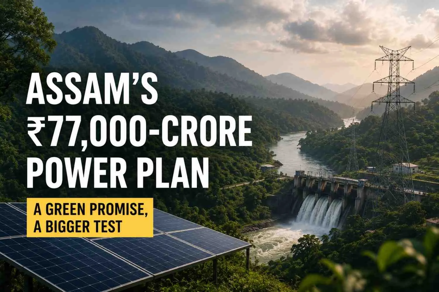
Massive investments promise clean power, jobs and growth. But can development keep up with nature?   By Tiyasha Ghosh   Kolkata | July 17, 2026:   Can one state reshape India’s sustainable energy roadmap? Can thousands of crores drive both growth and environmental protection? And can the Northeast emerge as India’s next green powerhouse? These questions sit at the heart of Assam’s ₹77,000-crore power investment plan - one of the largest clean energy initiatives announced by any Indian state. From hydropower and solar to batteries, transmission, and conventional plants - the investment is built to turn the Northeast into a powerhouse for India’s energy transition. The moment couldn’t be more critical. India's electricity demand is rising every year.EVs are on the rise. Data centres are booming. ACs are now a household need. With industries growing and cities consuming more, electricity demand has never been higher.  Balancing increasing electricity demand with the goal of coal reduction represents one of India’s most pressing challenges. Assam aims to be a key part of the answer. The proposed projects are designed to boost clean power generation, reinforce the national grid, and enhance energy security.New power highways will carry electricity from the Northeast to the rest of the country. Battery projects will save clean energy now so we can use it when demand spikes.Together, this is about steadier power today and a cleaner future tomorrow.   This goes beyond just funding and megawatts.   The central challenge is ensuring that rapid development does not compromise the unique ecological assets of the Northeast. Hydropower projects typically need dams, and transmission lines often run through forests and ecologically fragile zones. Assam and its neighbouring states have rich biodiversity, large river systems, and wildlife habitats that sustain both nature and local communities.  Environmental experts and civil society groups are therefore urging thorough ecological studies before proceeding with major projects. According to them, protecting forests, rivers, and biodiversity is as important as growing renewable energy. Another key question is whether these investments will actually benefit local communities. While construction brings short-term employment, experts argue that real success requires local industry, a skilled workforce, and sustainable jobs for people throughout the region.If local businesses, engineers, and workers are included in the clean energy supply chain, Assam’s investment could fuel economic growth for decades. According to experts, successful implementation is key to whether the investment works or not.Speeding up approvals isn’t enough. We also need strong transmission networks, modern battery storage, efficient project management, and clear environmental safeguards to work together.Without these basics in place, even big investments could fall short of providing reliable electricity. For ordinary citizens, the outcome matters more than any investment figure. A stronger electricity network can reduce power cuts, improve access to clean energy, create employment and support new industries. Stronger infrastructure may draw business investment to the Northeast and expand economic opportunities there. With India moving faster toward clean energy, Assam is now at a key turning point.This isn’t just about electricity. The ₹77,000-crore bet is on whether clean energy and growth can go hand-in-hand with responsibility.   If we get the balance right, Assam could do much more than power the Northeast - it could help drive India towards a greener and sustainable future!          Source:  The Times of India (10 July 2026) Ministry of New and Renewable Energy (MNRE); Ministry of Power, Government of India. ...Read more

08 Jul 2026

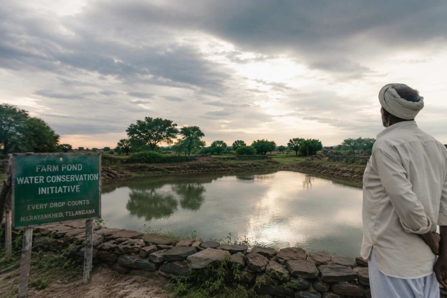
An unexpected initiative is helping villages make every drop of rain count.  How can a village receive rainfall every year and still struggle for water? It’s a question – many  parts of India continue to face. Wells run dry. Crops suffer. And by the summer season, lack of water becomes a major reason to worry! This is a real-life story covering a small town - Narayankhed, Telangana. The problem wasn’t lack of rain. It was lack of water conservation. Most of the rainwater flowed away before it could reach the roots of the ground. Years passed, and this cycle continued.  Farmers were aware of the problem. But addressing the problem wasn’t easy. Till someone showed up unexpectedly from an unexpected place as their ray of hope. Every Friday night, Dr P. Sudhakar Naik, an IRS officer posted in Mumbai, boarded a bus to Telangana. For seven consecutive weekends, he travelled about 600 kilometres to work with the villagers facing the crisis.  Environmentalist Paladugu Gnaneshwar, along with the local officials and residents, came together with him and helped him build farm ponds, soak pits and stone barriers. Simple structures. Simpler Ideas. But ones that could preserve rainwater and stop it from being wasted. And the cost? JUST 2 LAKHS!  The impact? Water that was nowhere to be seen now has a chance to stay. Groundwater levels are improving gradually. Farmers are becoming hopeful. And villages that suffered miserably due to lack of rain are now learning how to make every drop count. The story carries a larger and more impactful message. Water scarcity isn’t always caused by less rainfall. Sometimes, it’s about how we conserve the rain we already receive.  SOURCE- This report is based on a real-life story published by The Better India, an independent digital media platform known for reporting grassroots innovations and addressing positive social changes across India. ...Read more

08 Jul 2026

  Image courtesy: Imagesbazaar Expensive grocery bills? Neighbourhoods hotter than usual? Unpredictable rains? Well, it’s not your imagination, it’s the present reality. India has been warned about the probability of receiving below-normal rainfall in July 2026. This made June 2026 the driest in over a century. Why you may ask? That is because a monster is awakening in the open waters of the Pacific Ocean for months.  Delayed crop sowing, rising vegetable prices and increased pressure on water resources – all of which are influenced by one climate event.  A natural climate pattern which happens when sea surface temperatures become warmer in the central Pacific Ocean. How can something so far away, so deep affect India? Distance doesn’t matter; the air circulation is altered at a global level. This leads to the weakening of the southwest monsoon and uneven rainfall patterns in South Asia.  This climate event or pattern is known as El Nino. This year, the increasing intensity of El Nino conditions has been observed by the meteorologists. Having triggered concerns related to uneven heavy showers during the crucial monsoon season.  But the question is WHY should one care? One should, because this is where your grocery expenses become relevant. Monsoon is more than just a regular season for India’s farmers – it is the backbone of agriculture. The sowing of important crops such as rice, soybean, cotton, and maize may postpone due to delayed rainfall.  There have been reports of slower kharif crop planting compared to last year because of late rainfall.  When agricultural production becomes less, the consumers pay the price. Decrease in crop yield leads to increase in prices of vegetables, grains, and other food items. This eventually impacts the local market.  Image courtesy: Imagesbazaar Another growing concern is Water. Multiple reservoirs depend on monsoon rainfall to restore supplies. Several regions may face lack of water availability if rainfall remains below normal. Which may lead to stricter water management measure both in rural and urban areas.  Why does the weather drastically change on a day-to-day basis? One of the recent phenomena faced by some regions in India is very heavy rainfall and thunderstorm one day and heatwaves the very next day. This is the effect of El Nino. One of its most confusing aspects is that it doesn’t just cause less rainfall. It often changes how rain falls. Rather than even showers spread across the whole season, rainfall may occur as sudden bursts of intense storms followed by dry weather conditions. This may cause flash floods in one region while water shortages on another.  Such inconsistent weather results in difficulty in irrigation planning by farmers and drainage system management in city authorities.  Rise in global temperatures is causing the impacts of El Nino to be more pronounced even though El Nino is a naturally occurring climate cycle. More moisture is held by a warmer atmosphere intensifying extreme weather conditions. Heatwaves become hotter and rainfall becomes increasingly unpredictable.  Now, what do we await? The next few weeks will be very crucial for India’s monsoon. El Nino is closely monitored by India Meteorological Department (IMD) since it is expected to persist through the following months. However, some regions may have an improvement in rainfall.  For the common people, El Nino is not just a scientific term discussed by the meteorologists. It may be the rising expense of vegetables, lack of water availability in reservoirs, prolonged heat resulting in high electricity bills, and how difficult it is to cope with the uncertain climate changes for the farmers.  As the monsoon unfolds, the echoes of a warming Pacific Ocean remind us of a simple truth: in an interconnected climate, even the most distant changes can hit closest to home. Sources World Meteorological Organization (WMO) – Prepare for El Niñohttps://wmo.int/news/media-centre/wmo-prepare-el-ninoScroll.in – El Niño likely to intensify as India's monsoon advances slowlyhttps://scroll.in/article/1093913/el-nino-likely-to-intensify-as-indias-monsoon-advances-slowlyDown To Earth – Tackling the trilemma of El Niño, stagflation and shrinkflationhttps://www.downtoearth.org.in/climate-change/tackling-the-trilemma-of-el-nino-stagflation-and-shrinkflation ...Read more

26 Mar 2026

How contaminated supply lines in Indore and Gandhinagar triggered illness, panic, and a deeper question of accountability. It began with something easy to ignore. A smell. The kind that makes you wrinkle your nose, rinse the glass again, and hope it is a one-day problem. In Indore’s Bhagirathpura locality, Preeti Sharma says she noticed it first. The tap water, she recalls, had turned “foul-smelling”. She says she complained to the local councillor—again and again. Nothing changed. The water kept coming. So did the smell. Until the sickness arrived. And once it arrived, it moved fast. Families began rushing between homes, clinics, and hospital corridors with the same frightening pattern: vomiting, diarrhoea, weakness, dehydration. In a matter of days, Indore—often celebrated as India’s “cleanest city”—was confronting an uglier truth: the water itself had become a carrier of disease. Tests later confirmed bacterial contamination in drinking water, traced to leakage in the main supply pipeline. Omprakash, another Bhagirathpura resident, showed samples of muddy tap water to reporters. “Meanwhile,” he said, “sewage kept flowing into our drinking water.” It is the kind of sentence that should never be spoken in a country that talks of smart cities and world-class infrastructure. Yet it was spoken. And people were already paying the price. This is not only an Indore story. In Gandhinagar, Gujarat’s capital, children began arriving at the Civil Hospital with high fever and stomach distress. In just days, over a hundred suspected typhoid cases were reported—most of them children. Doctors warned that new cases could keep emerging for the next two weeks, even as repairs and disinfection began. Two cities. Different pathogens. One shared fear that lodges itself in the mind of every parent: what if the glass of water you gave your child was the beginning of a hospital visit? What happened — and why it matters beyond two cities In late December 2025 and early January 2026, contaminated drinking water triggered outbreaks of severe gastrointestinal illness in Indore and a sharp rise in suspected typhoid cases in Gandhinagar. Reports from Indore said more than 1,400 people were affected as the crisis escalated, and deaths were reported as the city struggled to contain the fallout. Gandhinagar’s hospital load was dominated by children—small bodies fighting a disease that should have been prevented long before the first fever. These outbreaks are not random accidents. They echo a pattern public health and water-systems experts have warned about for years: leak-prone distribution lines, pressure fluctuations, ageing networks, and contamination entering water through breaks and weak points. It is not only about how water is treated at the plant. It is about what happens after treatment—inside the distribution maze that carries water to your kitchen. Who suffers first — and who carries the burden next Water contamination does not hit everyone equally. The first to pay are households in dense neighbourhoods and older networks—places where pipelines run close to drains, where pressure fluctuates, where “temporary fixes” become permanent risk. In Indore, residents say complaints were raised for days before the outbreak was fully recognised as a civic emergency. In Gandhinagar, too, the worst-hit were specific sectors and villages where residents reported foul-smelling, visibly dirty water. Then comes the second burden: The Hospitals: Frontline doctors and nurses handle the overflow of dehydration cases, the panic of families, the crowding in emergency wards, and the quiet chaos of a preventable crisis. One doctor in Indore described a “deluge” of infections and warned that by the time boiling-water advisories spread widely, “it was too late” for many to avoid getting sick. For families, these are not “cases”. They are wages lost, school missed, savings drained, and fear that lingers long after the fever breaks. When the crisis unfolds — the dangerous window nobody watches The critical window in both outbreaks was late December 2025 through the first days of January 2026—exactly when many families were travelling, hosting relatives, or relying heavily on municipal supply during holiday routines. In Indore, the response mobilised as cases spiked around December 29–31, with outpatient attendance rising sharply in the affected locality. This timing matters because outbreaks often become fatal when early warning signs are ignored. The smell, the colour, the turbidity, the sudden change in taste—these are not minor inconveniences. They are alarms. Where it is happening — and why the warning lights are blinking elsewhere Indore and Gandhinagar are the current epicentres. But the warning signs are not confined to them. Reports have also described contamination scares and pipeline-linked illness spikes in other parts of India, including areas where residents complained of frothy, foul-smelling water and suspected sewage intrusion. Your research note underlines the wider stress signals: doubts over water quality, turbidity, faecal contamination risk, and persistent questions about monitoring transparency. When water quality data is not visible, not timely, and not trusted, the public learns the truth only after bodies start arriving at hospitals. Why it is happening — the governance gap between knowing and doing Water safety is not just an engineering issue. It is a governance issue.The National Human Rights Commission took Suo Motu cognizance of the Indore case, citing reports that the main pipeline passed beneath a public toilet and that leakage could have allowed sewage to mix with drinking water. It also noted allegations that residents’ complaints were not acted upon. NDTV’s reporting added a detail that should trouble every administrator: a tender to replace the Bhagirathpura pipeline had reportedly been floated months earlier, but work began only after deaths were reported. This is the deeper failure at the heart of contaminated-water tragedies. Risks are often known. They are sometimes mapped. They can even be budgeted. But they are not fixed in time. And when time is lost, people pay in sickness, and sometimes in death. How “clean” water becomes contaminated — the science of intrusion Public health experts use a stark word for what happens inside damaged networks: intrusion. Water may leave a treatment plant clean. But as it travels through cracked pipes, low-pressure stretches, or poorly maintained intersections with drainage lines, contamination can enter. It can happen through broken mains, cross-connections, and backflow during pressure drops. It can happen when sewage lines run close to drinking-water lines and a leak becomes an open doorway. In Gandhinagar, officials traced the outbreak to sewage leakage near a drinking-water pipeline after residents complained of dirty water for nearly a week. In Indore, official confirmations also pointed to leakage and sewage mixing as likely causes. The mechanics may vary. The consequence is the same: the tap turns into a threat. A humane truth — water is a basic service, but it is also daily trust. Municipal water is not like a road or a park. You do not simply “use” it. You put it inside your body. You give it to infants. You cook a sick parent’s meal with it. You swallow medicines with it. So when water turns unsafe, the damage is not only medical. It is moral. Indore’s crisis pushed that moral question into the open. When a national rights body steps in, it signals something important: safe drinking water is not a luxury. It is a duty of the state. And when that duty fails, accountability cannot be reduced to a press note or a temporary repair. This framing matters because it changes the question. It is no longer only, “Where was the leak?” It becomes, “Why was the warning ignored?” Not only, “How did bacteria enter the line?” but “Why did the system allow delay to become disaster?”   What policymakers must do now — not in the next budget cycle: If India treats these outbreaks as “episodes”, we will keep repeating them as “seasons”. The question is no longer whether contamination can happen. It is whether we will design systems that assume it will—and prevent it before wards overflow. The first shift must be conceptual: distribution networks must be treated as health infrastructure. Hospitals get audits. Vaccines get cold-chain monitoring. Drinking water pipelines require comparable seriousness because they are part of disease prevention, not merely service delivery. India’s drinking water standard, IS 10500, sets expectations. But standards become meaningless if the last-mile network is compromised and unmonitored. Next, every city must be required to operate with a Water Safety Plan mindset—risk management from source to tap. Global public health guidance is unambiguous: safe water is achieved through systematic identification of risks and rapid controls, especially in distribution systems. This means mapping high-risk intersections, ensuring residual disinfection, preventing backflow, and responding quickly when pressure drops or contamination signals appear. Then comes transparency. If residual chlorine drops in a locality, if turbidity rises, if contamination risk increases, citizens should see it as data—timely, local, and public. Not as rumours. Trust collapses in secrecy, and panic fills the gap that information should occupy. The fourth action is procurement discipline. Indore’s reporting points to stalled work and delayed upgrades. Pipeline replacement must be treated as time-bound risk mitigation. It cannot remain a file that waits for “administrative convenience”, because bacteria does not wait for approvals. Finally, every city needs a “first 48 hours” playbook for contamination events. Gandhinagar’s response included surveys, repairs, and disinfection steps, but such responses must become standard practice across the country: immediate alternate water supply, clear boil-water advisories, emergency chlorination, rapid sampling, and daily public updates until safety is restored.   What civil society can do — without waiting for tragedy at its own doorstep: Citizens do not run water utilities, but they can create the pressure and the early-warning systems that save lives. It starts with recognising signals. In both Indore and Gandhinagar, residents reported foul smell, abnormal colour, and dirty water before the case numbers surged. These complaints must be treated as alerts, not inconveniences. RWAs, school committees, and ward groups can build simple reporting chains and escalation points—clear people to call, clear documentation, and collective follow-up. Independent testing also matters. Visakhapatnam has launched a mobile water testing laboratory—a “lab-on-wheels”—to run onsite checks across wards and detect risks early. This should not remain a “good story” from one city. It should become a normal expectation everywhere. Civil society can also support a bigger water logic: protect drinking water for drinking. Your research note highlights greywater reuse as a strong policy direction, with the potential to save 30–40% of household water by recycling domestic wastewater for non-potable purposes. Less pressure on fresh supply often means better maintenance capacity and lower risk. Water stress and contamination frequently travel together. When systems are overdrawn, maintenance weakens and risk rises.   Proof that solutions exist — if we scale what works: India does not lack solutions. It lacks speed and scale. In Ludhiana, a canal-based water supply pipeline project is being built to improve reliable potable supply under a World Bank and AIIB-backed programme. In Chennai, Southern Railway is shifting to recycled sewage water for non-potable operations such as coach cleaning and track maintenance, reducing pressure on drinking-water resources. Your research note also points to smarter monitoring systems—AI-based tracking, predictive analytics, and real-time sensors—to detect leaks and manage networks before they turn into outbreaks. These are not merely “innovations”. They are protections. They are public health measures in engineering form.   The bottom line — before the next glass becomes the next headline: Indore and Gandhinagar are not only news stories. They are warnings written in hospital discharge slips and, in the worst cases, in death certificates. A country that can build metros and missions can also build water systems that do not poison the poor first. But it will require a shift in mindset—from celebrating access alone to guaranteeing safety at the tap. Clean water is not a favour. It is a constitutional promise in practice. And in January 2026, that promise is asking India to act—before the next glass becomes the next headline.   ...Read more

26 Mar 2026

At dawn in a village on Rajasthan’s edge, Meera lowers a rope into the family well the way her mother did. The bucket used to splash before it was half-way down. Now it drops, and drops, and lands with a dry thud that sounds like a door closing. She stands still for a moment, as if listening for an answer from the earth. Then she lifts the empty bucket, balances two pots, and starts walking toward a tanker that may or may not arrive on time. Two thousand kilometres away, on a Sundarbans island in West Bengal, a handpump coughs and sputters before giving up. The water that comes out is sometimes brackish, sometimes rusty, sometimes just not enough. People speak of boreholes going deeper each year, of tubewells that once felt reliable now turning uncertain, of salty tides and cyclones that leave a taste of the sea in soil and ponds long after the winds have gone. In coastal Gujarat, the crisis can be quieter and crueler. Water can still be found, but it changes character. It becomes saline. It corrodes pipes, spoils fields, and forces families to choose between expensive treatment and unsafe compromises. The sea does not need to invade on the surface; it can arrive underground. In Tamil Nadu, the story shifts again. When the summer comes early and the rains behave strangely, cities and farms start drawing harder from the same hidden reserves. In years of stress, water trains, tanker queues, private borewells, and rising salinity become part of urban routine. A city discovers, painfully, that groundwater does not announce its limits until it is already too late. These are not four separate stories. They are four chapters of one national plot: India’s groundwater is being asked to do more than it was ever designed to do, and it is being extracted faster than nature can replenish it in many places. The result is a slow-motion emergency with sudden moments of shock. The Invisible Utility Holding Up India Groundwater is India’s quiet backbone. It cushions drought years, stabilises drinking water supply, and keeps farms alive when canals, tanks, and rivers fall short. It is also the water source that individuals can access privately, through a pump, a borewell, or a handpump, without waiting for a pipeline or a municipal schedule. That ease has made groundwater feel like a personal asset rather than a shared resource. It has also made it dangerously easy to overuse. Surface water looks finite because you can see it. A river thins, a reservoir shrinks, a lake turns into a field. Groundwater behaves like a hidden bank account. People keep withdrawing because the day-to-day signals stay deceptively normal. The pump still runs. The water still comes. The crisis only becomes visible when the water table falls below suction, when wells fail, when water turns saline, or when contamination becomes concentrated enough to become undeniable. This is why groundwater is not merely an environmental issue. It is a food security issue because cropping and irrigation are, in large parts of India, groundwater decisions. It is a public health issue because depleted aquifers often become saline or concentrate pollutants. It is an economic stability issue because well failure pushes farmers into higher costs and deeper debt while cities face rising operational risks and water inflation. It is a social equity issue because the poorest households cannot drill deeper, buy tankers, store water, or treat it. It is a climate resilience issue because erratic rainfall reduces predictable recharge, and intense downpours create floods without replenishing aquifers effectively when water runs off too quickly. A Simple Thermometer That Explains a Complex Crisis One of the clearest ways to read groundwater stress is through the idea of extraction versus replenishment. If a region withdraws groundwater faster than it is naturally recharged, it is eating into its long-term savings. At the national level, India’s overall extraction-to-availability ratio can look deceptively “manageable.” But groundwater does not fail nationally. It fails locally, aquifer by aquifer, block by block, until a district crosses a threshold and daily life begins to unravel. India’s true groundwater reality is therefore best understood as a patchwork of extremes. Some areas are structurally water-scarce. Some are water-rich but quality-stressed. Some are stable in average years but collapse under two failed monsoons. Some have enough water underground but lack governance and infrastructure to use it sustainably. That patchwork becomes clearer when we travel through four contrasting states that represent four different kinds of groundwater pressure: Rajasthan, Tamil Nadu, coastal Gujarat, and West Bengal. Rajasthan: Where the Crisis Is About Quantity and Time Runs Faster Rajasthan is the most intuitive groundwater story in India because its surface reality mirrors its underground reality. Heat is intense, rainfall is low, and many regions have limited surface storage. The dependence on groundwater is high, and in many places it has become an overdraft economy beneath the soil. When extraction exceeds sustainable replenishment year after year, the water table retreats like a horizon. What makes Rajasthan’s groundwater fall so hard is not only the climate. It is the interaction between fragile aquifers and modern extraction. In large parts of Rajasthan, aquifers do not behave like vast underground lakes that refill easily. They behave like limited storage systems, sometimes fractured hard rock systems, which can be drained quickly and recharge slowly. Once depleted, the bounce-back is difficult unless rainfall is captured at scale and allowed to infiltrate. The state also carries the psychology of drought. When rainfall is uncertain, a borewell becomes insurance. When every farmer pumps “just in case,” the collective result is a tragedy of the commons. Add to this the economics of pumping, where cheap or free electricity can encourage longer run-times, and you get a system that rewards extraction more than efficiency. Yet Rajasthan also carries a powerful lesson of hope: the land responds when communities treat rainfall as a harvest. Traditional systems of water harvesting and local recharge, revived and adapted through community mobilisation, have shown that groundwater can return seasonally when catchments are protected and small structures are maintained. The sustainability insight is blunt in Rajasthan: in low rainfall zones, groundwater survival depends on both demand discipline and recharge culture. One without the other fails. Tamil Nadu: Hard-Rock Aquifers, Urban Thirst, and a Monsoon You Must Catch Tamil Nadu’s groundwater story often gets simplified into the language of drought, but the deeper truth is about variability and storage. Rainfall can be intense but seasonal, and aquifers in many regions are hard-rock with limited capacity. In such systems, recharge is not a slow, forgiving process. It is a narrow window. If rainwater is not captured and infiltrated quickly, it is lost to runoff and the sea. Tamil Nadu also reveals how groundwater crises emerge in cities. Urban demand can expand faster than water systems can keep up, and when surface sources falter, the city turns to groundwater and tankers. The crisis then shows up in two stages. First, quality changes: as fresh groundwater levels fall, salinity risks rise in coastal aquifers, and contamination risks increase where sanitation and waste management are weak. Then quantity collapses: borewells fail, tankers multiply, and a shadow water economy takes over, where those who can pay get water first. In Tamil Nadu, there is also a well-known counter-narrative: the state’s push for rainwater harvesting, including rooftop systems, helped mainstream the idea that monsoon water must be captured rather than drained away. Tamil Nadu’s sustainability signature is the insistence that every building and every neighbourhood has a role in recharge. The larger lesson is not that rainwater harvesting alone solves the crisis. It is that in hard-rock and variable rainfall states, groundwater security is built through a layered system: capturing rain, recharging aquifers, reusing treated water, and reducing demand through irrigation efficiency and sensible cropping patterns. Coastal Gujarat: When Depletion Turns Into Salinity and the Sea Moves In Underground Gujarat’s groundwater story is split between inland scarcity and coastal vulnerability. Inland regions can experience periodic stress typical of semi-arid landscapes, but the coast carries a different kind of threat. Here the crisis is often not announced by “no water,” but by “water that has turned unusable.” In coastal belts, freshwater and seawater exist in a delicate balance. When freshwater levels fall because of heavy pumping, saltwater can seep into aquifers through tidal influence and mixing, particularly in low-lying tracts. The sea does not need to breach embankments to damage groundwater; it can travel invisibly through the subsurface. The result is brackish water that is corrosive for infrastructure, harmful for many crops, and unsafe without treatment. This coastal challenge is intensified by concentrated demand. Farming, expanding settlements, and industrial corridors near ports can combine into high-density extraction zones. When surface water substitution is limited, groundwater becomes the default supply, and the coastal aquifer becomes a battleground between freshwater needs and saline intrusion. Gujarat also offers an important practical insight for the future: large-scale recharge drives and robust water conservation infrastructure can slow depletion, but coastal sustainability requires explicit salinity management. That means monitoring and regulating extraction in vulnerable zones, creating recharge barriers where feasible, and prioritising surface water and treated water reuse to relieve pressure on aquifers. Coastal groundwater must be treated as a frontier that needs defence, not merely a reservoir that needs refilling. West Bengal: The Water-Rich Paradox and the Double Threat of Salinity and Quality West Bengal is often assumed to be safe because it is riverine, rain-fed, and part of a vast deltaic system. Its overall extraction ratios can appear moderate compared to Rajasthan. But West Bengal’s groundwater risk is not captured by one statewide number because the state’s challenges are sharply local. In some belts, depletion rises with irrigation intensity. In coastal and deltaic regions, salinity risk grows when freshwater storage weakens. And across parts of the delta, water quality threats can be as serious as quantity threats. The Sundarbans captures this complexity with painful clarity. In blocks like Gosaba, people are confronting a pattern that feels like a slow retreat of freshwater. Tubewells that once produced dependable water now run dry or turn brackish. Boreholes must be drilled deeper, often at costs that small households can barely bear. Handpumps fail earlier in the season. During cyclones and storm surges, saline water floods land and ponds, contaminating local storage and forcing greater reliance on groundwater at exactly the time when recharge is weakest. When groundwater levels fall, saltwater intrusion accelerates, turning a shortage into a quality collapse. The Sundarbans story also reveals how groundwater crises become livelihood crises. Farmers who cannot find reliable freshwater for irrigation either invest in deeper wells, abandon crop cycles, or watch yields fall as salinity stresses the soil. Household water chores expand, especially for women and children, who walk farther for water that is often poorer in quality. Food security erodes not in one dramatic event but through repeated small losses: a failed crop, a contaminated pond, a fish stock damaged by salinity, an extra month of tanker costs. West Bengal also carries a lesson for urban India: not all cities sit on accessible shallow aquifers in a way that makes groundwater a reliable fallback. Urban planning must be based on hydrogeology, not assumptions. Where groundwater is limited or vulnerable, the city must lean harder on surface water resilience, treated water reuse, leak reduction, and decentralised rain capture. Why the Crisis Deepens: The Human System Behind the Hydrogeology It is tempting to blame groundwater depletion on climate and geography alone, but the real drivers are largely manmade. The crisis is a product of incentives that reward withdrawal and underinvest in replenishment, governance, and efficiency. The first driver is the economics of pumping. When electricity is free or heavily subsidised, when metering is weak, and when regulation is inconsistent, groundwater becomes an underpriced input. Farmers pump more because it makes immediate economic sense. Institutions pump because it is convenient. Industries pump because it reduces dependency on uncertain municipal supply. In such a system, individual rational choices add up to collective depletion. The second driver is cropping and irrigation choices. Groundwater depletion is tightly linked to what India grows, where it grows it, and when it grows it. Water-intensive crops cultivated in unsuitable agro-ecologies force groundwater substitution. Dry-season rice cultivation in certain belts turns groundwater into an invisible canal. Pricing, procurement, and market signals can unintentionally reward water stress by making certain crops profitable regardless of local water realities. Farmers do not choose groundwater depletion; they choose livelihood stability in the incentive landscape they are given. The third driver is urbanisation that blocks recharge. Cities consume water, but they also alter the land’s ability to absorb water. Paved surfaces reduce infiltration. Stormwater drains speed runoff. Wetlands and lakes that once acted as recharge engines are encroached, polluted, or disconnected from their catchments. The monsoon becomes a flood problem rather than a recharge opportunity. The fourth driver is fragmented governance. Groundwater is local, but governance is often split across departments that manage drinking water, irrigation, agriculture, rural development, urban infrastructure, and industry. Without aquifer-level budgeting and shared accountability, interventions become scattered. Recharge structures are built without demand control. Subsidies promote extraction while programmes plead for conservation. Data is collected but not always used to enforce limits. The fifth driver is quality collapse. Even where groundwater quantity remains, it can become unusable. Excess fertiliser can increase nitrate levels. Poor sanitation can contaminate shallow aquifers. Industrial discharge can poison subsurface water. In coastal and arid belts, salinity can rise as freshwater pressure drops. Groundwater then becomes a trap: the more you pump, the more you risk degrading the resource you depend on. The Corporate Connection: Groundwater as Operations, Risk, and Reputation Groundwater depletion is often narrated as a farmer’s problem, but it is equally a corporate and institutional problem, because modern India runs on groundwater in ways it rarely acknowledges. Many hotels, campuses, stadiums, malls, and factories use borewells when municipal supply is inadequate or unreliable. This turns groundwater into an invisible subsidy for urban growth. When regulators push institutions to shift toward treated wastewater and rainwater harvesting, the resistance is often not ideological; it is operational. Groundwater has been easy. Switching requires investment, redesign, and discipline. For businesses, groundwater is also a major risk variable. Falling water tables mean rising costs for deeper drilling, pumping energy, and treatment. Salinity and contamination add further costs and operational uncertainty. In water-stressed basins, community tensions can rise when local people believe commercial users are drawing down shared reserves. In a world increasingly shaped by ESG expectations, groundwater can become a reputational fault line, especially when corporate water stewardship is limited to CSR projects that do not address the actual extraction footprint. There is also a quieter connection through supply chains. A company may not pump groundwater directly, yet it may rely on agricultural and industrial suppliers whose production is groundwater-dependent. When water stress intensifies, supply reliability drops and costs rise. This is why serious sustainability strategy must treat groundwater as a basin-level issue rather than a factory-level efficiency metric. The question is not only how efficiently a unit uses water, but whether the water use is sustainable in its local aquifer context. What India Is Doing: The Toolkit Exists, the Alignment Is Hard India has not ignored the groundwater crisis. The country has built monitoring systems, mapping programmes, recharge missions, and community-led schemes. The challenge is that the problem is both vast and deeply local, and the hardest part of the solution is not engineering. It is alignment. Government initiatives increasingly recognise that groundwater must be managed with better data, better planning, and better community engagement. Aquifer mapping and regular assessments aim to move decision-making from guesswork to groundwater intelligence. Large national campaigns have focused on water harvesting, recharge, and water-body rejuvenation, aiming to restore local storage and infiltration capacity. Community-led groundwater management programmes have attempted to shift the conversation from “more wells” to “shared water budgets,” encouraging villages to plan extraction based on recharge realities. Agricultural schemes that promote micro-irrigation and efficiency seek to reduce demand without cutting productivity. Civil society has played a crucial last-mile role. Across India, NGOs and community groups have repeatedly demonstrated that groundwater is best saved through collective action. One farmer adopting water-saving practices cannot protect an aquifer if neighbouring farms continue to pump without limits. Community initiatives that revive tanks, protect catchments, maintain recharge structures, and create social norms around pumping can be remarkably effective, especially when local leadership is strong and benefits are visible. And yet, the gap remains demand control. Recharge projects are visible, fundable, and politically attractive. Demand management is harder because it forces changes in incentives and behaviour. It requires crop rationalisation, irrigation discipline, metering, pricing reform, and enforcement against unsustainable extraction by both private and institutional users. Without demand control, recharge becomes a treadmill: water is added back in, but extraction simply rises to match it. What the World Teaches: Three Global Lessons That India Can Adapt Other water-stressed regions have learned, often painfully, that groundwater cannot be managed by good intentions alone. Three lessons stand out for India, not as templates to copy but as principles to translate. The first lesson is governance with accountability. In places like California, groundwater overdraft prompted a legal and institutional shift toward basin-level management where local agencies must create sustainability plans and face consequences if they fail. The critical idea is not central control for its own sake; it is enforceable responsibility at the scale where groundwater actually behaves. The second lesson is the power of reuse. Countries like Israel treated wastewater not as waste but as a strategic resource, building high levels of treatment and reuse, particularly for agriculture. This reduced dependence on freshwater sources and created a circular water economy. India’s cities and industries can relieve groundwater pressure dramatically if treated wastewater becomes a mainstream supply for non-potable uses, landscaping, construction, and certain categories of industrial demand. The third lesson is measurement before markets. In parts of Australia, basin governance evolved toward caps, monitoring, and structured allocation systems, with trading mechanisms operating within defined limits. The essential insight is that allocation is only fair when measurement is credible and ecological safeguards are real. India’s immediate need is not a market-first model; it is measurement, caps in over-stressed aquifers, and local institutions empowered to implement and enforce groundwater budgets. Possibilities Ahead: The Path to a Groundwater-Secure India India’s groundwater future will not be decided by one mega-project. It will be decided by whether the country can build a culture of water accounting and a politics of sustainability. In Rajasthan, the path forward demands a relentless focus on catching rainfall where it falls, protecting micro-catchments, reviving and maintaining local recharge systems, and coupling those efforts with serious irrigation efficiency. The goal is not merely to create water structures but to rebuild water commons. In Tamil Nadu, the future depends on turning cities into recharge-friendly landscapes, treating stormwater as a resource rather than a drainage problem, expanding reuse so that treated wastewater displaces groundwater for non-drinking purposes, and supporting farm transitions toward efficient irrigation and climate-fit cropping. In coastal Gujarat, groundwater security must be framed as salinity defence. Monitoring must be tight, extraction must be disciplined in vulnerable zones, and surface water substitution and reuse must be scaled to reduce coastal pumping pressure. Industry and ports must treat groundwater stewardship as a core operational responsibility, not an optional CSR narrative. In West Bengal, especially in the delta, groundwater sustainability must be tied to climate resilience. The Sundarbans needs stronger freshwater storage through rain capture and pond conservation, resilient drinking water infrastructure that reduces emergency over-pumping, and local adaptation planning that acknowledges salinity as a permanent risk. In areas where groundwater quality threats exist, safe sourcing, regular testing, and alternative supply systems become as vital as recharge. Across all regions, the deeper shift is the same. Farmers need incentives that reward water-smart choices, not water-blind productivity. Cities need design norms that prioritise infiltration, reuse, and leak reduction. Corporations need water stewardship that includes basin health, extraction transparency, and circular systems, not only efficiency claims. Governance needs to move from counting structures to managing aquifers, from celebrating projects to sustaining outcomes. The Hidden River, and the Choice India Must Make Groundwater is often described as water beneath our feet, but that phrase does not capture what it truly is. It is a hidden river of stability that runs through India’s food system, health system, and economic system. When it falls, everything becomes more fragile. Crops fail more easily. Diseases spread faster. Inequality sharpens. Migration accelerates. Conflict becomes more likely, not because people want conflict, but because water is the base layer of dignity. India is at a crossroads that does not look dramatic until it becomes unavoidable. The country can continue pumping as if the underground is infinite, and accept that wells will fail more frequently and water quality will worsen. Or it can choose a groundwater transition that treats water as a shared resource with real limits, invests in recharge and reuse, reforms incentives, and builds local institutions capable of governing aquifers. If India makes that choice, the scenes that opened this story can change. Meera’s bucket can splash again, not because a miracle happened, but because the village treated rain as wealth and pumping as a shared decision. Gosaba’s handpumps can become more reliable, not because cyclones will stop, but because freshwater storage and supply resilience reduced the need to mine fragile aquifers. Coastal Gujarat’s water can stay usable, not because the sea retreated, but because humans stopped inviting it underground. Groundwater is not just a resource. It is memory, survival, and the quiet infrastructure of life.   ...Read more