
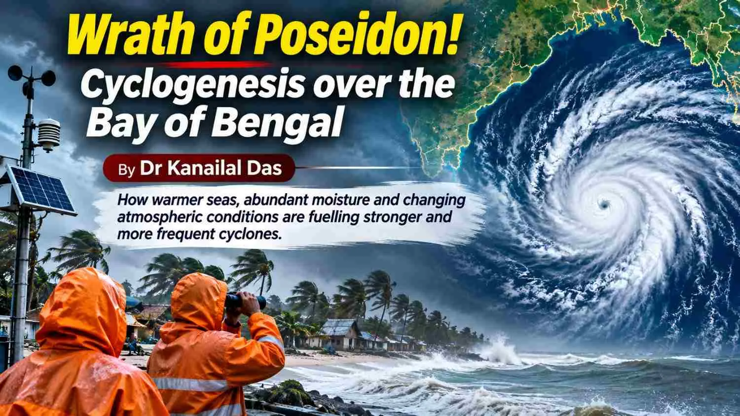
Summary: Overheated Bay of Bengal is often known as the breeding ground of cyclones. Cyclogenesis over the Bay of Bengal is catalysed by increasing sea surface temperature, huge supply of moisture and geographical orientation. The frequency of severe cyclones is on the increase off late which is the cause of perturbation. Proper interdisciplinary research regarding the reason behind increasing cyclogenesis is the need of the hour with proper capacity building to address the vulnerabilities of the teeming population. The Bay of Bengal is known as the breeding ground of tropical cyclones. This is because of its nature regarding sea surface temperature and supply of moisture and geographical characteristics. High sea surface temperature is an important condition for the genesis of tropical storm. The Bay of Bengal experiences above 26.5°C temperature during pre-monsoon and post monsoon period. |
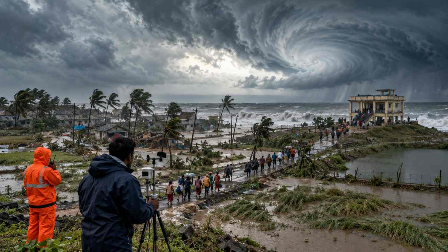
Tropical Cyclogenesis: Forms over warm ocean waters (typically above 26.5°C) where clusters of thunderstorms organize around a low-pressure center. Latent heat released by condensing water vapor drives the system, creating a warm-core structure. Key factors include high mid-level moisture, low vertical wind shear, and sufficient Coriolis force.
High sea surface temperature ----------- supplies heat and moisture to the atmosphere.
Development of low-pressure areas due to heat and moisture --------------- attract surrounding air towards the low-pressure area.
High moisture in the lower and middle atmosphere -------------------------cloud formation and heavy downpours.
Low vertical wind shear, small changes in wind speed and direction -------------------- vertical development of storm without disruption.
Low level convergence. Wind converges towards low pressure ----------------------- warm and moist air is forced to rise.
Atmospheric instability helps warm, moist air to rise ----------------------- development of strong thunderclouds.
Sustained heat in ocean water --------------------------- helps maintain the cyclones energy supply.
Why is the Bay of particularly favourable for cyclogenesis?
Bay of Bengal always experiences high sea surface temperature especially during pre and post monsoon period. Warm water is necessary condition for the development of strong tropical storms. Warm surface of the Bay of Bengal supplies huge moisture to the atmosphere.
Again, seasonal atmospheric circulation during pre and post monsoon period make suitable wind condition for the development of storms.
Frequently low-pressure systems develop over the Andaman Sea and the central or southern Bay of Bengal. These systems with other favourable conditions are intensified into deep depressions and even cyclones.
Warm ocean water, abundant moisture and favourable wind conditions in the Southern and central Bay of Bengal prevail during October, November and even December. Cyclones can develop during this period and move towards eastern coast of India and southern coast of Bangladesh.
May is one of the two major cyclone -forming months in the Bay of Bengal. High surface temperature, abundant moisture and favourable atmospheric circulation before the monsoon may create suitable conditions for the cyclone generation.
The Bay of Bengal has experienced several severe cyclones in the recent past. These cyclones affected greatly the coastal areas of India, Bangladesh and Myanmar.
Major cyclones in recent years:
- The super cyclone of the Odisha coast on 29 October, 1999 with a wind speed of 260 kmph caused the death of at least 10,000 people. The height of the storm water reached 7 to 10 m.
- Cyclone Nargis in 2008 made landfall on the Myanmar coast causing huge damage of lives and properties of Bangladesh and Myanmar. The death toll rose to 34,000.
- Cyclone Aila, 2009, made a landfall on Indian Sundarbans on 25th May. The wind speed of the storm reached at 120 kmph and caused damage in extensive areas of Sundarbans in both India and Bangladesh.
- Cyclone Phalin, 2013, made a landfall on the Odisha coast on 12th October with a wind speed of 200 kmph. Lakhs of people were evacuated to save lives though the storm caused damage of agriculture heavily.
- Cyclone Hud Hud, 2014, again made a landfall on 12th October at Visakhapatnam coast. The speed of storm wind reached 195 kmph.
- Cyclone Phani,2019, made a landfall on the Odisha coast on 3 may and caused damage in coastal areas of West Bengal and Odisha.
- Cyclone Bulbul, 2019, on 9th November caused damage to mangrove forest in Indian Sundarbans.
- Cyclone Amphan, 2020 made landfall near the India -Bangladesh border on 20th May. It was one of the most powerful storms in the Bay of Bengal in recent decades.
Cyclone Amphan caused extensive damage in coastal districts of India and Bangladesh.
- Cyclone Yaas,2021, Yaas made landfall in northern Odisha on 26th May. The cyclone affected large low-lying areas of South 24parganas and East Medinipur by salt water flooding and storm surge. It also caused damage in parts of Odisha.
- Cyclone Jawad, 2021 struck the Odisha coast on 5th December causing heavy downpours, flooding and consequent loss of crops.
- Cyclone Sitrang, 2022, made landfall on Barishal of Bangladesh in October causing embankment breaching and salt water flooding in Sundarbans of India and Bangladesh.
- Cyclone Mocha, 2023, made a landfall on the Myanmar coast with a wind speed of 230 kmph. Mocha mainly caused damage in coastal districts of West Bengal and Bangladesh.
- Cyclone Remal, 2024, struck the coastal areas of Sundarbans in both India and Bangladesh in May.
- Cyclone Dana, 2024, made landfall at Dhamra coast of odisha. The result were heavy rainfall, flooding and loss of agriculture and vegetation.
- Cyclone Motha, 2025, made landfall on Andhra Pradesh coast on 29 October. The cyclone affected coastal areas of odisha , Andhrapradesh and Tamilnadu.
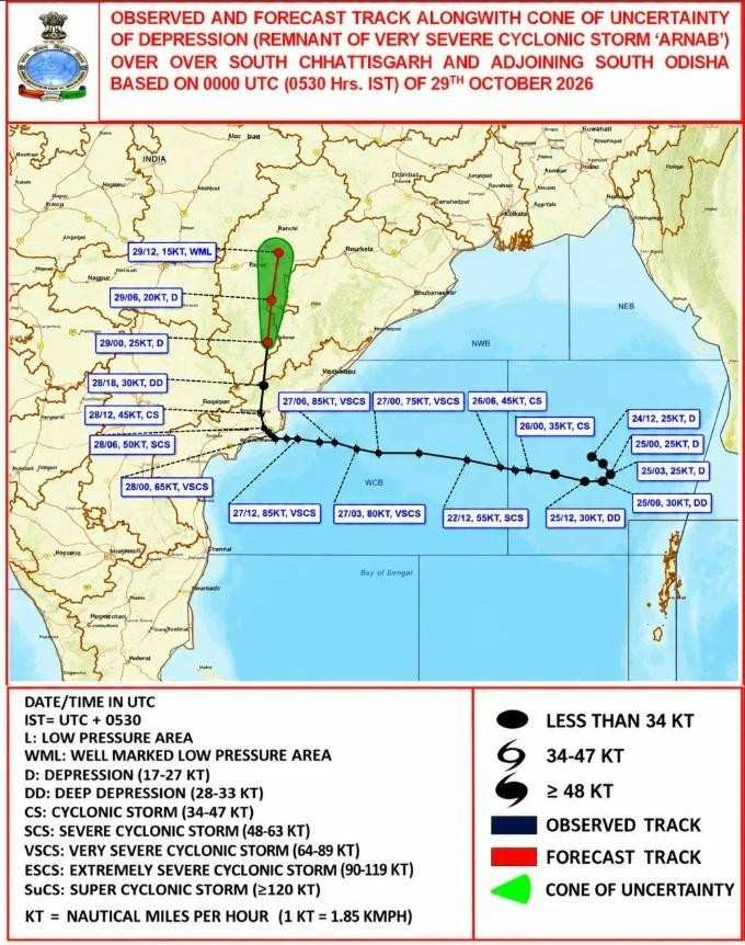
- Cyclone Arnab, 2026, made landfall on Visakhapatnam coast of Andhra Pradesh on 28 October.
Cyclone Arnab is the first cyclonic storm over the Bay of Bengal in 2026. It is very likely to move northwestward and cross Andhra Pradesh Yanam coast between Baptala and Visakhapatnam as a very severe cyclonic storm with a maximum sustained wind speed of 115- 125 kmph gusting to 140 kmph by Wednesday forenoon.
The cyclone is likely to make a landfall near Yanam around 1,050 km from Kolkata. Even though Kolkata is far away from cyclone path, the system is expected to bring spell of rain to the city. Thursday likely to bear the maximum impact of the cyclonic rainfall.
(The Times of India, Tuesday, October 27, 2026)
Arnab aftermath:
Cyclone Arnab killed nine people after making landfall on Yanam in Puducherry between 2am and 8am with wind speed of up to150 kmph and torrential rain. The deaths confirmed till Wednesday, 28 October evening, were almost entirely caused by the uprooted trees, collapsed electric poles and live electric cables strewn across the land. Highly affected areas are Bhimavaram of West Godavari district, Yealamanchili of Anaka palli district and Mangalapalem in Visakhapatnam district.
The cyclone damaged, as reported, two lakh hectares of crops. Damage to crops has been massive but the survival of coconut trees is a relief. Crops were destroyed across 2.24 lakh hectares in 14 districts affecting about 3.45 lakh farmers.
The cyclonic storm also washed away roads and damaged hundreds of houses.
More than 20,000 people had been evacuated from the coastal areas of Andhrapradesh before the landfall of the storm.
Across the border in odisha, rain lashed most of the state after the storm came ashore, hitting the southern districts of odisha. Trees and electric poles are uprooted. 20 lakh consumers of electricity in eight districts were affected .CM Mohan Majhi said 17 districts were affected, with Gajapati reporting the maximum impact, followed by Ganjam, Koraput and Rayagada.
Kolkata and west Bengal coastal areas were impacted by Arnab with rainfall till 30 October. Though the impact on South Bengal will be reduced after 30 October, North Bengal may heavy get heavy rainfall, said HR Biswas, head of the Regional Meteorological Centre, Kolkata.
Pre disaster capacity building:
Reinforce the Property
Manage Surroundings
Identify Safe Zones
Map Evacuation Routes
Secure Financial Protection
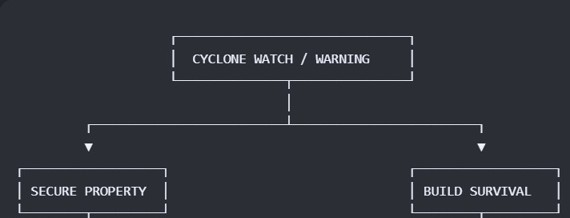
Keep all emergency items including water, medicines and food ready
In the third world countries, the Government needs to provide financial social safety nets to people who are vulnerable. With this they can construct safe houses, also the government needs to strengthen the storm shelters, fortify those with adequate evacuation plan, properly engineered for combating cyclones, located at a place easily accessible from the houses of the local people. Proper rehabilitation plans should be charted out and prior research with adequate alerts should be carried out in order to combat cyclones.
SL.NO
FEATURES
REASON
1
A central fresh water pond with brick layer at the base
For freshwater supply for cooking and drinking during flood.
2
Ring like embankment with 17ft height around freshwater pond
For makeshift tents of the people during flood.
3
A storage of food grain on the embankment collected from villagers at the rate of 5kg/month for future use
Food grain will be consumed during cyclone and flood. Excess food will be used through yearly village festival.
4
Inward and outward slopes of the embankment will have vegetation
To stabilize the embankment.
5
Inward slope of the embankment is 25ft and outward slope will be 50-60 ft
To make the embankment strong enough
6
There will be a vegetable field of width 70 feet in between embankment and fresh water pond
To supply vegetables during disasters.
7
There will be fisheries of width 100 ft outside the embankment
8
One or two tubewells should be installed on the embankments
To have pure water during cyclones and floods.
9
Storm shelters should be located at the centre of the village
To make it accessible for all villagers.
10
Roads should be extended to all directions from the embankment
So that people from all corners can reach the storm shelter.






Add a Comment