
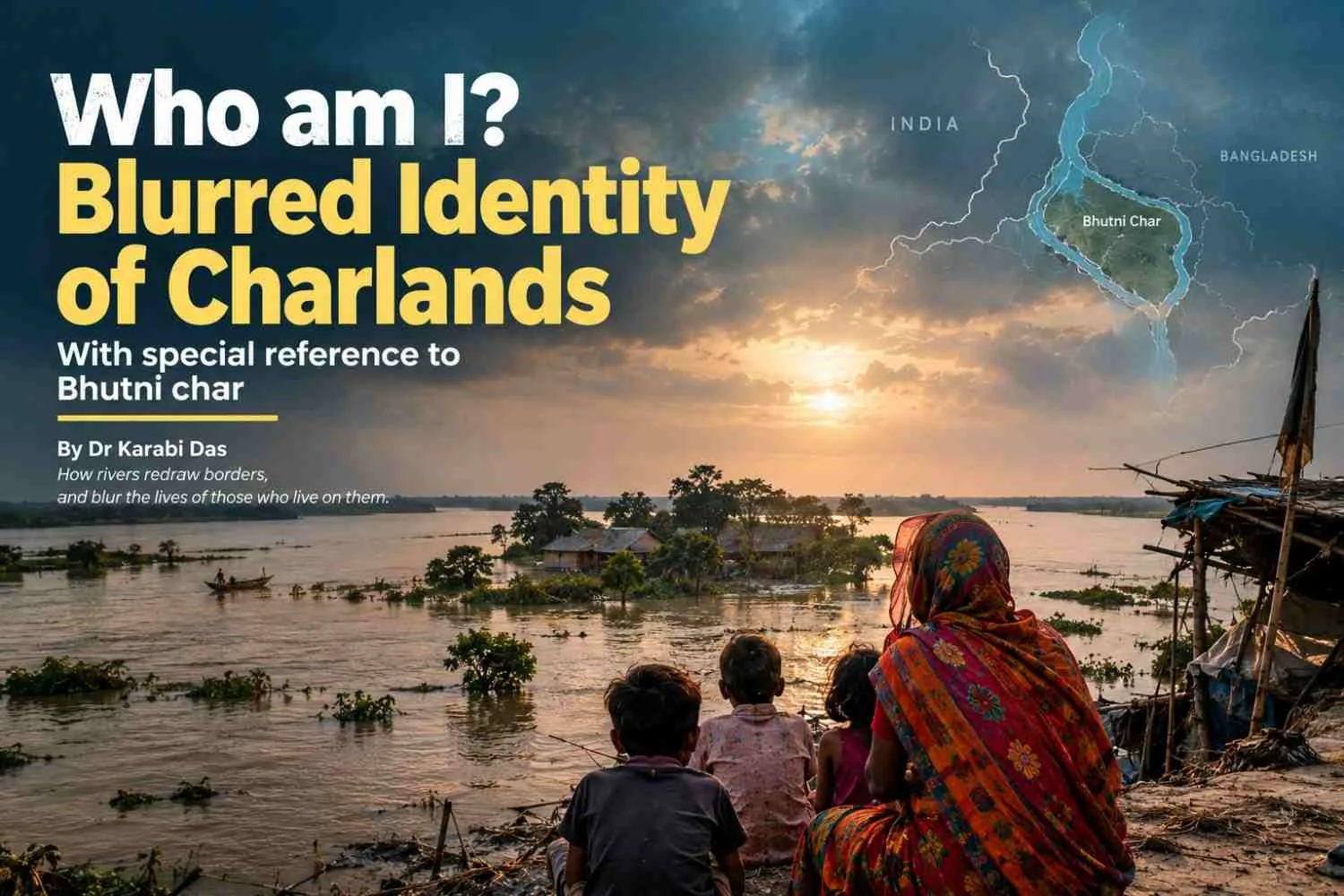
Summary: Charlands of West Bengal have blurred lines of identities, which state claims whom, which country claims whom is under constant change due to fluvial dynamics and ensuing riverbank erosion and flood deluge. Bhutni diara has been ravaged by the worst flood this year and this is the hour when we are left to think about another episode of blurred identity of lives and livelihoods. |
Seated in dimly lit auditorium of Jadavpur University, I was greeted by the snap of a forlorn yet mighty Ganga River. The one who engulfs lands, devouring people of their lives and livelihoods and also gifts people a bounty of harvests too. She was flowing whispering about her people - the people with blurred identities, people of chars (islands) divided by rivers, also united by the rivers to share the same fate of deprivation and fight.
Deprived of the fertile agricultural land which used to feed the belly, there stands Rubel who is compelled to smuggle rice to Bangladesh. Rubel, who is entrusted with the responsibility of the entire family wants to continue school but cannot afford such luxury. Rivers change courses and with these capitals change like chessboard, lives and livelihoods are shaped, reshaped even obliterated.
Bhutni Diara: Sandwiched between two rivers with a weeping tale
Bhutni, part of the Manikchak Community Development Block is surrounded by rivers Ganga and Fulhar. This island falls in the physiographic subregion called Diara, which is a relatively well drained flat land formed by fluvial deposition of newer alluvium. The bank of the Ganges between Bhutni and Panchanandapur is the area worst hit by left bank erosion of river Ganga.
Bhutni diara, the largest of the three diaras of Maldah is situated near the point where river Ganga begins to bend south. The river also enters into Maldah district from this point. Ganga previously split into two streams here -
The eastern channel connecting the diara to Maldah mainland. This channel has gradually silted up becoming shallow and defunct.
The western channel which is now the primary flow through the deeper channel.
Fulahar joins Ganga below the relict Mara Kosi, forming a spill channel that diverts excess floodwaters away from Ganga, towards Mahananda.
Retracing James Rennell's map shows that Ganges in the first half of the 19th century, after taking a round around Rajmahal hills, flowed past the island of Bhutni Diara, following the eastern channel resulting in considerable erosion on the Maldah bank.
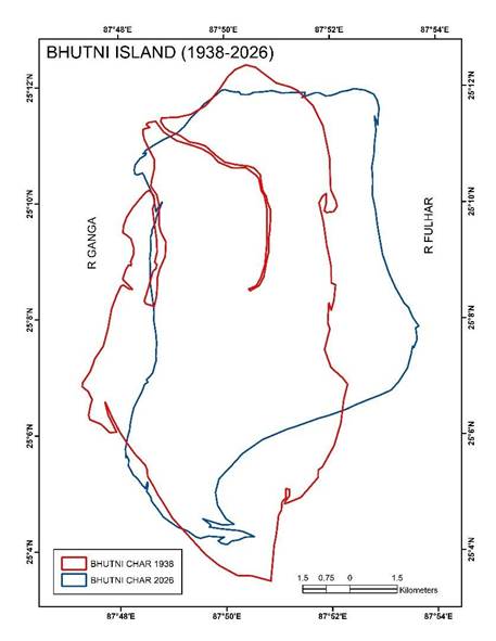
Fig 1: Change of Bhutni char (prepared by author using SOI toposheet and Google Earth
Image)
Geological experts and local authorities are concerned about the impeding danger of flooding impacts which can extend beyond Maldah into South Bengal if a permanent river avulsion occurs due to merging of Ganga and Fulhar rivers.
Since 1922-23, bankline surveys and maps have indicated that Ganga has kept its course stable past the Maldah diara at two sites - Rajmahal and Farakka. Ganga has been scouring a deep path for itself along its left bank as it traverses the Maldah diara after passing the circular embankment protecting Bhutni. This has caused major left bank erosion in Manikchak and Kaliachak II blocks. The diara formations are built on a foundation of sandbanks overlain by colloidal silts and thus they are prone to saturation and bank failure, as the river scours away the base material at flood stage. The water levels regularly cross the Extreme Danger Level (EDL), with the Ganga peaking well over 25.64 meters during peak surges, turning the island into an open sea.
Bhutni: Abode of children of the Lesser God
Life at Bhutni revolves around the cultivation of jute (the golden fibre) but for families flooded every now and then, children turn out to be vital contributors from being mere spectators. By the time the children reach the age of five they become skilled in stripping and jute processing. Children here lack balanced nutrition. Balancing school and work becomes another issue of concern. During harvest, tuition classes are abandoned, school attendance becomes irregular.
However, parents need to rely on the income from jute cultivation for survival. Also prolonged immersion in stagnant water causes skin problems, injuries and other health risks.
If vulnerability among the dwellers by the riverbanks and char dwellers is gauged, char dwellers are found to be more vulnerable. Basic facilities are less accessible due to physical remoteness from the mainland. Facing both floods and riverbank erosion, char dwellers face more health vulnerabilities. Availability of food is another issue. Higher sensitivity for water is found among the char dwellers as most of them use hand pumps as a source of drinking water. Lower adaptive capacity is observed in case of char dwellers as they abound in dependent population more having to fight out inadequate access to financial and social institutions.
Bhutni, literally turned into open sea: 2026 flood
Bhutni char rose first to prominence from the riverbed around 1913 and since then has been losing itself to the erosive claws of rivers Ganga and Kosi, this year being the worst since 1998. 2,00,000 people are marooned across the 3 village panchayats of Bhutni - Uttar Chandipur, Dakshin Chandipur and Hiranandapur with more than 50 villages under water and thousands of families reduced to only the summis of the embankments and tiled roofs of the concrete houses still available.
Protective embankment at Kesarpur, built a year ago, costing over 6 crores, breached within months of construction - second major breach in the Bhutni ring bund since Mid August after an earlier rupture at Kata Dam in Dakshin Chandipur, this rupture led Fulhar gush in.
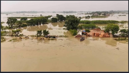
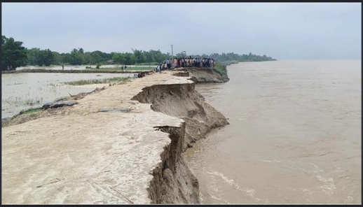
Photo plate 1: Flood and embankment breaching situation at Bhutni, 2026 (Source: News tap one and The Statesman)
A fresh embankment breach was observed on 2nd September. 3 high schools, 50 primary schools have got fully submerged alongwith Bhutni - Chandipur primary health centre and the local police station. 174 in patients had to be evacuated from the health centre. 5 schools have ceased to exist from Ratua I block, 3 more from Bhutni, 1 from Manikchak. Roadway connectivity to the main block of Manikchak has completely snapped, turning boats into the only viable mode of transport for relief, medical emergencies, and pregnant women. The situation has grown severe enough that the Indian Army (Panagarh unit) has been deployed to carry out mass deep-water rescue operations. Residents are surviving without cooked food, with dry ration which are being supplied by relief convoys.
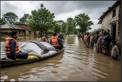
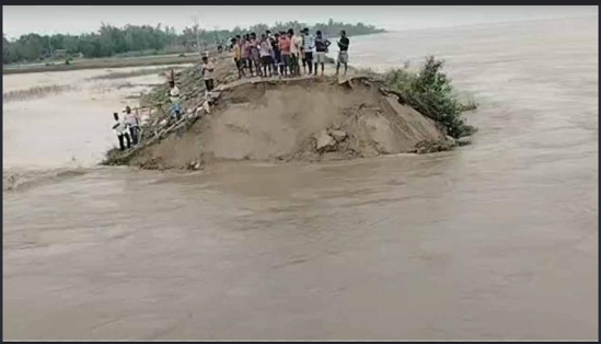
Photo plate 2: Flood situation and relief convoys at Bhutni, 2026 (Source: Urban acres and Anandabazar)
Deaths due to snakebites and electric shocks were also reported. People of Bhutni are demanding a concrete solution to the repeated flooding and river bank erosion. However, any concrete solution awaits adequate comprehension of fluvial dynamics of the rivers surrounding Bhutni. Until then, let us strengthen the hands of the hapless people of Bhutni by adequate capacity building so that they are able to atleast cope up with the impeding danger lurking in the corner.
References:
Das R and Samanta G (2022): Impact of floods and river-bank erosion on the riverine people in Manikchak Block of Malda District, West Bengal Environment, Development and Sustainability, https://doi.org/10.1007/s10668-022-02648-1
Majumdar S, Das A and Mandal S (2020): Riverbank erosion and livelihood vulnerability of the local population at Manikchak block in West Bengal, India
Environment, Development and Sustainability, https://doi.org/10.1007/s10668-02102046-z
Bhaumik I and Upadhyay C.S. (2025): Little Hands in Golden Fibre: Childhood, Work and Hope in Bhutni Island Childhood matters Vol V(3)
Char: A No Man’s Land documentary by Sourav Sarangi
Char Gang ek Char by Md Sadequl Islam, Barnik Prakashani


1 Comments
DR.MD.SADEQUL ISLAM
Very good discussion as well as real picture of Vutni Diara has been depicted.